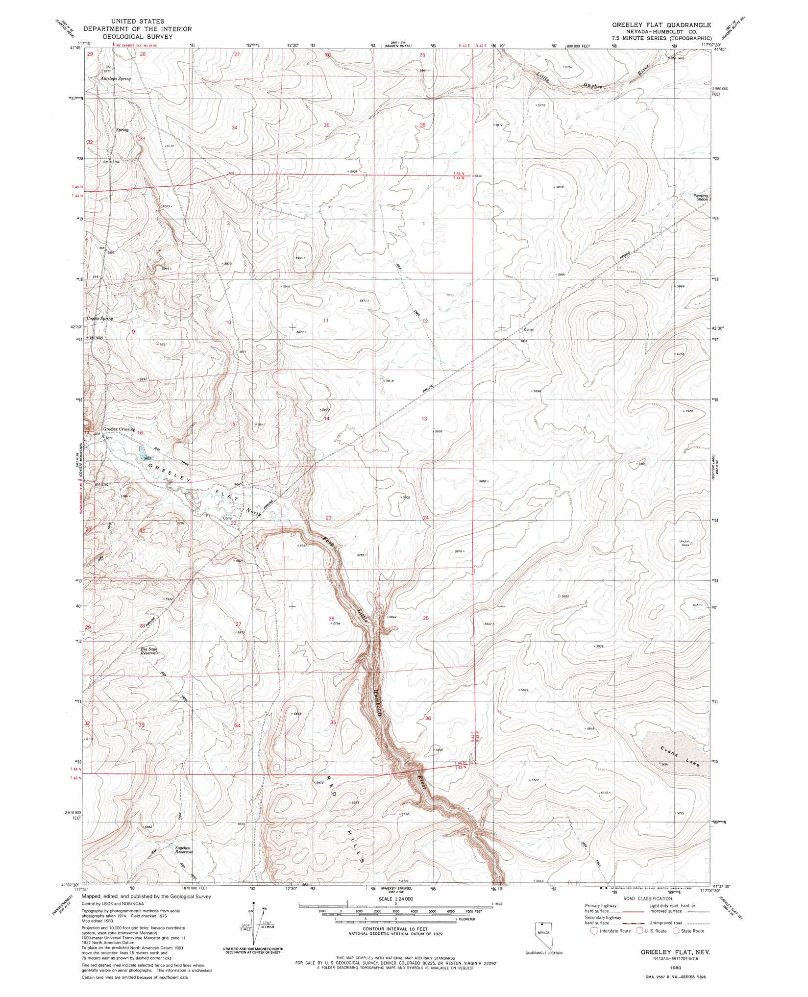
Greeley Flat Topo Map Nevada
To zoom in, hover over the map of Greeley Flat
USGS Topo Quad 41117f2 - 1:24,000 scale
| Topo Map Name: | Greeley Flat |
| USGS Topo Quad ID: | 41117f2 |
| Print Size: | ca. 21 1/4" wide x 27" high |
| Southeast Coordinates: | 41.625° N latitude / 117.125° W longitude |
| Map Center Coordinates: | 41.6875° N latitude / 117.1875° W longitude |
| U.S. State: | NV |
| Filename: | o41117f2.jpg |
| Download Map JPG Image: | Greeley Flat topo map 1:24,000 scale |
| Map Type: | Topographic |
| Topo Series: | 7.5´ |
| Map Scale: | 1:24,000 |
| Source of Map Images: | United States Geological Survey (USGS) |
| Alternate Map Versions: |
Greeley Flat NV 1980, updated 1980 Download PDF Buy paper map Greeley Flat NV 2011 Download PDF Buy paper map Greeley Flat NV 2015 Download PDF Buy paper map |
1:24,000 Topo Quads surrounding Greeley Flat
Odell Mountain |
Mahogany Spring |
Calico Butte |
Nadine Butte |
Star Valley Ridge West |
Holloway Meadows |
Capitol Peak |
Maiden Butte |
Maiden Butte Se |
Star Valley Ridge Sw |
Black Ridge |
Coyote Mountain |
Greeley Flat |
Button Lake |
Button Lake Well |
Spring City |
Hardscrabble |
Whiskey Springs |
Greeley Flat Se |
Humboldt Hill |
Little Poverty |
Fairbanks Canyon |
Chimney Reservoir |
Layton Spring |
Rodear Flat |
> Back to 41117e1 at 1:100,000 scale
> Back to 41116a1 at 1:250,000 scale
> Back to U.S. Topo Maps home
Greeley Flat topo map: Gazetteer
Greeley Flat: Crossings
Greeley Crossing elevation 1730m 5675′Greeley Flat: Flats
Evans Lake elevation 1737m 5698′Greeley Flat elevation 1723m 5652′
Greeley Flat: Reservoirs
Big Sage Reservoir elevation 1801m 5908′Sagehen Reservoir elevation 1749m 5738′
Greeley Flat: Springs
Antelope Spring elevation 1875m 6151′Greeley Flat digital topo map on disk
Buy this Greeley Flat topo map showing relief, roads, GPS coordinates and other geographical features, as a high-resolution digital map file on DVD: