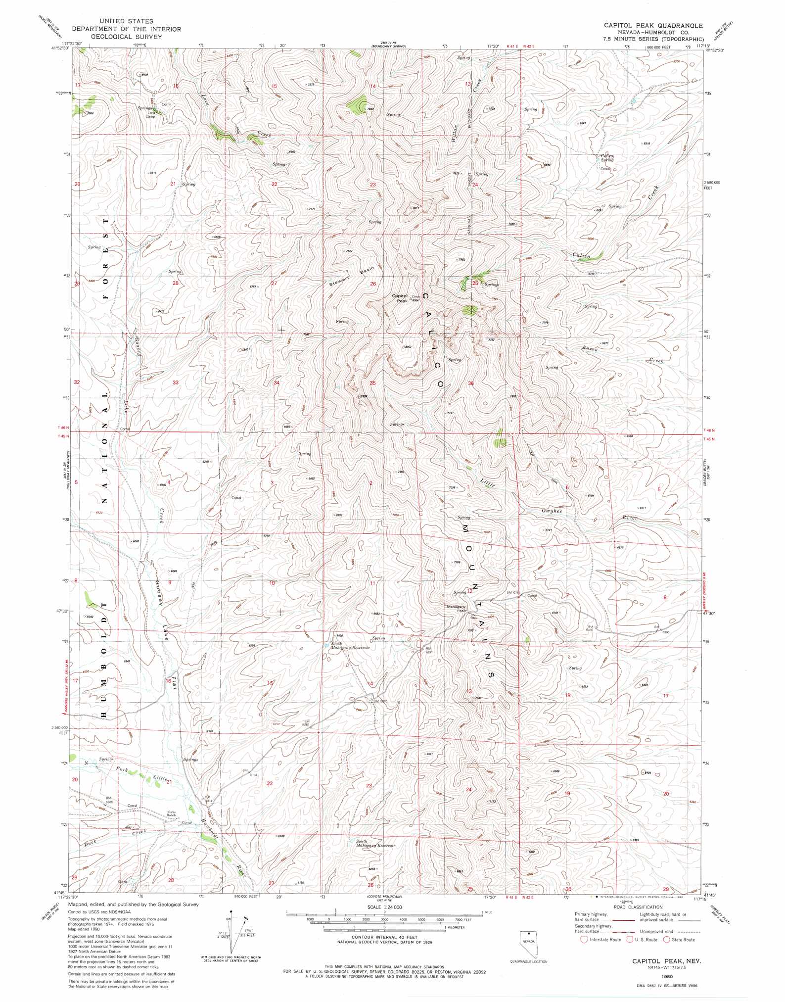
Capitol Peak Topo Map Nevada
To zoom in, hover over the map of Capitol Peak
USGS Topo Quad 41117g3 - 1:24,000 scale
| Topo Map Name: | Capitol Peak |
| USGS Topo Quad ID: | 41117g3 |
| Print Size: | ca. 21 1/4" wide x 27" high |
| Southeast Coordinates: | 41.75° N latitude / 117.25° W longitude |
| Map Center Coordinates: | 41.8125° N latitude / 117.3125° W longitude |
| U.S. State: | NV |
| Filename: | o41117g3.jpg |
| Download Map JPG Image: | Capitol Peak topo map 1:24,000 scale |
| Map Type: | Topographic |
| Topo Series: | 7.5´ |
| Map Scale: | 1:24,000 |
| Source of Map Images: | United States Geological Survey (USGS) |
| Alternate Map Versions: |
Capitol Peak NV 1980, updated 1980 Download PDF Buy paper map Capitol Peak NV 2011 Download PDF Buy paper map Capitol Peak NV 2015 Download PDF Buy paper map |
| FStopo: | US Forest Service topo Capitol Peak is available: Download FStopo PDF Download FStopo TIF |
1:24,000 Topo Quads surrounding Capitol Peak
Hoppin Springs |
Deer Flat |
Oregon Butte |
Lookout Lake |
Star Valley Knoll |
Mcconnell Peak |
Odell Mountain |
Mahogany Spring |
Calico Butte |
Nadine Butte |
Buckskin Mountain |
Holloway Meadows |
Capitol Peak |
Maiden Butte |
Maiden Butte Se |
Hinkey Summit |
Black Ridge |
Coyote Mountain |
Greeley Flat |
Button Lake |
Mullinix Creek |
Spring City |
Hardscrabble |
Whiskey Springs |
Greeley Flat Se |
> Back to 41117e1 at 1:100,000 scale
> Back to 41116a1 at 1:250,000 scale
> Back to U.S. Topo Maps home
Capitol Peak topo map: Gazetteer
Capitol Peak: Basins
Stewart Basin elevation 2190m 7185′Capitol Peak: Flats
Goosey Lake Flat elevation 1821m 5974′Capitol Peak: Gaps
Mahogany Pass elevation 2134m 7001′Capitol Peak: Ranges
Calico Mountains elevation 2103m 6899′Capitol Peak: Reservoirs
North Mahogany Reservoir elevation 1939m 6361′South Mahogany Reservoir elevation 1855m 6085′
Capitol Peak: Springs
Calico Spring elevation 1954m 6410′Capitol Peak: Streams
Duck Creek elevation 1797m 5895′Goosey Lake Creek elevation 1798m 5898′
Capitol Peak: Summits
Capitol Peak elevation 2511m 8238′Capitol Peak digital topo map on disk
Buy this Capitol Peak topo map showing relief, roads, GPS coordinates and other geographical features, as a high-resolution digital map file on DVD: