Calico Butte Topo Map Nevada
To zoom in, hover over the map of Calico Butte
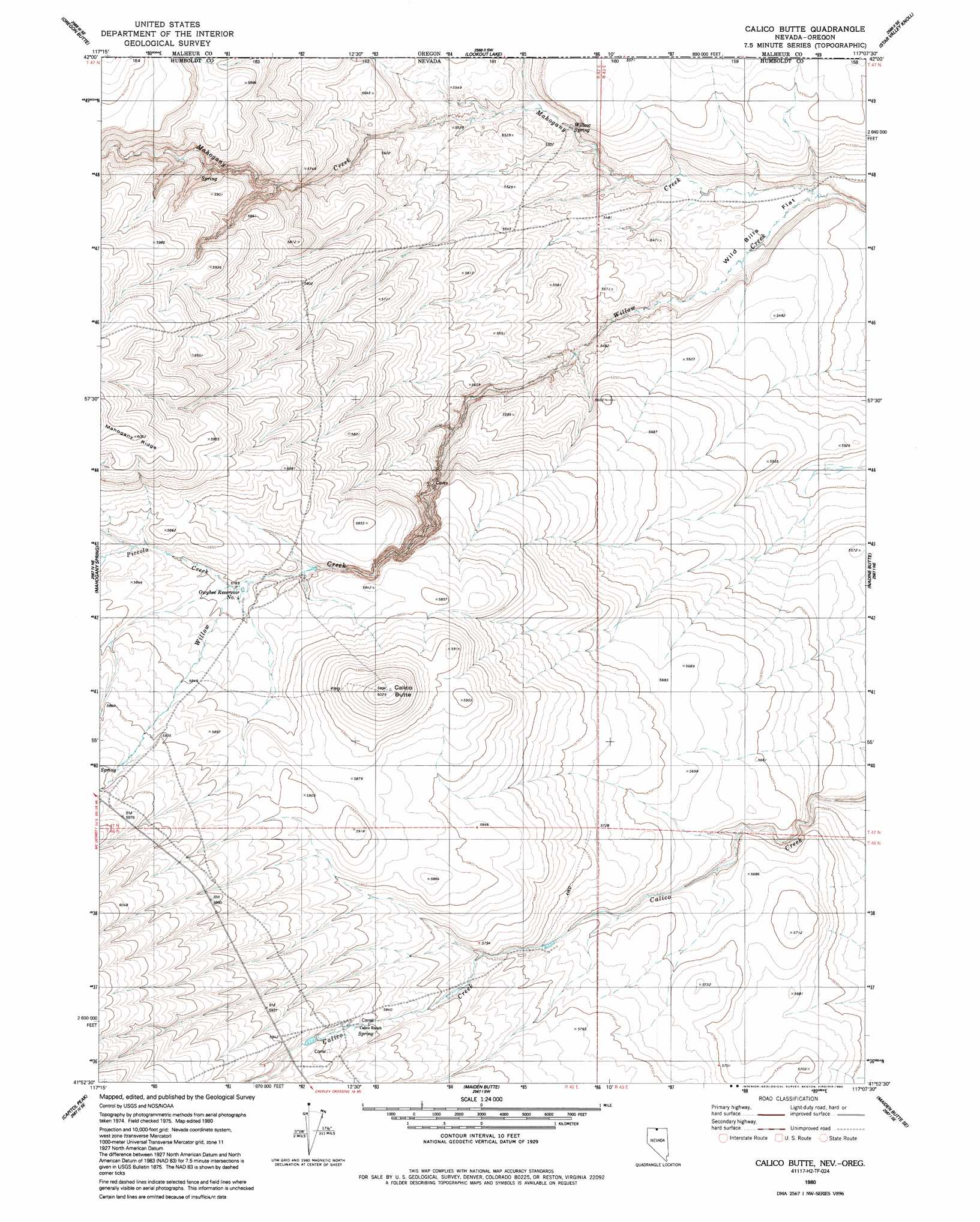
USGS Topo Quad 41117h2 - 1:24,000 scale
| Topo Map Name: | Calico Butte |
| USGS Topo Quad ID: | 41117h2 |
| Print Size: | ca. 21 1/4" wide x 27" high |
| Southeast Coordinates: | 41.875° N latitude / 117.125° W longitude |
| Map Center Coordinates: | 41.9375° N latitude / 117.1875° W longitude |
| U.S. State: | NV |
| Filename: | o41117h2.jpg |
| Download Map JPG Image: | Calico Butte topo map 1:24,000 scale |
| Map Type: | Topographic |
| Topo Series: | 7.5´ |
| Map Scale: | 1:24,000 |
| Source of Map Images: | United States Geological Survey (USGS) |
| Alternate Map Versions: |
Calico Butte NV 1980, updated 1980 Download PDF Buy paper map Calico Butte NV 1980, updated 1992 Download PDF Buy paper map Calico Butte NV 2011 Download PDF Buy paper map Calico Butte NV 2015 Download PDF Buy paper map |
1:24,000 Topo Quads surrounding Calico Butte
Chipmunk Basin |
Guadalupe Meadows |
Stoney Corral |
Defeat Butte |
Spring Creek Basin |
Deer Flat |
Oregon Butte |
Lookout Lake |
Star Valley Knoll |
Star Valley |
Odell Mountain |
Mahogany Spring |
Calico Butte |
Nadine Butte |
Star Valley Ridge West |
Holloway Meadows |
Capitol Peak |
Maiden Butte |
Maiden Butte Se |
Star Valley Ridge Sw |
Black Ridge |
Coyote Mountain |
Greeley Flat |
Button Lake |
Button Lake Well |
> Back to 41117e1 at 1:100,000 scale
> Back to 41116a1 at 1:250,000 scale
> Back to U.S. Topo Maps home
Calico Butte topo map: Gazetteer
Calico Butte: Flats
Wild Bills Flat elevation 1645m 5396′Calico Butte: Reservoirs
Owyhee Reservoir Number Four elevation 1765m 5790′Calico Butte: Springs
Willow Spring elevation 1662m 5452′Calico Butte: Streams
Mahogany Creek elevation 1641m 5383′Piccolo Creek elevation 1765m 5790′
Calico Butte: Summits
Calico Butte elevation 1838m 6030′Calico Butte digital topo map on disk
Buy this Calico Butte topo map showing relief, roads, GPS coordinates and other geographical features, as a high-resolution digital map file on DVD: