Spring Creek Basin Topo Map Idaho
To zoom in, hover over the map of Spring Creek Basin
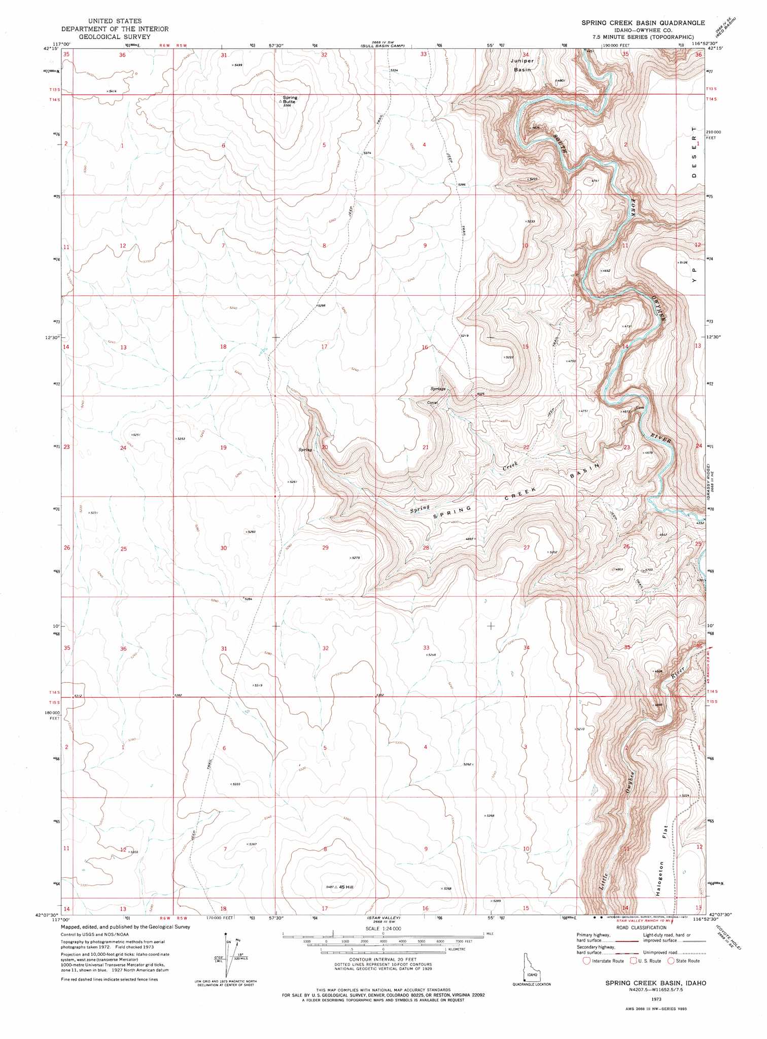
USGS Topo Quad 42116b8 - 1:24,000 scale
| Topo Map Name: | Spring Creek Basin |
| USGS Topo Quad ID: | 42116b8 |
| Print Size: | ca. 21 1/4" wide x 27" high |
| Southeast Coordinates: | 42.125° N latitude / 116.875° W longitude |
| Map Center Coordinates: | 42.1875° N latitude / 116.9375° W longitude |
| U.S. State: | ID |
| Filename: | o42116b8.jpg |
| Download Map JPG Image: | Spring Creek Basin topo map 1:24,000 scale |
| Map Type: | Topographic |
| Topo Series: | 7.5´ |
| Map Scale: | 1:24,000 |
| Source of Map Images: | United States Geological Survey (USGS) |
| Alternate Map Versions: |
Spring Creek Basin ID 1973, updated 1977 Download PDF Buy paper map Spring Creek Basin ID 2010 Download PDF Buy paper map Spring Creek Basin ID 2013 Download PDF Buy paper map |
1:24,000 Topo Quads surrounding Spring Creek Basin
Drummond Basin |
Deacon Crossing |
Bedstead Ridge |
Smith Creek |
Castro Table |
Rawhide Pocket |
Beaver Charlie Breaks |
Bull Basin Camp |
Red Basin |
Brace Flat |
Stoney Corral |
Defeat Butte |
Spring Creek Basin |
Grassy Ridge |
Piute Basin West |
Lookout Lake |
Star Valley Knoll |
Star Valley |
Coyote Hole |
Bull Camp Butte |
Calico Butte |
Nadine Butte |
Star Valley Ridge West |
Star Valley Ridge East |
Rubber Hill |
> Back to 42116a1 at 1:100,000 scale
> Back to 42116a1 at 1:250,000 scale
> Back to U.S. Topo Maps home
Spring Creek Basin topo map: Gazetteer
Spring Creek Basin: Basins
Spring Creek Basin elevation 1407m 4616′Spring Creek Basin: Flats
Halogeton Flat elevation 1598m 5242′Spring Creek Basin: Streams
Spring Creek elevation 1324m 4343′Spring Creek Basin: Summits
45 Hill elevation 1673m 5488′Spring Butte elevation 1698m 5570′
Spring Creek Basin digital topo map on disk
Buy this Spring Creek Basin topo map showing relief, roads, GPS coordinates and other geographical features, as a high-resolution digital map file on DVD: