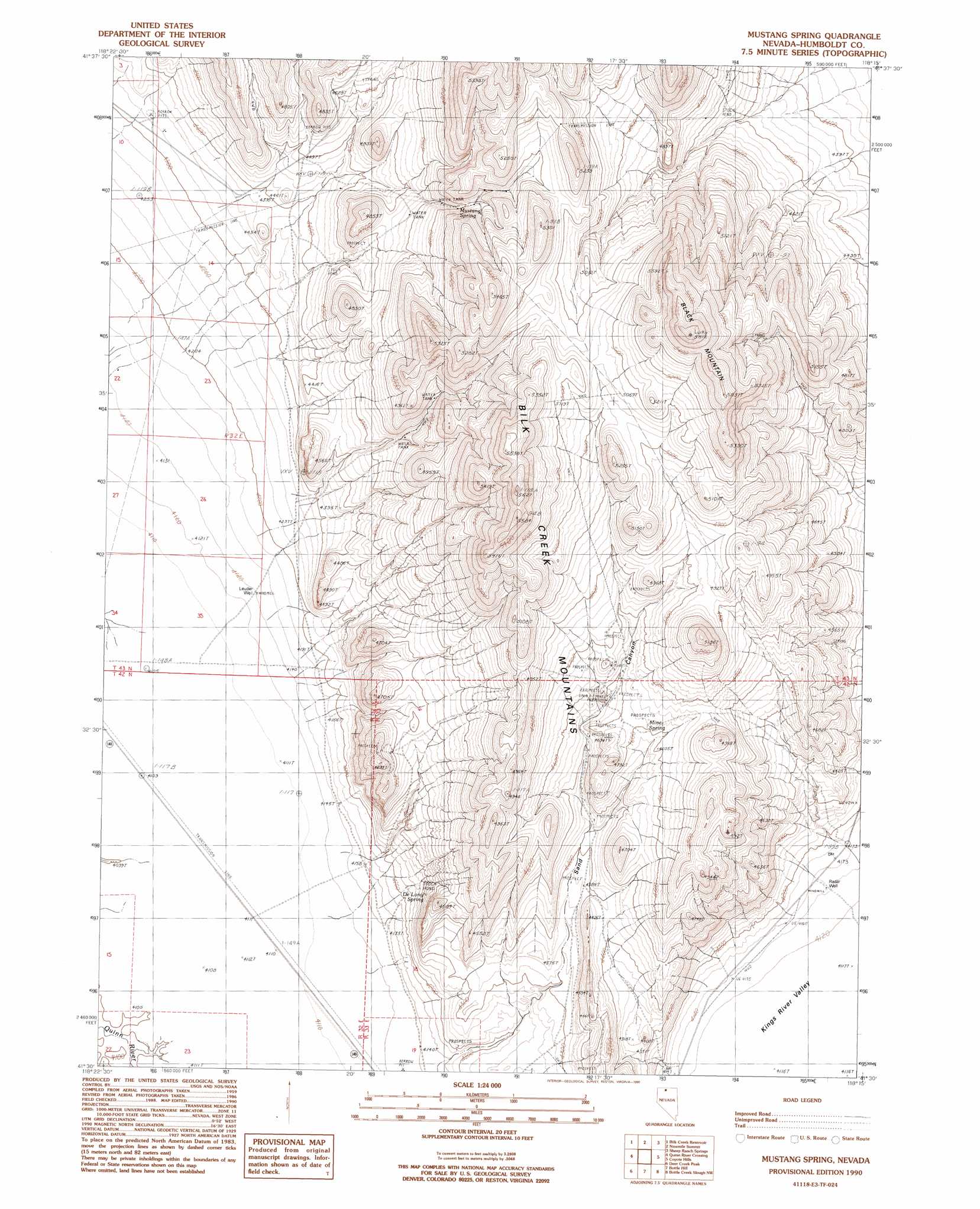
Mustang Spring Topo Map Nevada
To zoom in, hover over the map of Mustang Spring
USGS Topo Quad 41118e3 - 1:24,000 scale
| Topo Map Name: | Mustang Spring |
| USGS Topo Quad ID: | 41118e3 |
| Print Size: | ca. 21 1/4" wide x 27" high |
| Southeast Coordinates: | 41.5° N latitude / 118.25° W longitude |
| Map Center Coordinates: | 41.5625° N latitude / 118.3125° W longitude |
| U.S. State: | NV |
| Filename: | o41118e3.jpg |
| Download Map JPG Image: | Mustang Spring topo map 1:24,000 scale |
| Map Type: | Topographic |
| Topo Series: | 7.5´ |
| Map Scale: | 1:24,000 |
| Source of Map Images: | United States Geological Survey (USGS) |
| Alternate Map Versions: |
Mustang Spring NV 1990, updated 1990 Download PDF Buy paper map Mustang Spring NV 2011 Download PDF Buy paper map Mustang Spring NV 2015 Download PDF Buy paper map |
1:24,000 Topo Quads surrounding Mustang Spring
Denio Summit |
Shyster Butte |
Kings River Ranch |
Calavera Canyon |
Jordan Meadow Mountain |
Howard Hot Springs |
Bilk Creek Reservoir |
Ninemile Summit |
Sheep Ranch Springs |
Thacker Pass |
Dyke Canyon |
Quinn River Crossing |
Mustang Spring |
Coyote Hills |
Moonshine Canyon |
Deer Creek Slough |
Deer Creek Peak |
Bottle Hill |
Bottle Creek Slough Nw |
Sod House |
Hobo Canyon |
Parrot Peak |
Bottle Creek Ranch |
Bottle Creek Slough Sw |
Jackson Well |
> Back to 41118e1 at 1:100,000 scale
> Back to 41118a1 at 1:250,000 scale
> Back to U.S. Topo Maps home
Mustang Spring topo map: Gazetteer
Mustang Spring: Springs
DeLong Spring elevation 1312m 4304′Mine Spring elevation 1407m 4616′
Mustang Spring elevation 1457m 4780′
Mustang Spring: Summits
Black Mountain elevation 1763m 5784′Mustang Spring: Valleys
Sand Canyon elevation 1268m 4160′Mustang Spring: Wells
Leuder Well elevation 1264m 4146′Radar Well elevation 1265m 4150′
Mustang Spring digital topo map on disk
Buy this Mustang Spring topo map showing relief, roads, GPS coordinates and other geographical features, as a high-resolution digital map file on DVD: