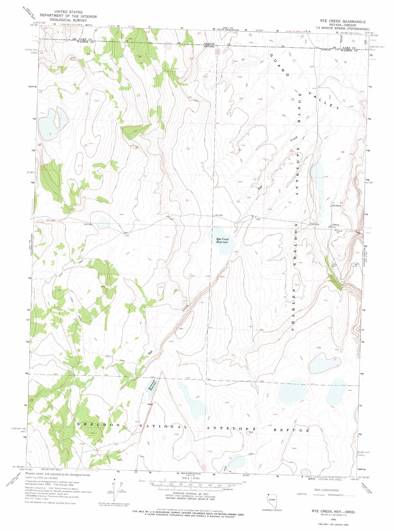
Rye Creek Topo Map Nevada
To zoom in, hover over the map of Rye Creek
USGS Topo Quad 41119h5 - 1:24,000 scale
| Topo Map Name: | Rye Creek |
| USGS Topo Quad ID: | 41119h5 |
| Print Size: | ca. 21 1/4" wide x 27" high |
| Southeast Coordinates: | 41.875° N latitude / 119.5° W longitude |
| Map Center Coordinates: | 41.9375° N latitude / 119.5625° W longitude |
| U.S. States: | NV, OR |
| Filename: | o41119h5.jpg |
| Download Map JPG Image: | Rye Creek topo map 1:24,000 scale |
| Map Type: | Topographic |
| Topo Series: | 7.5´ |
| Map Scale: | 1:24,000 |
| Source of Map Images: | United States Geological Survey (USGS) |
| Alternate Map Versions: |
Rye Creek NV 1966, updated 1968 Download PDF Buy paper map Rye Creek NV 1966, updated 1975 Download PDF Buy paper map Rye Creek NV 2011 Download PDF Buy paper map Rye Creek NV 2015 Download PDF Buy paper map |
1:24,000 Topo Quads surrounding Rye Creek
Calderwood Reservoir |
Mud Lake Reservoir |
Guano Lake |
Rocky Canyon |
Chimney Rock |
Coleman Lake |
Blizzard Gap |
Piute Reservoir |
Antelope Butte |
Sage Hen Flats |
Little Coleman Canyon |
Coleman Canyon |
Rye Creek |
Catnip Canyon |
Sage Hen Hills |
Mosquito Valley |
Calcutta Lake |
Bald Mountain |
Swan Lake |
Catnip Mountain Se |
Alkali Lake |
Massacre Lake Nw |
Massacre Lake |
Badger Mountain Nw |
Blowout Mountain |
> Back to 41119e1 at 1:100,000 scale
> Back to 41118a1 at 1:250,000 scale
> Back to U.S. Topo Maps home
Rye Creek topo map: Gazetteer
Rye Creek: Dams
Rye Creek Reservoir Dam elevation 1650m 5413′Rye Creek: Reservoirs
Racetrack Reservoir elevation 1750m 5741′Rye Creek Reservoir elevation 1650m 5413′
Rye Creek: Streams
Catnip Creek elevation 1601m 5252′Rye Creek elevation 1593m 5226′
Rye Creek digital topo map on disk
Buy this Rye Creek topo map showing relief, roads, GPS coordinates and other geographical features, as a high-resolution digital map file on DVD: