Swan Lake Topo Map Nevada
To zoom in, hover over the map of Swan Lake
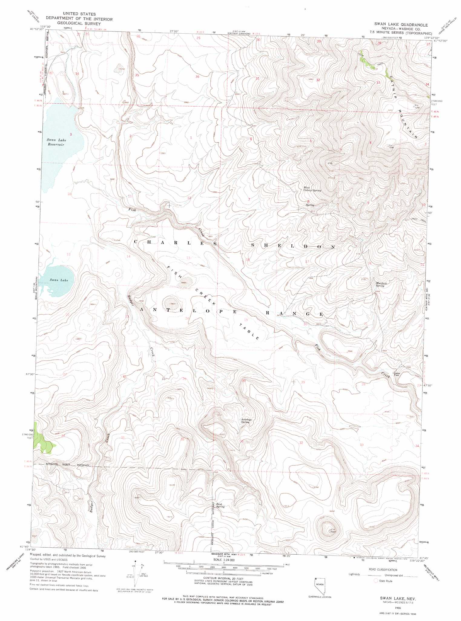
USGS Topo Quad 41119g4 - 1:24,000 scale
| Topo Map Name: | Swan Lake |
| USGS Topo Quad ID: | 41119g4 |
| Print Size: | ca. 21 1/4" wide x 27" high |
| Southeast Coordinates: | 41.75° N latitude / 119.375° W longitude |
| Map Center Coordinates: | 41.8125° N latitude / 119.4375° W longitude |
| U.S. State: | NV |
| Filename: | o41119g4.jpg |
| Download Map JPG Image: | Swan Lake topo map 1:24,000 scale |
| Map Type: | Topographic |
| Topo Series: | 7.5´ |
| Map Scale: | 1:24,000 |
| Source of Map Images: | United States Geological Survey (USGS) |
| Alternate Map Versions: |
Swan Lake NV 1966, updated 1978 Download PDF Buy paper map Swan Lake NV 2011 Download PDF Buy paper map Swan Lake NV 2015 Download PDF Buy paper map |
1:24,000 Topo Quads surrounding Swan Lake
Blizzard Gap |
Piute Reservoir |
Antelope Butte |
Sage Hen Flats |
Acty Mountain |
Coleman Canyon |
Rye Creek |
Catnip Canyon |
Sage Hen Hills |
Big Spring Butte |
Calcutta Lake |
Bald Mountain |
Swan Lake |
Catnip Mountain Se |
Gooch Lake |
Massacre Lake Nw |
Massacre Lake |
Badger Mountain Nw |
Blowout Mountain |
Alkali Peak |
Painted Point |
Massacre Creek |
Nut Mountain |
Badger Mountain Se |
Bear Buttes |
> Back to 41119e1 at 1:100,000 scale
> Back to 41118a1 at 1:250,000 scale
> Back to U.S. Topo Maps home
Swan Lake topo map: Gazetteer
Swan Lake: Dams
Swan Lake Reservoir Dam elevation 1723m 5652′Swan Lake: Flats
Fish Creek Table elevation 1808m 5931′Swan Lake: Lakes
Swan Lake elevation 1719m 5639′Swan Lake: Populated Places
Andys Place elevation 1799m 5902′Swan Lake: Reservoirs
Swan Lake Reservoir elevation 1723m 5652′Swan Lake: Springs
Antelope Spring elevation 1786m 5859′East Spring elevation 1878m 6161′
Murdock Spring elevation 1841m 6040′
West Catnip Spring elevation 1866m 6122′
Swan Lake: Streams
Badger Creek elevation 1720m 5643′Fish Creek elevation 1719m 5639′
Swan Lake: Summits
Catnip Mountain elevation 2222m 7290′Swan Lake digital topo map on disk
Buy this Swan Lake topo map showing relief, roads, GPS coordinates and other geographical features, as a high-resolution digital map file on DVD: