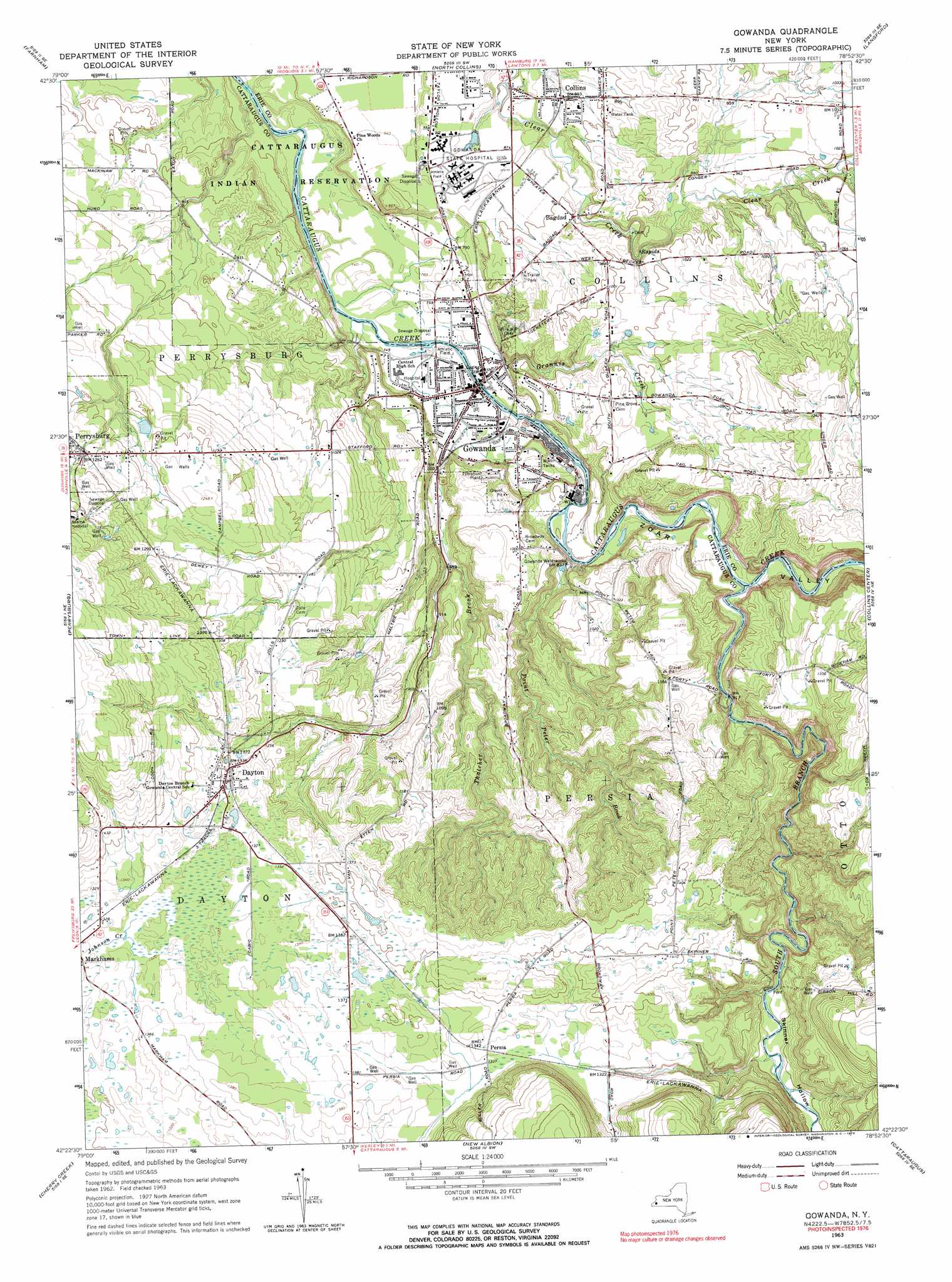
Gowanda Topo Map New York
To zoom in, hover over the map of Gowanda
USGS Topo Quad 42078d8 - 1:24,000 scale
| Topo Map Name: | Gowanda |
| USGS Topo Quad ID: | 42078d8 |
| Print Size: | ca. 21 1/4" wide x 27" high |
| Southeast Coordinates: | 42.375° N latitude / 78.875° W longitude |
| Map Center Coordinates: | 42.4375° N latitude / 78.9375° W longitude |
| U.S. State: | NY |
| Filename: | o42078d8.jpg |
| Download Map JPG Image: | Gowanda topo map 1:24,000 scale |
| Map Type: | Topographic |
| Topo Series: | 7.5´ |
| Map Scale: | 1:24,000 |
| Source of Map Images: | United States Geological Survey (USGS) |
| Alternate Map Versions: |
Gowanda NY 1963, updated 1964 Download PDF Buy paper map Gowanda NY 1963, updated 1973 Download PDF Buy paper map Gowanda NY 2010 Download PDF Buy paper map Gowanda NY 2013 Download PDF Buy paper map Gowanda NY 2016 Download PDF Buy paper map |
1:24,000 Topo Quads surrounding Gowanda
Angola |
Eden |
Hamburg |
Colden |
|
Silver Creek |
Farnham |
North Collins |
Langford |
Springville |
Forestville |
Perrysburg |
Gowanda |
Collins Center |
Ashford Hollow |
Hamlet |
Cherry Creek |
New Albion |
Cattaraugus |
Ellicottville |
Gerry |
Kennedy |
Randolph |
Little Valley |
Salamanca |
> Back to 42078a1 at 1:100,000 scale
> Back to 42078a1 at 1:250,000 scale
> Back to U.S. Topo Maps home
Gowanda topo map: Gazetteer
Gowanda: Bridges
Forty Bridge elevation 324m 1062′Gowanda: Populated Places
Bagdad elevation 276m 905′Collins elevation 268m 879′
Dayton elevation 408m 1338′
Gowanda elevation 232m 761′
Persia elevation 409m 1341′
Gowanda: Streams
Grannis Creek elevation 224m 734′Point Peter Brook elevation 238m 780′
South Branch Cattaraugus Creek elevation 256m 839′
Thatcher Brook elevation 220m 721′
Gowanda: Valleys
Skinner Hollow elevation 316m 1036′Zoar Valley elevation 238m 780′
Gowanda digital topo map on disk
Buy this Gowanda topo map showing relief, roads, GPS coordinates and other geographical features, as a high-resolution digital map file on DVD:
 map DVD")