Angola Topo Map New York
To zoom in, hover over the map of Angola
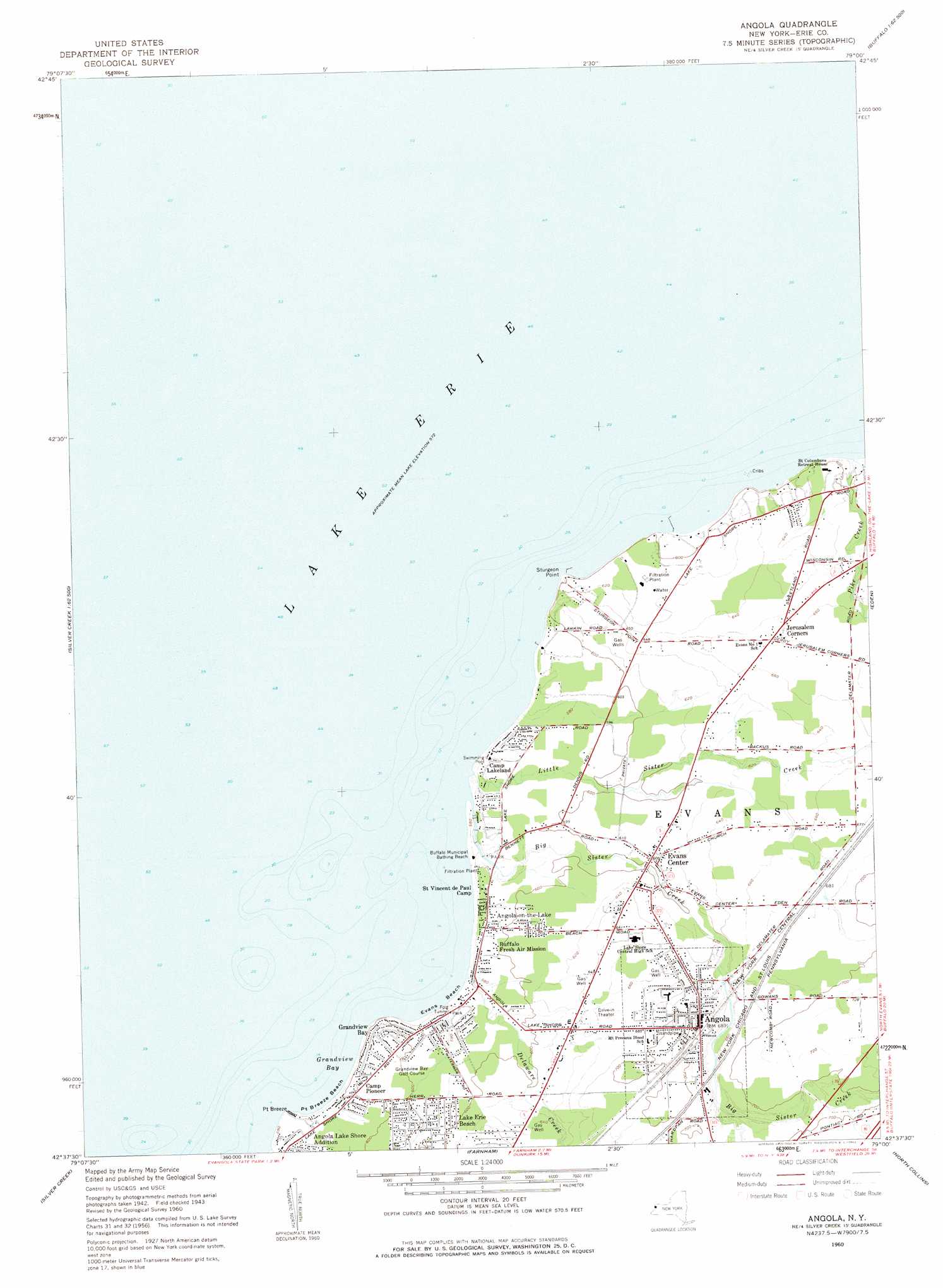
USGS Topo Quad 42079f1 - 1:24,000 scale
| Topo Map Name: | Angola |
| USGS Topo Quad ID: | 42079f1 |
| Print Size: | ca. 21 1/4" wide x 27" high |
| Southeast Coordinates: | 42.625° N latitude / 79° W longitude |
| Map Center Coordinates: | 42.6875° N latitude / 79.0625° W longitude |
| U.S. State: | NY |
| Filename: | o42079f1.jpg |
| Download Map JPG Image: | Angola topo map 1:24,000 scale |
| Map Type: | Topographic |
| Topo Series: | 7.5´ |
| Map Scale: | 1:24,000 |
| Source of Map Images: | United States Geological Survey (USGS) |
| Alternate Map Versions: |
Angola NY 1960, updated 1962 Download PDF Buy paper map Angola NY 1960, updated 1962 Download PDF Buy paper map Angola NY 2010 Download PDF Buy paper map Angola NY 2013 Download PDF Buy paper map Angola NY 2016 Download PDF Buy paper map |
1:24,000 Topo Quads surrounding Angola
Buffalo Nw |
Buffalo Ne |
|||
Buffalo Se |
||||
Angola |
Eden |
Hamburg |
||
North Of Dunkirk |
Silver Creek |
Farnham |
North Collins |
Langford |
Dunkirk |
Forestville |
Perrysburg |
Gowanda |
Collins Center |
> Back to 42079e1 at 1:100,000 scale
> Back to 42078a1 at 1:250,000 scale
> Back to U.S. Topo Maps home
Angola topo map: Gazetteer
Angola: Bays
Grandview Bay elevation 174m 570′Angola: Beaches
Buffalo Municipal Bathing Beach elevation 175m 574′Evans Beach elevation 174m 570′
Point Breeze Beach elevation 177m 580′
Angola: Capes
Point Breeze elevation 179m 587′Sturgeon Point elevation 179m 587′
Angola: Parks
Evans Park elevation 177m 580′Wendt Beach Park elevation 177m 580′
Angola: Populated Places
Angola elevation 209m 685′Angola on the Lake elevation 183m 600′
Angola-on-the-Lake elevation 184m 603′
Camp Lakeland elevation 177m 580′
Camp Pioneer elevation 184m 603′
Evans Center elevation 184m 603′
Jerusalem Corners elevation 202m 662′
Saint Vencent de Paul Camp elevation 178m 583′
Angola: Streams
Big Sister Creek elevation 174m 570′Delaware Creek elevation 175m 574′
Little Sister Creek elevation 174m 570′
Muddy Creek elevation 175m 574′
Pike Creek elevation 175m 574′
Angola digital topo map on disk
Buy this Angola topo map showing relief, roads, GPS coordinates and other geographical features, as a high-resolution digital map file on DVD:
 map DVD")