Lena Topo Map Illinois
To zoom in, hover over the map of Lena
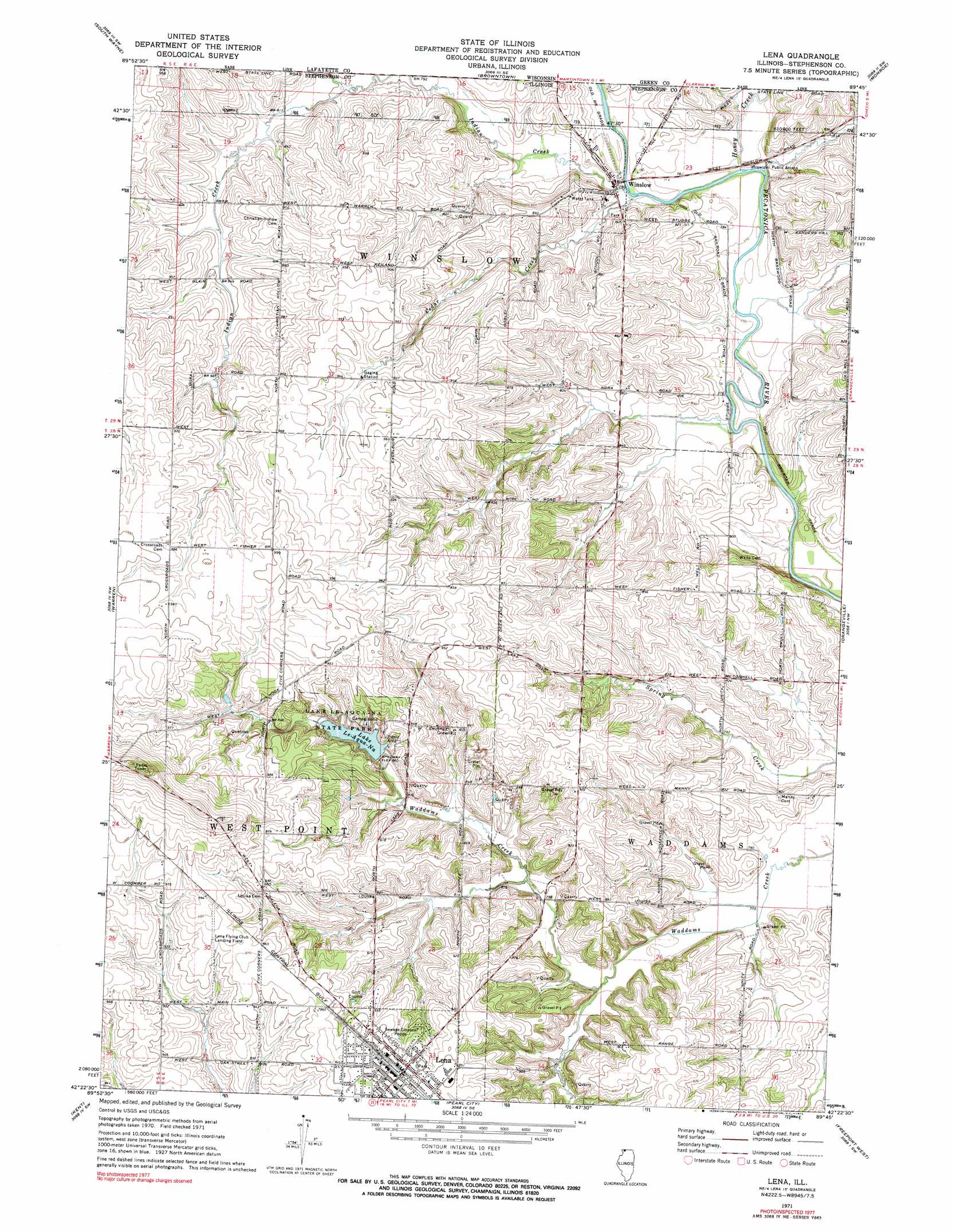
USGS Topo Quad 42089d7 - 1:24,000 scale
| Topo Map Name: | Lena |
| USGS Topo Quad ID: | 42089d7 |
| Print Size: | ca. 21 1/4" wide x 27" high |
| Southeast Coordinates: | 42.375° N latitude / 89.75° W longitude |
| Map Center Coordinates: | 42.4375° N latitude / 89.8125° W longitude |
| U.S. State: | IL |
| Filename: | o42089d7.jpg |
| Download Map JPG Image: | Lena topo map 1:24,000 scale |
| Map Type: | Topographic |
| Topo Series: | 7.5´ |
| Map Scale: | 1:24,000 |
| Source of Map Images: | United States Geological Survey (USGS) |
| Alternate Map Versions: |
Lena IL 1971, updated 1974 Download PDF Buy paper map Lena IL 1971, updated 1974 Download PDF Buy paper map Lena IL 2012 Download PDF Buy paper map Lena IL 2015 Download PDF Buy paper map |
1:24,000 Topo Quads surrounding Lena
Darlington |
Wiota |
Argyle |
Monroe Nw |
Monticello |
Apple River |
South Wayne |
Browntown |
Monroe |
Juda |
Elizabeth Ne |
Warren |
Lena |
Orangeville |
Dakota |
Stockton |
Kent |
Pearl City |
Freeport West |
Freeport East |
Pleasant Valley |
Loran |
Boone Branch |
Shannon |
Forreston North |
> Back to 42089a1 at 1:100,000 scale
> Back to 42088a1 at 1:250,000 scale
> Back to U.S. Topo Maps home
Lena topo map: Gazetteer
Lena: Airports
Kramer Airport elevation 278m 912′Lena Flying Club Landing Field elevation 298m 977′
Mitek Airport elevation 235m 770′
Red Shed Field elevation 280m 918′
Lena: Dams
Lake Le-Aqua-Na Dam elevation 260m 853′Lena: Mines
Fritsch Quarry elevation 255m 836′Lena: Parks
Lake Le-Aqua-Na State Park elevation 274m 898′Lena: Populated Places
Lena elevation 289m 948′Winslow elevation 236m 774′
Lena: Reservoirs
Lake Le-Aqua-Na elevation 262m 859′Lena: Streams
Cedar Creek elevation 235m 770′Honey Creek elevation 235m 770′
Indian Creek elevation 233m 764′
Indian Creek elevation 235m 770′
Lena digital topo map on disk
Buy this Lena topo map showing relief, roads, GPS coordinates and other geographical features, as a high-resolution digital map file on DVD:
Northern Illinois, Northern Indiana & Southwestern Michigan
Buy digital topo maps: Northern Illinois, Northern Indiana & Southwestern Michigan