Manson Topo Map Iowa
To zoom in, hover over the map of Manson
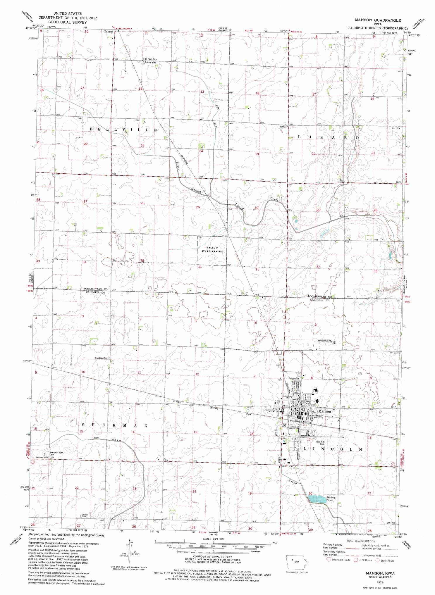
USGS Topo Quad 42094e5 - 1:24,000 scale
| Topo Map Name: | Manson |
| USGS Topo Quad ID: | 42094e5 |
| Print Size: | ca. 21 1/4" wide x 27" high |
| Southeast Coordinates: | 42.5° N latitude / 94.5° W longitude |
| Map Center Coordinates: | 42.5625° N latitude / 94.5625° W longitude |
| U.S. State: | IA |
| Filename: | o42094e5.jpg |
| Download Map JPG Image: | Manson topo map 1:24,000 scale |
| Map Type: | Topographic |
| Topo Series: | 7.5´ |
| Map Scale: | 1:24,000 |
| Source of Map Images: | United States Geological Survey (USGS) |
| Alternate Map Versions: |
Manson IA 1979, updated 1983 Download PDF Buy paper map Manson IA 2010 Download PDF Buy paper map Manson IA 2013 Download PDF Buy paper map Manson IA 2015 Download PDF Buy paper map |
1:24,000 Topo Quads surrounding Manson
Laurens |
Havelock |
Rolfe |
Bradgate |
Bode |
Fonda Ne |
Pocahontas |
Palmer |
Gilmore City |
Umque |
Fonda |
Pomeroy |
Manson |
Gilmore City Sw |
Clare |
Lytton |
Rockwell City |
Richard |
Knierim |
Moorland |
Yetter |
Lake City |
Lohrville |
Farnhamville |
Gowrie |
> Back to 42094e1 at 1:100,000 scale
> Back to 42094a1 at 1:250,000 scale
> Back to U.S. Topo Maps home
Manson topo map: Gazetteer
Manson: Areas
Wiegert Prairie elevation 369m 1210′Manson: Canals
Drainage Ditch Number 47 elevation 369m 1210′Manson: Parks
Kaslow Prairie State Preserve elevation 378m 1240′Manson Fairground Park elevation 378m 1240′
Mendenhall Park elevation 375m 1230′
Munson Prairie elevation 373m 1223′
Palmer Wildlife Refuge elevation 375m 1230′
Veterans Memorial Park elevation 376m 1233′
Watertower Park elevation 374m 1227′
Manson: Populated Places
Blanden elevation 375m 1230′Manson elevation 378m 1240′
Manson: Post Offices
Blanden Post Office (historical) elevation 375m 1230′Manson Post Office elevation 378m 1240′
Manson digital topo map on disk
Buy this Manson topo map showing relief, roads, GPS coordinates and other geographical features, as a high-resolution digital map file on DVD: