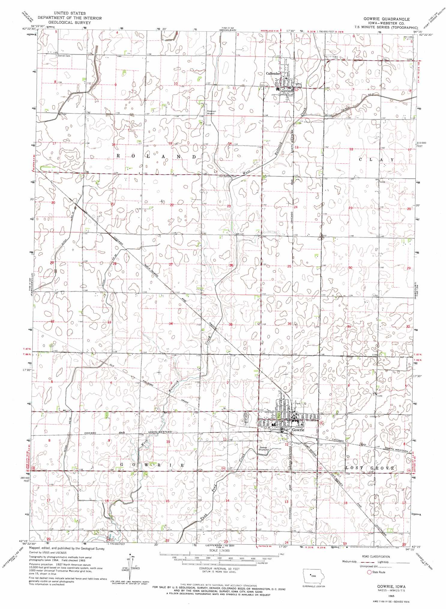
Gowrie Topo Map Iowa
To zoom in, hover over the map of Gowrie
USGS Topo Quad 42094c3 - 1:24,000 scale
| Topo Map Name: | Gowrie |
| USGS Topo Quad ID: | 42094c3 |
| Print Size: | ca. 21 1/4" wide x 27" high |
| Southeast Coordinates: | 42.25° N latitude / 94.25° W longitude |
| Map Center Coordinates: | 42.3125° N latitude / 94.3125° W longitude |
| U.S. State: | IA |
| Filename: | o42094c3.jpg |
| Download Map JPG Image: | Gowrie topo map 1:24,000 scale |
| Map Type: | Topographic |
| Topo Series: | 7.5´ |
| Map Scale: | 1:24,000 |
| Source of Map Images: | United States Geological Survey (USGS) |
| Alternate Map Versions: |
Gowrie IA 1965, updated 1966 Download PDF Buy paper map Gowrie IA 2010 Download PDF Buy paper map Gowrie IA 2013 Download PDF Buy paper map Gowrie IA 2015 Download PDF Buy paper map |
1:24,000 Topo Quads surrounding Gowrie
Manson |
Gilmore City Sw |
Clare |
Fort Dodge North |
Vincent |
Richard |
Knierim |
Moorland |
Fort Dodge South |
Evanston |
Lohrville |
Farnhamville |
Gowrie |
Harcourt |
Lehigh |
Wightman |
Churdan |
Paton |
Lanyon |
Boxholm |
Scranton |
Jefferson West |
Jefferson East |
Grand Junction |
Ogden |
> Back to 42094a1 at 1:100,000 scale
> Back to 42094a1 at 1:250,000 scale
> Back to U.S. Topo Maps home
Gowrie topo map: Gazetteer
Gowrie: Airports
Peterson Airport elevation 349m 1145′Gowrie: Canals
Ditch Number 5 elevation 351m 1151′Ditch Number 52 elevation 347m 1138′
Gowrie: Parks
Laurel Park elevation 347m 1138′Lindquist Wildlife Sanctuary elevation 347m 1138′
Gowrie: Populated Places
Callender elevation 351m 1151′Gowrie elevation 348m 1141′
Gowrie: Post Offices
Callender Post Office elevation 351m 1151′Gowrie Post Office elevation 346m 1135′
Gowrie digital topo map on disk
Buy this Gowrie topo map showing relief, roads, GPS coordinates and other geographical features, as a high-resolution digital map file on DVD: