Richard Topo Map Iowa
To zoom in, hover over the map of Richard
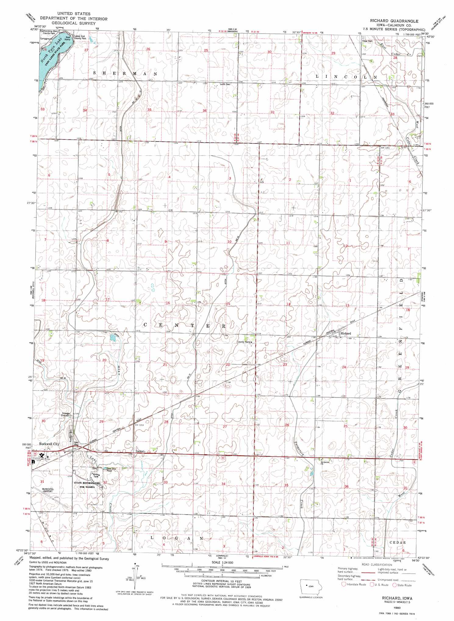
USGS Topo Quad 42094d5 - 1:24,000 scale
| Topo Map Name: | Richard |
| USGS Topo Quad ID: | 42094d5 |
| Print Size: | ca. 21 1/4" wide x 27" high |
| Southeast Coordinates: | 42.375° N latitude / 94.5° W longitude |
| Map Center Coordinates: | 42.4375° N latitude / 94.5625° W longitude |
| U.S. State: | IA |
| Filename: | o42094d5.jpg |
| Download Map JPG Image: | Richard topo map 1:24,000 scale |
| Map Type: | Topographic |
| Topo Series: | 7.5´ |
| Map Scale: | 1:24,000 |
| Source of Map Images: | United States Geological Survey (USGS) |
| Alternate Map Versions: |
Richard IA 1980, updated 1980 Download PDF Buy paper map Richard IA 2010 Download PDF Buy paper map Richard IA 2013 Download PDF Buy paper map Richard IA 2015 Download PDF Buy paper map |
1:24,000 Topo Quads surrounding Richard
Fonda Ne |
Pocahontas |
Palmer |
Gilmore City |
Umque |
Fonda |
Pomeroy |
Manson |
Gilmore City Sw |
Clare |
Lytton |
Rockwell City |
Richard |
Knierim |
Moorland |
Yetter |
Lake City |
Lohrville |
Farnhamville |
Gowrie |
Carroll Ne |
Lanesboro |
Wightman |
Churdan |
Paton |
> Back to 42094a1 at 1:100,000 scale
> Back to 42094a1 at 1:250,000 scale
> Back to U.S. Topo Maps home
Richard topo map: Gazetteer
Richard: Airports
Rockwell City Municipal Airport elevation 370m 1213′Richard: Bridges
Rockwell City Bridge elevation 360m 1181′Richard: Canals
Drainage Ditch 13 elevation 363m 1190′Drainage Ditch 65 elevation 366m 1200′
Richard: Parks
Center Wildlife Area elevation 366m 1200′Lake End County Park elevation 374m 1227′
Twin Lakes State Park elevation 376m 1233′
Richard: Populated Places
Richard elevation 361m 1184′Richard: Post Offices
Richards Post Office (historical) elevation 361m 1184′Richard digital topo map on disk
Buy this Richard topo map showing relief, roads, GPS coordinates and other geographical features, as a high-resolution digital map file on DVD: