Stuart Topo Map Nebraska
To zoom in, hover over the map of Stuart
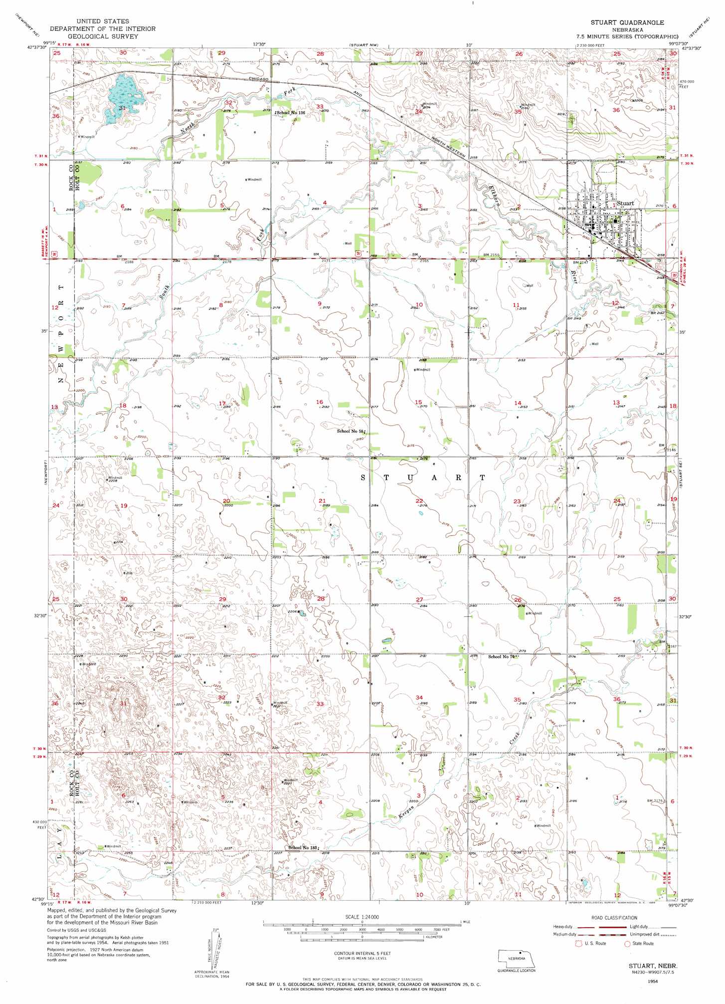
USGS Topo Quad 42099e2 - 1:24,000 scale
| Topo Map Name: | Stuart |
| USGS Topo Quad ID: | 42099e2 |
| Print Size: | ca. 21 1/4" wide x 27" high |
| Southeast Coordinates: | 42.5° N latitude / 99.125° W longitude |
| Map Center Coordinates: | 42.5625° N latitude / 99.1875° W longitude |
| U.S. State: | NE |
| Filename: | O42099E2.jpg |
| Download Map JPG Image: | Stuart topo map 1:24,000 scale |
| Map Type: | Topographic |
| Topo Series: | 7.5´ |
| Map Scale: | 1:24,000 |
| Source of Map Images: | United States Geological Survey (USGS) |
| Alternate Map Versions: |
Stuart NE 1954, updated 1955 Download PDF Buy paper map Stuart NE 1954, updated 1955 Download PDF Buy paper map Stuart NE 2011 Download PDF Buy paper map Stuart NE 2014 Download PDF Buy paper map |
1:24,000 Topo Quads surrounding Stuart
Jamison Sw |
Mariaville |
Naper Sw |
Dustin |
Butte Sw |
Carns |
Newport Ne |
Stuart Nw |
Stuart Ne |
Atkinson Nw |
Newport Sw |
Newport |
Stuart |
Stuart Se |
Atkinson |
Linke Lake |
Pony Lake |
Dora Lake |
Lambs Lake Ne |
Emmet Nw |
Stockdale Lake |
Sybrant |
Lambs Lake |
Cottonwood Lake |
Emmet Sw |
> Back to 42099e1 at 1:100,000 scale
> Back to 42098a1 at 1:250,000 scale
> Back to U.S. Topo Maps home
Stuart topo map: Gazetteer
Stuart: Parks
Stuart Municipal Park elevation 658m 2158′Stuart: Populated Places
Kaup Trailer Court elevation 658m 2158′Stuart elevation 658m 2158′
Stuart: Post Offices
Stuart Post Office elevation 658m 2158′Stuart: Streams
North Branch Elkhorn River elevation 659m 2162′South Fork Elkhorn River elevation 659m 2162′
Stuart digital topo map on disk
Buy this Stuart topo map showing relief, roads, GPS coordinates and other geographical features, as a high-resolution digital map file on DVD: