Eden Reservoir West Topo Map Wyoming
To zoom in, hover over the map of Eden Reservoir West
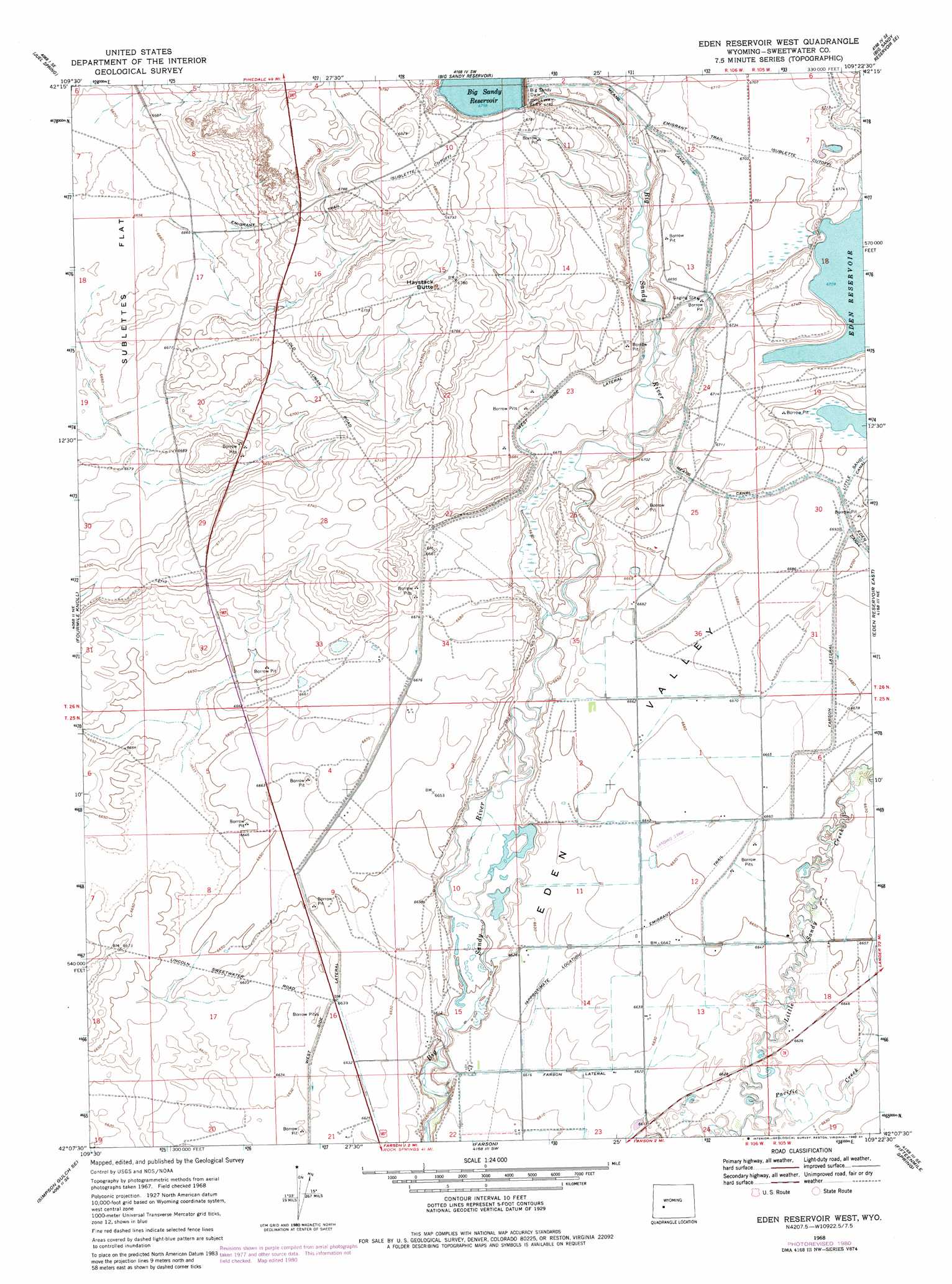
USGS Topo Quad 42109b4 - 1:24,000 scale
| Topo Map Name: | Eden Reservoir West |
| USGS Topo Quad ID: | 42109b4 |
| Print Size: | ca. 21 1/4" wide x 27" high |
| Southeast Coordinates: | 42.125° N latitude / 109.375° W longitude |
| Map Center Coordinates: | 42.1875° N latitude / 109.4375° W longitude |
| U.S. State: | WY |
| Filename: | o42109b4.jpg |
| Download Map JPG Image: | Eden Reservoir West topo map 1:24,000 scale |
| Map Type: | Topographic |
| Topo Series: | 7.5´ |
| Map Scale: | 1:24,000 |
| Source of Map Images: | United States Geological Survey (USGS) |
| Alternate Map Versions: |
Eden Reservoir West WY 1968, updated 1971 Download PDF Buy paper map Eden Reservoir West WY 1968, updated 1980 Download PDF Buy paper map Eden Reservoir West WY 1968, updated 1984 Download PDF Buy paper map Eden Reservoir West WY 2012 Download PDF Buy paper map Eden Reservoir West WY 2015 Download PDF Buy paper map |
1:24,000 Topo Quads surrounding Eden Reservoir West
Stud Horse Butte |
Bull Draw |
Tabernacle Butte |
Leckie Reservoir |
Prospect Mountains |
Teakettle Butte |
Juel Spring |
Big Sandy Reservoir |
Big Sandy Reservoir Se |
Parting Of The Ways |
Twelvemile Knoll |
Fourmile Knoll |
Eden Reservoir West |
Eden Reservoir East |
Tule Butte |
Simpson Gulch Sw |
Simpson Gulch Se |
Farson |
Fifteenmile Spring |
Ox Yoke Springs |
Gasson Bridge |
Pittman Well |
Clay Buttes |
White Rocks |
Boars Tusk |
> Back to 42109a1 at 1:100,000 scale
> Back to 42108a1 at 1:250,000 scale
> Back to U.S. Topo Maps home
Eden Reservoir West topo map: Gazetteer
Eden Reservoir West: Canals
Farson Lateral elevation 2031m 6663′Means Canal elevation 2043m 6702′
West Side Lateral elevation 2031m 6663′
Eden Reservoir West: Dams
Big Sandy Dam elevation 2045m 6709′Big Sandy Dam elevation 2046m 6712′
Eden Irrigation and Land Company Number 1 Dam elevation 2051m 6729′
Eden Reservoir West: Reservoirs
Big Sandy Reservoir elevation 2046m 6712′Eden Reservoir Number 1 elevation 2051m 6729′
Eden Reservoir West: Streams
Pacific Creek elevation 2016m 6614′Eden Reservoir West: Summits
Haystack Butte elevation 2071m 6794′Eden Reservoir West digital topo map on disk
Buy this Eden Reservoir West topo map showing relief, roads, GPS coordinates and other geographical features, as a high-resolution digital map file on DVD: