Community Lake Topo Map Idaho
To zoom in, hover over the map of Community Lake
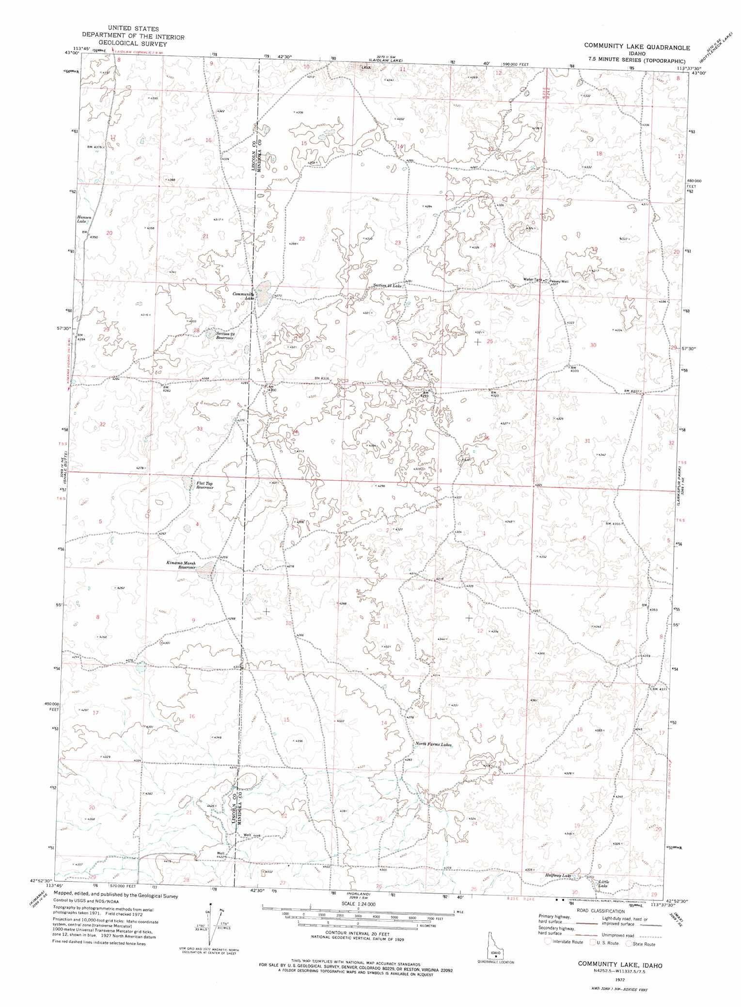
USGS Topo Quad 42113h6 - 1:24,000 scale
| Topo Map Name: | Community Lake |
| USGS Topo Quad ID: | 42113h6 |
| Print Size: | ca. 21 1/4" wide x 27" high |
| Southeast Coordinates: | 42.875° N latitude / 113.625° W longitude |
| Map Center Coordinates: | 42.9375° N latitude / 113.6875° W longitude |
| U.S. State: | ID |
| Filename: | o42113h6.jpg |
| Download Map JPG Image: | Community Lake topo map 1:24,000 scale |
| Map Type: | Topographic |
| Topo Series: | 7.5´ |
| Map Scale: | 1:24,000 |
| Source of Map Images: | United States Geological Survey (USGS) |
| Alternate Map Versions: |
Community Lake ID 1972, updated 1976 Download PDF Buy paper map Community Lake ID 2010 Download PDF Buy paper map Community Lake ID 2013 Download PDF Buy paper map |
1:24,000 Topo Quads surrounding Community Lake
Pagari Well |
Wagon Butte |
Laidlaw Butte |
Bear Den Butte |
Bear Park West |
Black Ridge Crater |
Halfway Lake |
Laidlaw Lake |
Bottleneck Lake |
Bear Park Sw |
Senter |
Shale Butte |
Community Lake |
Larkspur Park |
Brigham Point |
Kimama Butte |
Kimama |
Norland |
Max |
Minidoka |
Burley Nw |
Burley Ne |
Rupert Nw |
Acequia |
Lake Walcott West |
> Back to 42113e1 at 1:100,000 scale
> Back to 42112a1 at 1:250,000 scale
> Back to U.S. Topo Maps home
Community Lake topo map: Gazetteer
Community Lake: Lakes
Community Lake elevation 1305m 4281′Halfway Lake elevation 1314m 4311′
Hansen Lake elevation 1327m 4353′
Little Lake elevation 1314m 4311′
North Farms Lakes elevation 1305m 4281′
Section Twenty-Five Lake elevation 1312m 4304′
Community Lake: Reservoirs
Flat Top Reservoir elevation 1299m 4261′Kimama Marsh Reservoir elevation 1299m 4261′
Section Twenty-Eight Reservoir elevation 1299m 4261′
Community Lake: Wells
Peavey Well elevation 1317m 4320′Community Lake digital topo map on disk
Buy this Community Lake topo map showing relief, roads, GPS coordinates and other geographical features, as a high-resolution digital map file on DVD: