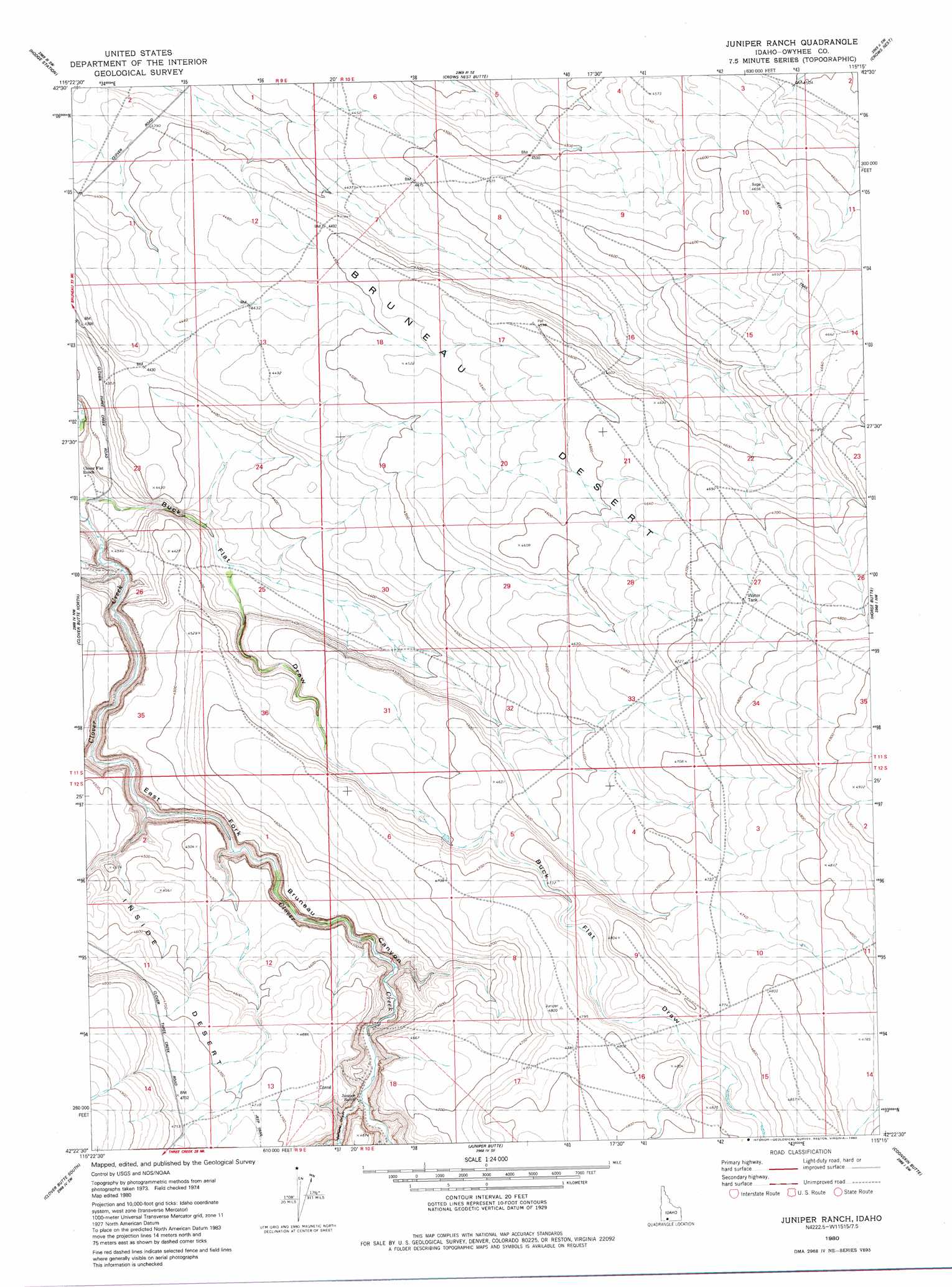
Juniper Ranch Topo Map Idaho
To zoom in, hover over the map of Juniper Ranch
USGS Topo Quad 42115d3 - 1:24,000 scale
| Topo Map Name: | Juniper Ranch |
| USGS Topo Quad ID: | 42115d3 |
| Print Size: | ca. 21 1/4" wide x 27" high |
| Southeast Coordinates: | 42.375° N latitude / 115.25° W longitude |
| Map Center Coordinates: | 42.4375° N latitude / 115.3125° W longitude |
| U.S. State: | ID |
| Filename: | o42115d3.jpg |
| Download Map JPG Image: | Juniper Ranch topo map 1:24,000 scale |
| Map Type: | Topographic |
| Topo Series: | 7.5´ |
| Map Scale: | 1:24,000 |
| Source of Map Images: | United States Geological Survey (USGS) |
| Alternate Map Versions: |
Juniper Ranch ID 1980, updated 1980 Download PDF Buy paper map Juniper Ranch ID 2010 Download PDF Buy paper map Juniper Ranch ID 2013 Download PDF Buy paper map |
1:24,000 Topo Quads surrounding Juniper Ranch
Pot Hole Butte |
Black Butte West |
Black Butte East |
Notch Butte |
Crows Nest Ne |
Winter Camp |
Hodge Station |
Crows Nest Butte |
Crows Nest |
Castleford Butte |
Stiff Tree Draw |
Clover Butte North |
Juniper Ranch |
Horse Butte |
Coonskin Butte Ne |
Inside Lakes |
Clover Butte South |
Juniper Butte |
Coonskin Butte |
Big Bend Crossing |
The Arch |
Poison Butte |
Mosquito Lake Butte |
Salls Crossing |
Grassy Hills |
> Back to 42115a1 at 1:100,000 scale
> Back to 42114a1 at 1:250,000 scale
> Back to U.S. Topo Maps home
Juniper Ranch digital topo map on disk
Buy this Juniper Ranch topo map showing relief, roads, GPS coordinates and other geographical features, as a high-resolution digital map file on DVD: