The Arch Topo Map Idaho
To zoom in, hover over the map of The Arch
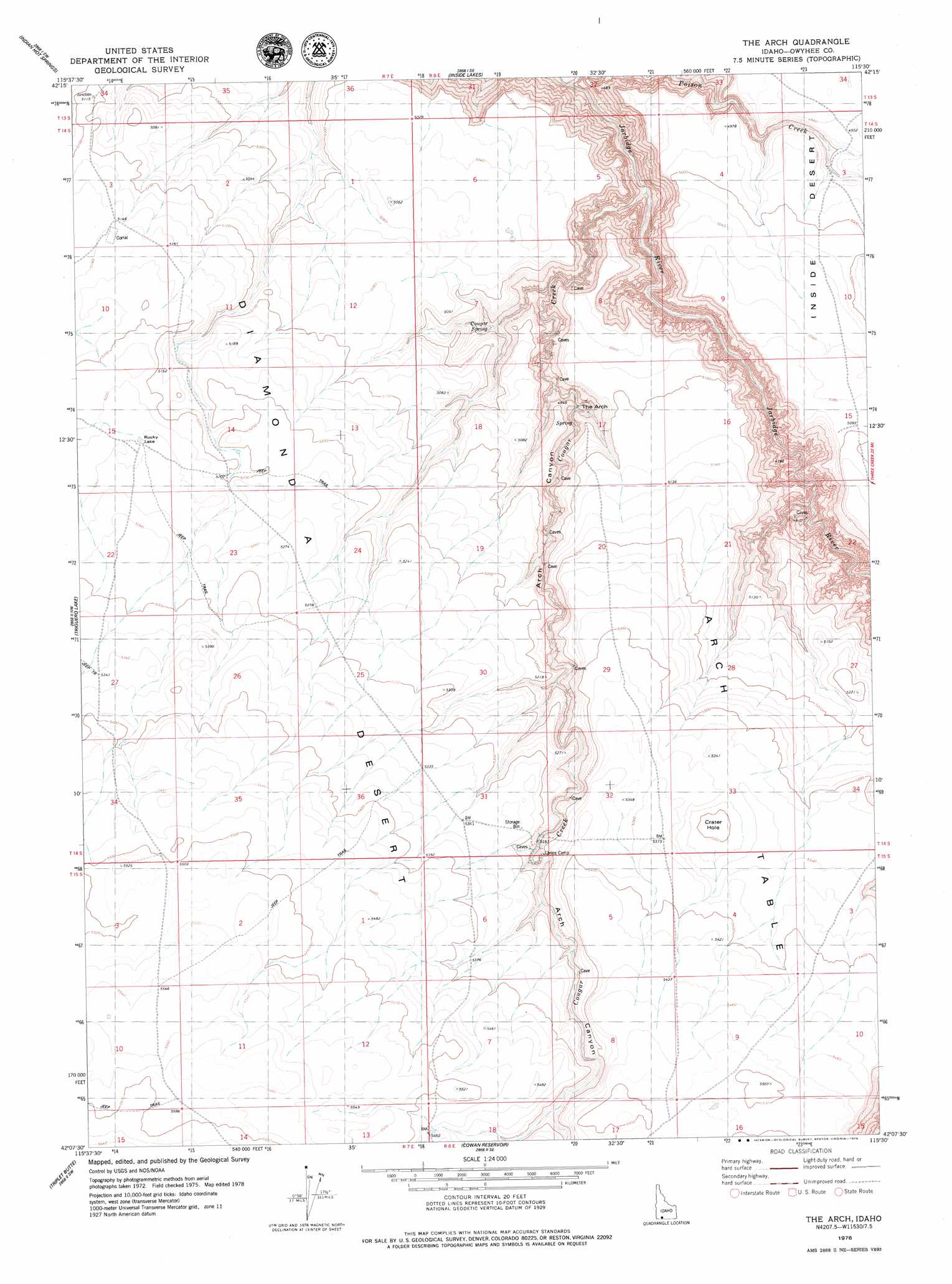
USGS Topo Quad 42115b5 - 1:24,000 scale
| Topo Map Name: | The Arch |
| USGS Topo Quad ID: | 42115b5 |
| Print Size: | ca. 21 1/4" wide x 27" high |
| Southeast Coordinates: | 42.125° N latitude / 115.5° W longitude |
| Map Center Coordinates: | 42.1875° N latitude / 115.5625° W longitude |
| U.S. State: | ID |
| Filename: | o42115b5.jpg |
| Download Map JPG Image: | The Arch topo map 1:24,000 scale |
| Map Type: | Topographic |
| Topo Series: | 7.5´ |
| Map Scale: | 1:24,000 |
| Source of Map Images: | United States Geological Survey (USGS) |
| Alternate Map Versions: |
The Arch ID 1978, updated 1979 Download PDF Buy paper map The Arch ID 2010 Download PDF Buy paper map The Arch ID 2013 Download PDF Buy paper map |
1:24,000 Topo Quads surrounding The Arch
Blackstone Reservoir |
Cave Draw |
Stiff Tree Draw |
Clover Butte North |
Juniper Ranch |
Buster Butte |
Indian Hot Springs |
Inside Lakes |
Clover Butte South |
Juniper Butte |
Antelope Creek |
Triguero Lake |
The Arch |
Poison Butte |
Mosquito Lake Butte |
Black Leg Creek |
Triplet Butte |
Cowan Reservoir |
Dishpan |
Murphy Hot Springs |
Hicks Mountain |
Big Table |
Bearpaw Mountain |
Jarbidge North |
Robinson Creek |
> Back to 42115a1 at 1:100,000 scale
> Back to 42114a1 at 1:250,000 scale
> Back to U.S. Topo Maps home
The Arch topo map: Gazetteer
The Arch: Arches
The Arch elevation 1463m 4799′The Arch: Craters
Crater Hole elevation 1614m 5295′The Arch: Lakes
Rocky Lake elevation 1597m 5239′The Arch: Plains
Diamond A Desert elevation 1614m 5295′The Arch: Springs
Cougar Spring elevation 1497m 4911′The Arch: Streams
Cougar Creek elevation 1291m 4235′Poison Creek elevation 1260m 4133′
Poison Creek elevation 1260m 4133′
The Arch: Summits
Arch Table elevation 1637m 5370′The Arch: Valleys
Arch Canyon elevation 1291m 4235′The Arch digital topo map on disk
Buy this The Arch topo map showing relief, roads, GPS coordinates and other geographical features, as a high-resolution digital map file on DVD: