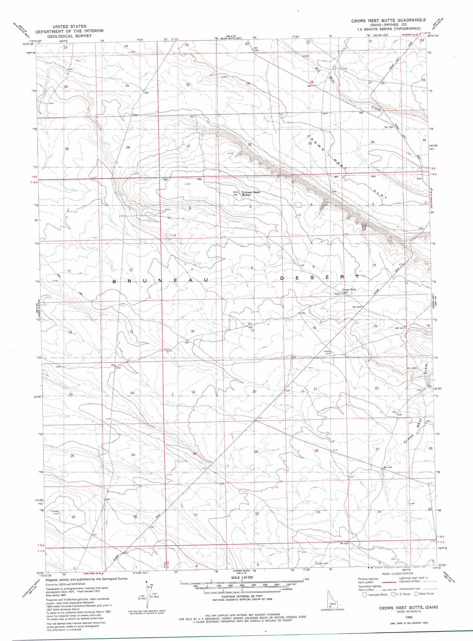
Crows Nest Butte Topo Map Idaho
To zoom in, hover over the map of Crows Nest Butte
USGS Topo Quad 42115e3 - 1:24,000 scale
| Topo Map Name: | Crows Nest Butte |
| USGS Topo Quad ID: | 42115e3 |
| Print Size: | ca. 21 1/4" wide x 27" high |
| Southeast Coordinates: | 42.5° N latitude / 115.25° W longitude |
| Map Center Coordinates: | 42.5625° N latitude / 115.3125° W longitude |
| U.S. State: | ID |
| Filename: | o42115e3.jpg |
| Download Map JPG Image: | Crows Nest Butte topo map 1:24,000 scale |
| Map Type: | Topographic |
| Topo Series: | 7.5´ |
| Map Scale: | 1:24,000 |
| Source of Map Images: | United States Geological Survey (USGS) |
| Alternate Map Versions: |
Crows Nest Butte ID 1980, updated 1980 Download PDF Buy paper map Crows Nest Butte ID 2010 Download PDF Buy paper map Crows Nest Butte ID 2013 Download PDF Buy paper map |
1:24,000 Topo Quads surrounding Crows Nest Butte
Pence Butte |
Pot Hole Canyon |
Grindstone Butte |
Twentymile Butte |
Indian Butte |
Pot Hole Butte |
Black Butte West |
Black Butte East |
Notch Butte |
Crows Nest Ne |
Winter Camp |
Hodge Station |
Crows Nest Butte |
Crows Nest |
Castleford Butte |
Stiff Tree Draw |
Clover Butte North |
Juniper Ranch |
Horse Butte |
Coonskin Butte Ne |
Inside Lakes |
Clover Butte South |
Juniper Butte |
Coonskin Butte |
Big Bend Crossing |
> Back to 42115e1 at 1:100,000 scale
> Back to 42114a1 at 1:250,000 scale
> Back to U.S. Topo Maps home
Crows Nest Butte topo map: Gazetteer
Crows Nest Butte: Flats
Crows Nest Flat elevation 1188m 3897′Crows Nest Butte: Reservoirs
Crows Nest Lake elevation 1289m 4229′Crows Nest Butte: Summits
Crows Nest Butte elevation 1300m 4265′Crows Nest Butte digital topo map on disk
Buy this Crows Nest Butte topo map showing relief, roads, GPS coordinates and other geographical features, as a high-resolution digital map file on DVD: