Notch Butte Topo Map Idaho
To zoom in, hover over the map of Notch Butte
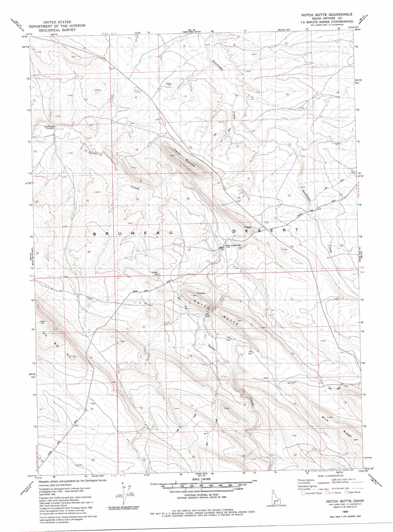
USGS Topo Quad 42115f2 - 1:24,000 scale
| Topo Map Name: | Notch Butte |
| USGS Topo Quad ID: | 42115f2 |
| Print Size: | ca. 21 1/4" wide x 27" high |
| Southeast Coordinates: | 42.625° N latitude / 115.125° W longitude |
| Map Center Coordinates: | 42.6875° N latitude / 115.1875° W longitude |
| U.S. State: | ID |
| Filename: | o42115f2.jpg |
| Download Map JPG Image: | Notch Butte topo map 1:24,000 scale |
| Map Type: | Topographic |
| Topo Series: | 7.5´ |
| Map Scale: | 1:24,000 |
| Source of Map Images: | United States Geological Survey (USGS) |
| Alternate Map Versions: |
Notch Butte ID 1980, updated 1980 Download PDF Buy paper map Notch Butte ID 2010 Download PDF Buy paper map Notch Butte ID 2013 Download PDF Buy paper map |
1:24,000 Topo Quads surrounding Notch Butte
Hammett |
Glenns Ferry |
Pasadena Valley |
Ticeska |
Bliss |
Pot Hole Canyon |
Grindstone Butte |
Twentymile Butte |
Indian Butte |
Hagerman |
Black Butte West |
Black Butte East |
Notch Butte |
Crows Nest Ne |
Yahoo Creek |
Hodge Station |
Crows Nest Butte |
Crows Nest |
Castleford Butte |
Balanced Rock |
Clover Butte North |
Juniper Ranch |
Horse Butte |
Coonskin Butte Ne |
Tuanna Butte |
> Back to 42115e1 at 1:100,000 scale
> Back to 42114a1 at 1:250,000 scale
> Back to U.S. Topo Maps home
Notch Butte topo map: Gazetteer
Notch Butte: Crossings
Deadhorse Crossing elevation 940m 3083′Notch Butte: Summits
Notch Butte elevation 1093m 3585′The Big Hill elevation 1212m 3976′
Twin Buttes elevation 1066m 3497′
Notch Butte: Wells
Sailor Creek Well elevation 965m 3166′Notch Butte digital topo map on disk
Buy this Notch Butte topo map showing relief, roads, GPS coordinates and other geographical features, as a high-resolution digital map file on DVD: