Grindstone Butte Topo Map Idaho
To zoom in, hover over the map of Grindstone Butte
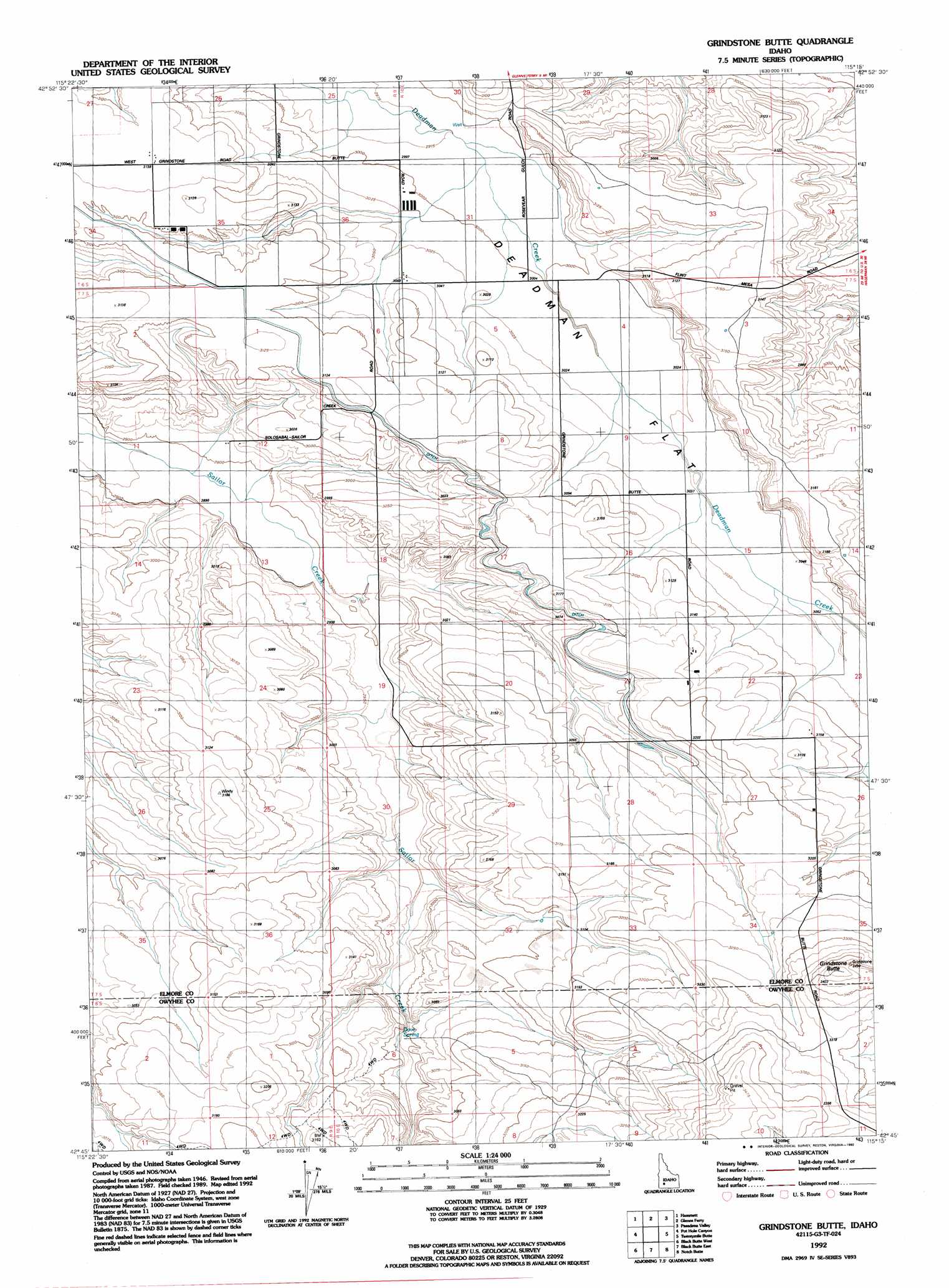
USGS Topo Quad 42115g3 - 1:24,000 scale
| Topo Map Name: | Grindstone Butte |
| USGS Topo Quad ID: | 42115g3 |
| Print Size: | ca. 21 1/4" wide x 27" high |
| Southeast Coordinates: | 42.75° N latitude / 115.25° W longitude |
| Map Center Coordinates: | 42.8125° N latitude / 115.3125° W longitude |
| U.S. State: | ID |
| Filename: | o42115g3.jpg |
| Download Map JPG Image: | Grindstone Butte topo map 1:24,000 scale |
| Map Type: | Topographic |
| Topo Series: | 7.5´ |
| Map Scale: | 1:24,000 |
| Source of Map Images: | United States Geological Survey (USGS) |
| Alternate Map Versions: |
Grindstone Butte ID 1948, updated 1973 Download PDF Buy paper map Grindstone Butte ID 1949 Download PDF Buy paper map Grindstone Butte ID 1992, updated 1992 Download PDF Buy paper map Grindstone Butte ID 2010 Download PDF Buy paper map Grindstone Butte ID 2013 Download PDF Buy paper map |
1:24,000 Topo Quads surrounding Grindstone Butte
Reverse |
Hot Springs Creek Reservoir |
Morrow Reservoir |
King Hill |
Hog Creek |
Indian Cove |
Hammett |
Glenns Ferry |
Pasadena Valley |
Ticeska |
Pence Butte |
Pot Hole Canyon |
Grindstone Butte |
Twentymile Butte |
Indian Butte |
Pot Hole Butte |
Black Butte West |
Black Butte East |
Notch Butte |
Crows Nest Ne |
Winter Camp |
Hodge Station |
Crows Nest Butte |
Crows Nest |
Castleford Butte |
> Back to 42115e1 at 1:100,000 scale
> Back to 42114a1 at 1:250,000 scale
> Back to U.S. Topo Maps home
Grindstone Butte topo map: Gazetteer
Grindstone Butte: Basins
Dove Spring elevation 902m 2959′Grindstone Butte: Summits
Grindstone Butte elevation 1052m 3451′Grindstone Butte: Wells
Wilson Well (historical) elevation 916m 3005′Grindstone Butte digital topo map on disk
Buy this Grindstone Butte topo map showing relief, roads, GPS coordinates and other geographical features, as a high-resolution digital map file on DVD: