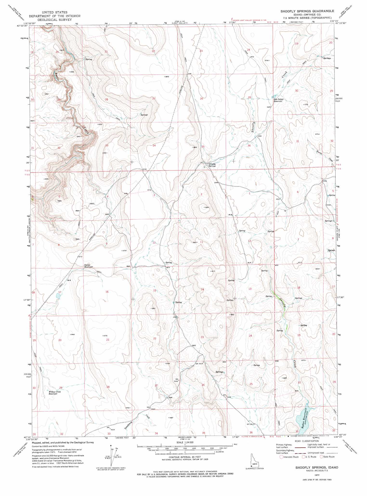
Shoofly Springs Topo Map Idaho
To zoom in, hover over the map of Shoofly Springs
USGS Topo Quad 42116c3 - 1:24,000 scale
| Topo Map Name: | Shoofly Springs |
| USGS Topo Quad ID: | 42116c3 |
| Print Size: | ca. 21 1/4" wide x 27" high |
| Southeast Coordinates: | 42.25° N latitude / 116.25° W longitude |
| Map Center Coordinates: | 42.3125° N latitude / 116.3125° W longitude |
| U.S. State: | ID |
| Filename: | o42116c3.jpg |
| Download Map JPG Image: | Shoofly Springs topo map 1:24,000 scale |
| Map Type: | Topographic |
| Topo Series: | 7.5´ |
| Map Scale: | 1:24,000 |
| Source of Map Images: | United States Geological Survey (USGS) |
| Alternate Map Versions: |
Shoofly Springs ID 1972, updated 1976 Download PDF Buy paper map Shoofly Springs ID 2010 Download PDF Buy paper map Shoofly Springs ID 2013 Download PDF Buy paper map |
1:24,000 Topo Quads surrounding Shoofly Springs
Wagon Box Basin |
Big Springs Ranch |
Crab Spring Butte |
Sugarloaf |
Hill Pasture |
Dickshooter Reservoir |
Frying Pan Basin |
Lost Valley |
Turner Table |
Wickahoney Point |
Dickshooter Ridge |
Battle Creek Lakes |
Shoofly Springs |
Nichol Flat |
Little Blue Table |
Piute Basin East |
Jarvis Pasture |
Ross Lake |
Flying H Ranch |
Riddle |
Four Corners |
Juniper Basin |
Juniper Basin Se |
Mountain View Lake |
Three Forks |
> Back to 42116a1 at 1:100,000 scale
> Back to 42116a1 at 1:250,000 scale
> Back to U.S. Topo Maps home
Shoofly Springs topo map: Gazetteer
Shoofly Springs: Dams
Bybee Dam elevation 1657m 5436′Shoofly Dam elevation 1709m 5606′
Shoofly Springs: Reservoirs
Bybee Reservoir elevation 1657m 5436′Eds Defeat Reservoir elevation 1711m 5613′
Harris Creek Reservoir elevation 1699m 5574′
Owens Reservoir elevation 1725m 5659′
Shoofly Reservoir elevation 1709m 5606′
Willow Creek Reservoir elevation 1695m 5561′
Shoofly Springs: Springs
Shoofly Springs elevation 1705m 5593′Shoofly Springs digital topo map on disk
Buy this Shoofly Springs topo map showing relief, roads, GPS coordinates and other geographical features, as a high-resolution digital map file on DVD: