Mountain View Lake Topo Map Idaho
To zoom in, hover over the map of Mountain View Lake
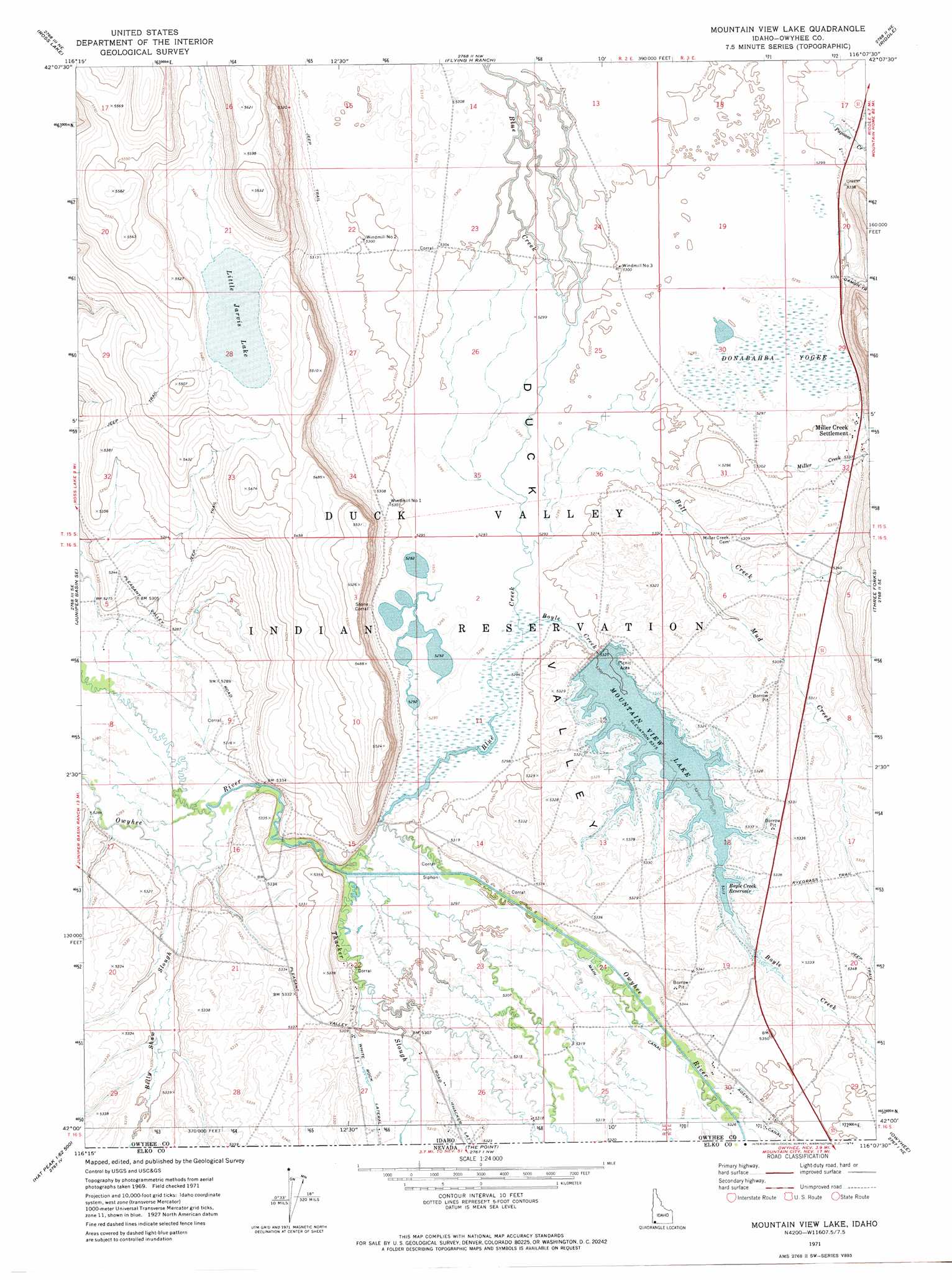
USGS Topo Quad 42116a2 - 1:24,000 scale
| Topo Map Name: | Mountain View Lake |
| USGS Topo Quad ID: | 42116a2 |
| Print Size: | ca. 21 1/4" wide x 27" high |
| Southeast Coordinates: | 42° N latitude / 116.125° W longitude |
| Map Center Coordinates: | 42.0625° N latitude / 116.1875° W longitude |
| U.S. State: | ID |
| Filename: | o42116a2.jpg |
| Download Map JPG Image: | Mountain View Lake topo map 1:24,000 scale |
| Map Type: | Topographic |
| Topo Series: | 7.5´ |
| Map Scale: | 1:24,000 |
| Source of Map Images: | United States Geological Survey (USGS) |
| Alternate Map Versions: |
Mountain View Lake ID 1971, updated 1974 Download PDF Buy paper map Mountain View Lake ID 2010 Download PDF Buy paper map Mountain View Lake ID 2013 Download PDF Buy paper map |
1:24,000 Topo Quads surrounding Mountain View Lake
Battle Creek Lakes |
Shoofly Springs |
Nichol Flat |
Little Blue Table |
Grasmere Reservoir |
Jarvis Pasture |
Ross Lake |
Flying H Ranch |
Riddle |
Buckhorn |
Juniper Basin |
Juniper Basin Se |
Mountain View Lake |
Three Forks |
Indian Hay Meadows |
Hat Peak |
Groundhog Reservoir |
The Point |
Owyhee |
Winter Ridge |
Peterson Table East |
Sheep Creek Reservoir |
Dry Creek Reservoir |
Ungina Wongo |
Mountain City |
> Back to 42116a1 at 1:100,000 scale
> Back to 42116a1 at 1:250,000 scale
> Back to U.S. Topo Maps home
Mountain View Lake topo map: Gazetteer
Mountain View Lake: Canals
Main Canal elevation 1622m 5321′Thacker Lateral elevation 1624m 5328′
Mountain View Lake: Dams
Mountain View Dam elevation 1621m 5318′Mountain View Lake: Lakes
Little Jarvis Lake elevation 1663m 5456′Mountain View Lake: Populated Places
Miller Creek Settlement elevation 1623m 5324′Mountain View Lake: Reservoirs
Boyle Creek Reservoir elevation 1622m 5321′Mountain View Lake elevation 1621m 5318′
Mountain View Lake: Streams
Bell Creek elevation 1614m 5295′Billy Shaw Slough elevation 1611m 5285′
Billy Shaw Slough elevation 1611m 5285′
Blue Creek elevation 1612m 5288′
Boyle Creek elevation 1613m 5291′
Boyle Creek elevation 1614m 5295′
Damon Trail Creek elevation 1616m 5301′
Miller Creek elevation 1616m 5301′
Mud Creek elevation 1616m 5301′
Thacker Slough elevation 1612m 5288′
Thacker Slough elevation 1613m 5291′
Mountain View Lake: Swamps
Donabahba Yogee elevation 1614m 5295′Mountain View Lake digital topo map on disk
Buy this Mountain View Lake topo map showing relief, roads, GPS coordinates and other geographical features, as a high-resolution digital map file on DVD: