Breckenridge Topo Map Michigan
To zoom in, hover over the map of Breckenridge
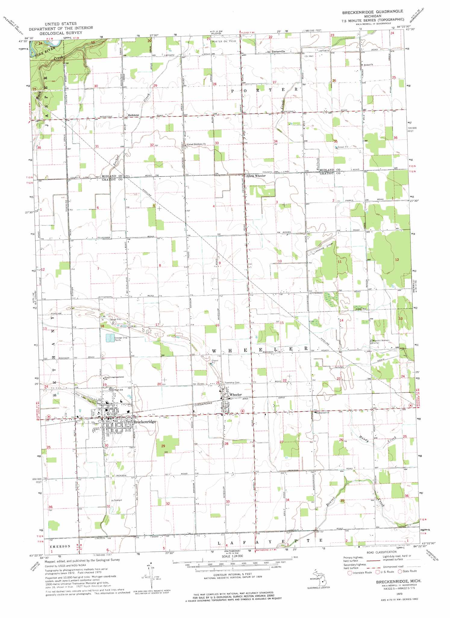
USGS Topo Quad 43084d4 - 1:24,000 scale
| Topo Map Name: | Breckenridge |
| USGS Topo Quad ID: | 43084d4 |
| Print Size: | ca. 21 1/4" wide x 27" high |
| Southeast Coordinates: | 43.375° N latitude / 84.375° W longitude |
| Map Center Coordinates: | 43.4375° N latitude / 84.4375° W longitude |
| U.S. State: | MI |
| Filename: | o43084d4.jpg |
| Download Map JPG Image: | Breckenridge topo map 1:24,000 scale |
| Map Type: | Topographic |
| Topo Series: | 7.5´ |
| Map Scale: | 1:24,000 |
| Source of Map Images: | United States Geological Survey (USGS) |
| Alternate Map Versions: |
Breckenridge MI 1973, updated 1977 Download PDF Buy paper map Breckenridge MI 2011 Download PDF Buy paper map Breckenridge MI 2014 Download PDF Buy paper map Breckenridge MI 2016 Download PDF Buy paper map |
1:24,000 Topo Quads surrounding Breckenridge
Leaton |
Alamando |
Sanford |
Averill |
Midland North |
Shepherd |
Pleasant Valley |
Floyd |
Gordonville |
Midland South |
Alma North |
Saint Louis |
Breckenridge |
Merrill |
Hemlock |
Alma South |
Ithaca |
Rathbone |
Lakefield |
Saint Charles |
Perrinton |
Pompeii |
Ashley |
Chapin |
Chesaning West |
> Back to 43084a1 at 1:100,000 scale
> Back to 43084a1 at 1:250,000 scale
> Back to U.S. Topo Maps home
Breckenridge topo map: Gazetteer
Breckenridge: Canals
Bush Drain elevation 210m 688′Centerline Drain elevation 212m 695′
Jackson Street Drain elevation 212m 695′
Redstone Drain elevation 209m 685′
Ryan Drain elevation 206m 675′
Townline Drain elevation 212m 695′
Weeks Drain elevation 212m 695′
Breckenridge: Parks
Saginaw and Gratiot County State Road Historical Marker elevation 224m 734′Saginaw Valley and Saint Louis Railroad Historical Marker elevation 224m 734′
Breckenridge: Populated Places
Breckenridge elevation 224m 734′Breckenridge Mobile Home Park elevation 222m 728′
North Wheeler elevation 213m 698′
Redstone elevation 211m 692′
Teeterville elevation 207m 679′
Wheeler elevation 219m 718′
Breckenridge: Post Offices
Breckenridge Post Office elevation -1m -4′North Wheeler Post Office (historical) elevation 213m 698′
Redstone Post Office (historical) elevation 211m 692′
Wheeler Post Office elevation 221m 725′
Breckenridge digital topo map on disk
Buy this Breckenridge topo map showing relief, roads, GPS coordinates and other geographical features, as a high-resolution digital map file on DVD: