Saint Louis Topo Map Michigan
To zoom in, hover over the map of Saint Louis
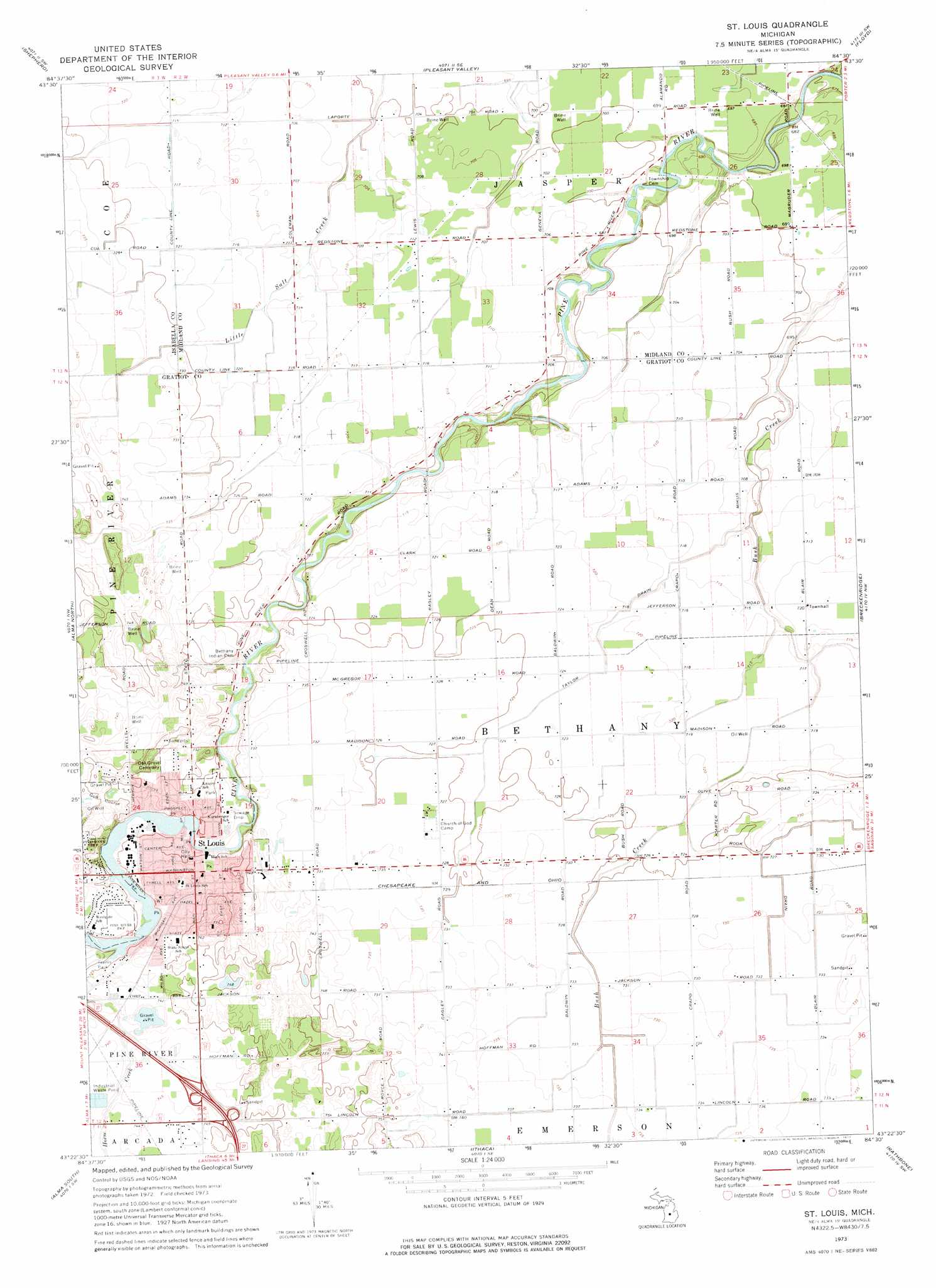
USGS Topo Quad 43084d5 - 1:24,000 scale
| Topo Map Name: | Saint Louis |
| USGS Topo Quad ID: | 43084d5 |
| Print Size: | ca. 21 1/4" wide x 27" high |
| Southeast Coordinates: | 43.375° N latitude / 84.5° W longitude |
| Map Center Coordinates: | 43.4375° N latitude / 84.5625° W longitude |
| U.S. State: | MI |
| Filename: | o43084d5.jpg |
| Download Map JPG Image: | Saint Louis topo map 1:24,000 scale |
| Map Type: | Topographic |
| Topo Series: | 7.5´ |
| Map Scale: | 1:24,000 |
| Source of Map Images: | United States Geological Survey (USGS) |
| Alternate Map Versions: |
St. Louis MI 1973, updated 1977 Download PDF Buy paper map Saint Louis MI 2011 Download PDF Buy paper map Saint Louis MI 2014 Download PDF Buy paper map Saint Louis MI 2016 Download PDF Buy paper map |
1:24,000 Topo Quads surrounding Saint Louis
Rosebush |
Leaton |
Alamando |
Sanford |
Averill |
Mount Pleasant |
Shepherd |
Pleasant Valley |
Floyd |
Gordonville |
Riverdale |
Alma North |
Saint Louis |
Breckenridge |
Merrill |
Sumner |
Alma South |
Ithaca |
Rathbone |
Lakefield |
Carson City |
Perrinton |
Pompeii |
Ashley |
Chapin |
> Back to 43084a1 at 1:100,000 scale
> Back to 43084a1 at 1:250,000 scale
> Back to U.S. Topo Maps home
Saint Louis topo map: Gazetteer
Saint Louis: Airports
McJilton Field elevation 222m 728′Saint Louis: Canals
Rook Drain elevation 221m 725′Taylor Drain elevation 220m 721′
Saint Louis: Crossings
Interchange 123 elevation 232m 761′Interchange 124 elevation 231m 757′
Saint Louis: Populated Places
Evergreen Village Mobile Home Park elevation 221m 725′Nesen's Countryside Mobile Home Park elevation 220m 721′
Saint Louis elevation 223m 731′
Woodcrest Estates Mobile Home Park elevation 0m 0′
Saint Louis: Post Offices
Bush Post Office (historical) elevation 214m 702′Saint Louis Post Office elevation 0m 0′
Saint Louis: Streams
Horse Creek elevation 219m 718′Saint Louis digital topo map on disk
Buy this Saint Louis topo map showing relief, roads, GPS coordinates and other geographical features, as a high-resolution digital map file on DVD: