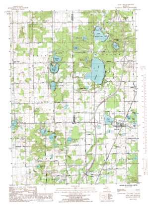
Sand Lake Topo Map Michigan
To zoom in, hover over the map of Sand Lake
USGS Topo Quad 43085c5 - 1:24,000 scale
| Topo Map Name: | Sand Lake |
| USGS Topo Quad ID: | 43085c5 |
| Print Size: | ca. 21 1/4" wide x 27" high |
| Southeast Coordinates: | 43.25° N latitude / 85.5° W longitude |
| Map Center Coordinates: | 43.3125° N latitude / 85.5625° W longitude |
| U.S. State: | MI |
| Filename: | o43085c5.jpg |
| Download Map JPG Image: | Sand Lake topo map 1:24,000 scale |
| Map Type: | Topographic |
| Topo Series: | 7.5´ |
| Map Scale: | 1:24,000 |
| Source of Map Images: | United States Geological Survey (USGS) |
| Alternate Map Versions: |
Sand Lake MI 1985, updated 1985 Download PDF Buy paper map Sand Lake MI 2011 Download PDF Buy paper map Sand Lake MI 2014 Download PDF Buy paper map Sand Lake MI 2017 Download PDF Buy paper map |
1:24,000 Topo Quads surrounding Sand Lake
> Back to 43085a1 at 1:100,000 scale
> Back to 43084a1 at 1:250,000 scale
> Back to U.S. Topo Maps home
Sand Lake topo map: Gazetteer
Sand Lake: Airports
North Cedar Airport elevation 268m 879′North Kent Airpark elevation 279m 915′
Sand Lake: Canals
Lockwood Drain elevation 270m 885′Sand Lake: Crossings
Interchange 110 elevation 276m 905′Interchange 114 elevation 292m 958′
Sand Lake: Lakes
Amazie Lake elevation 267m 875′Baptist Lake elevation 281m 921′
Bass Lake elevation 270m 885′
Blind Lake elevation 269m 882′
Breford Lake elevation 278m 912′
Butternut Lake elevation 267m 875′
Conover Lake elevation 280m 918′
Cook and White Lake elevation 272m 892′
Englewright Lake elevation 276m 905′
Gidding Lake elevation 273m 895′
Helena Lake elevation 277m 908′
Little Bass Lake elevation 271m 889′
Little Mud Lake elevation 281m 921′
Little Whitefish Lake elevation 264m 866′
Lost Lake elevation 272m 892′
Lower Lake elevation 272m 892′
Middle Lake elevation 273m 895′
Mill Pond elevation 261m 856′
Newcomb Lake elevation 281m 921′
No-Ko-Mos Lake elevation 269m 882′
Reed Lake elevation 269m 882′
Sand Lake elevation 280m 918′
Sealey Lake elevation 271m 889′
Spring Pond elevation 273m 895′
Upper Lake elevation 273m 895′
Waltman Lake elevation 274m 898′
Ware Lake elevation 270m 885′
Whitefish Lake elevation 265m 869′
Sand Lake: Parks
Baptist Lake Township Park elevation 285m 935′Spangs County Park elevation 269m 882′
Sand Lake: Populated Places
Ensley Center elevation 303m 994′Sand Lake elevation 279m 915′
White Creek Country Estates Mobile Home Park elevation 275m 902′
Sand Lake: Post Offices
Ensley Post Office (historical) elevation 291m 954′Grove Post Office (historical) elevation 301m 987′
Lockwood Post Office (historical) elevation 270m 885′
Sand Lake Post Office elevation 279m 915′
Sand Lake digital topo map on disk
Buy this Sand Lake topo map showing relief, roads, GPS coordinates and other geographical features, as a high-resolution digital map file on DVD:


