Whipple Lake Topo Map Michigan
To zoom in, hover over the map of Whipple Lake
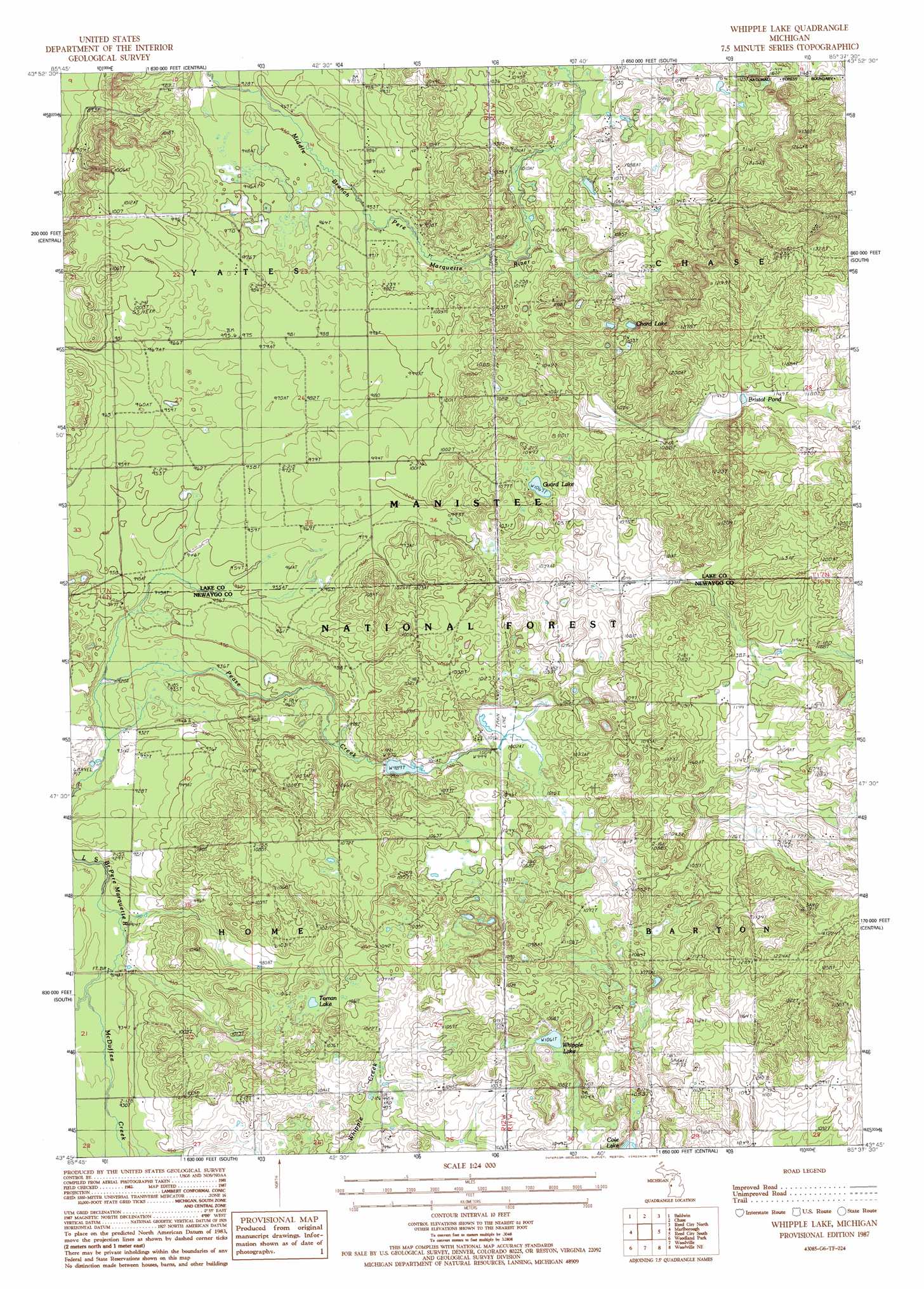
USGS Topo Quad 43085g6 - 1:24,000 scale
| Topo Map Name: | Whipple Lake |
| USGS Topo Quad ID: | 43085g6 |
| Print Size: | ca. 21 1/4" wide x 27" high |
| Southeast Coordinates: | 43.75° N latitude / 85.625° W longitude |
| Map Center Coordinates: | 43.8125° N latitude / 85.6875° W longitude |
| U.S. State: | MI |
| Filename: | o43085g6.jpg |
| Download Map JPG Image: | Whipple Lake topo map 1:24,000 scale |
| Map Type: | Topographic |
| Topo Series: | 7.5´ |
| Map Scale: | 1:24,000 |
| Source of Map Images: | United States Geological Survey (USGS) |
| Alternate Map Versions: |
Whipple Lake MI 1987, updated 1987 Download PDF Buy paper map Whipple Lake MI 2012 Download PDF Buy paper map Whipple Lake MI 2014 Download PDF Buy paper map Whipple Lake MI 2017 Download PDF Buy paper map |
| FStopo: | US Forest Service topo Whipple Lake is available: Download FStopo PDF Download FStopo TIF |
1:24,000 Topo Quads surrounding Whipple Lake
Peacock Sw |
Peacock Se |
Luther Sw |
Luther Se |
Le Roy |
Townsend Lake |
Baldwin |
Chase |
Reed City North |
Slaybaugh Corner |
Big Star Lake |
Marlborough |
Whipple Lake |
Reed City South |
Hersey |
Walkup Lake |
Woodland Park |
Woodville |
Woodville Ne |
Big Rapids |
Dayton Center |
White Cloud |
Big Prairie |
Big Bend |
Stanwood |
> Back to 43085e1 at 1:100,000 scale
> Back to 43084a1 at 1:250,000 scale
> Back to U.S. Topo Maps home
Whipple Lake topo map: Gazetteer
Whipple Lake: Lakes
Bristol Pond elevation 346m 1135′Chard Lake elevation 336m 1102′
Cole Lake elevation 313m 1026′
Guard Lake elevation 325m 1066′
Toman Lake elevation 313m 1026′
Whipple Lake elevation 326m 1069′
Whipple Lake: Post Offices
Cook's Station Post Office (historical) elevation 310m 1017′Norway Hall Post Office (historical) elevation 321m 1053′
Whipple Lake: Streams
McDuffee Creek elevation 277m 908′Whipple Lake digital topo map on disk
Buy this Whipple Lake topo map showing relief, roads, GPS coordinates and other geographical features, as a high-resolution digital map file on DVD: