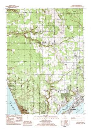
Dalton Topo Map Michigan
To zoom in, hover over the map of Dalton
USGS Topo Quad 43086c3 - 1:25,000 scale
| Topo Map Name: | Dalton |
| USGS Topo Quad ID: | 43086c3 |
| Print Size: | ca. 21 1/4" wide x 27" high |
| Southeast Coordinates: | 43.25° N latitude / 86.25° W longitude |
| Map Center Coordinates: | 43.3125° N latitude / 86.3125° W longitude |
| U.S. State: | MI |
| Filename: | l43086c3.jpg |
| Download Map JPG Image: | Dalton topo map 1:25,000 scale |
| Map Type: | Topographic |
| Topo Series: | 7.5´ |
| Map Scale: | 1:25,000 |
| Source of Map Images: | United States Geological Survey (USGS) |
| Alternate Map Versions: |
Dalton MI 1983, updated 1983 Download PDF Buy paper map |
1:24,000 Topo Quads surrounding Dalton
Bigsbie Lake |
Town Corners |
Shelby |
Ferry |
Hesperia |
Flower Creek |
Montague |
Big Blue Lake |
Holton |
|
Michillinda |
Dalton |
Twin Lake |
Wolf Lake |
|
Muskegon West |
Muskegon East |
Sullivan |
||
Grand Haven |
Nunica |
> Back to 43086a1 at 1:100,000 scale
> Back to 43086a1 at 1:250,000 scale
> Back to U.S. Topo Maps home
Dalton topo map: Gazetteer
Dalton: Lakes
Bear Lake elevation 177m 580′Dalton: Oilfields
Laketon Oil Field elevation 188m 616′Dalton: Parks
Castenholtz Park elevation 202m 662′Jack's Field elevation 190m 623′
Mullally Park elevation 192m 629′
Pioneer County Park elevation 187m 613′
Pioneer Park elevation 187m 613′
Dalton: Populated Places
Berry Junction elevation 196m 643′Dalton elevation 201m 659′
Franklin Communities Mobile Home Park elevation 199m 652′
Lakewood Club elevation 207m 679′
North Muskegon elevation 189m 620′
Shady Oaks Mobile Home Park elevation 194m 636′
Dalton: Post Offices
Dalton Post Office (historical) elevation 201m 659′Green Creek Post Office (historical) elevation 186m 610′
Lakewood Club Post Office (historical) elevation 207m 679′
North Muskegon Post Office elevation 190m 623′
Dalton: Streams
Bear Creek elevation 177m 580′North Channel elevation 177m 580′
Scholes Creek elevation 184m 603′
Todd Creek elevation 183m 600′
Dalton digital topo map on disk
Buy this Dalton topo map showing relief, roads, GPS coordinates and other geographical features, as a high-resolution digital map file on DVD:


