Duncan Topo Map Iowa
To zoom in, hover over the map of Duncan
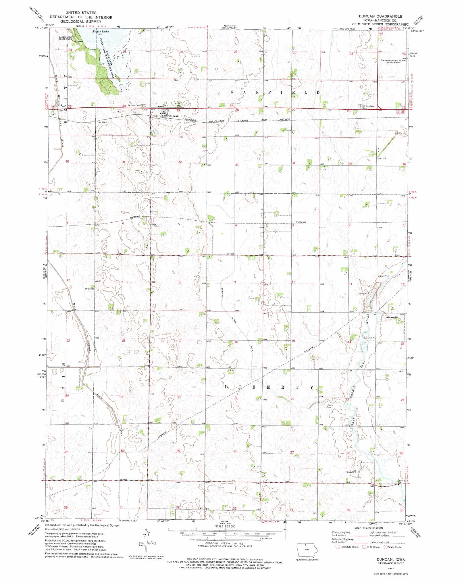
USGS Topo Quad 43093a6 - 1:24,000 scale
| Topo Map Name: | Duncan |
| USGS Topo Quad ID: | 43093a6 |
| Print Size: | ca. 21 1/4" wide x 27" high |
| Southeast Coordinates: | 43° N latitude / 93.625° W longitude |
| Map Center Coordinates: | 43.0625° N latitude / 93.6875° W longitude |
| U.S. State: | IA |
| Filename: | o43093a6.jpg |
| Download Map JPG Image: | Duncan topo map 1:24,000 scale |
| Map Type: | Topographic |
| Topo Series: | 7.5´ |
| Map Scale: | 1:24,000 |
| Source of Map Images: | United States Geological Survey (USGS) |
| Alternate Map Versions: |
Duncan IA 1972, updated 1975 Download PDF Buy paper map Duncan IA 2010 Download PDF Buy paper map Duncan IA 2013 Download PDF Buy paper map Duncan IA 2015 Download PDF Buy paper map |
1:24,000 Topo Quads surrounding Duncan
Buffalo Center Sw |
Thompson |
Forest City |
Pilot Knob |
Fertile |
Woden |
Crystal Lake |
Hayfield |
Miller |
Clear Lake West |
Wesley |
Britt |
Duncan |
Garner |
Ventura Heights |
Corwith |
Kanawha |
Olaf |
Goodell |
Thornton |
Renwick |
Kanawha Se |
Cornelia |
Belmond |
Alexander |
> Back to 43093a1 at 1:100,000 scale
> Back to 43092a1 at 1:250,000 scale
> Back to U.S. Topo Maps home
Duncan topo map: Gazetteer
Duncan: Canals
Drainage Ditch Number 6 elevation 371m 1217′Duncan: Parks
Eagle Lake Woodland Area elevation 372m 1220′Duncan: Populated Places
Duncan elevation 375m 1230′Duncan: Post Offices
Duncan Post Office (historical) elevation 378m 1240′German Post Office (historical) elevation 375m 1230′
Duncan digital topo map on disk
Buy this Duncan topo map showing relief, roads, GPS coordinates and other geographical features, as a high-resolution digital map file on DVD: