Goodell Topo Map Iowa
To zoom in, hover over the map of Goodell
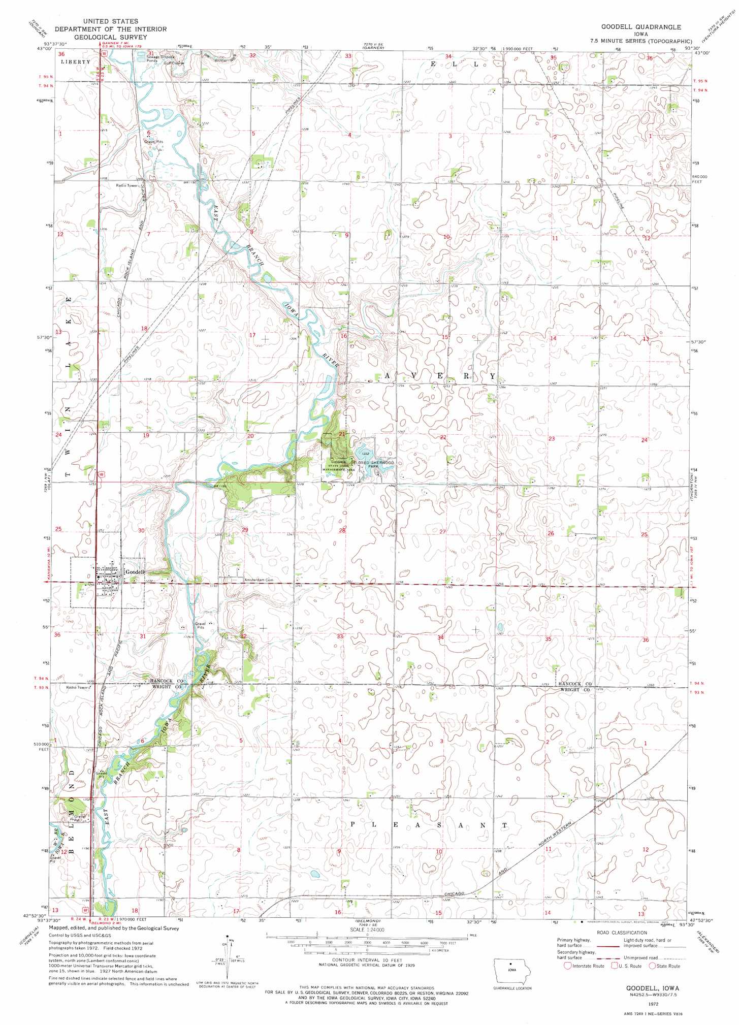
USGS Topo Quad 42093h5 - 1:24,000 scale
| Topo Map Name: | Goodell |
| USGS Topo Quad ID: | 42093h5 |
| Print Size: | ca. 21 1/4" wide x 27" high |
| Southeast Coordinates: | 42.875° N latitude / 93.5° W longitude |
| Map Center Coordinates: | 42.9375° N latitude / 93.5625° W longitude |
| U.S. State: | IA |
| Filename: | o42093h5.jpg |
| Download Map JPG Image: | Goodell topo map 1:24,000 scale |
| Map Type: | Topographic |
| Topo Series: | 7.5´ |
| Map Scale: | 1:24,000 |
| Source of Map Images: | United States Geological Survey (USGS) |
| Alternate Map Versions: |
Goodell IA 1972, updated 1975 Download PDF Buy paper map Goodell IA 2010 Download PDF Buy paper map Goodell IA 2013 Download PDF Buy paper map Goodell IA 2015 Download PDF Buy paper map |
1:24,000 Topo Quads surrounding Goodell
Crystal Lake |
Hayfield |
Miller |
Clear Lake West |
Clear Lake East |
Britt |
Duncan |
Garner |
Ventura Heights |
Burchinal |
Kanawha |
Olaf |
Goodell |
Thornton |
Swaledale |
Kanawha Se |
Cornelia |
Belmond |
Alexander |
Latimer |
Holmes |
Clarion |
Dows West |
Dows East |
Coulter |
> Back to 42093e1 at 1:100,000 scale
> Back to 42092a1 at 1:250,000 scale
> Back to U.S. Topo Maps home
Goodell topo map: Gazetteer
Goodell: Dams
Eldred Sherwood Park Lake Dam elevation 373m 1223′Goodell: Parks
Eldred-Sherwood Recreation Area elevation 375m 1230′Goodell Wildlife Area elevation 378m 1240′
Lau Wildlife Area elevation 362m 1187′
Sullivan Wildlife Area elevation 356m 1167′
Goodell: Populated Places
Goodell elevation 379m 1243′Goodell: Post Offices
Goodell Post Office elevation 379m 1243′Palsville Post Office (historical) elevation 379m 1243′
Goodell: Reservoirs
Eldred Sherwood Park Lake elevation 373m 1223′Goodell digital topo map on disk
Buy this Goodell topo map showing relief, roads, GPS coordinates and other geographical features, as a high-resolution digital map file on DVD: