Minnesota Lake Topo Map Minnesota
To zoom in, hover over the map of Minnesota Lake
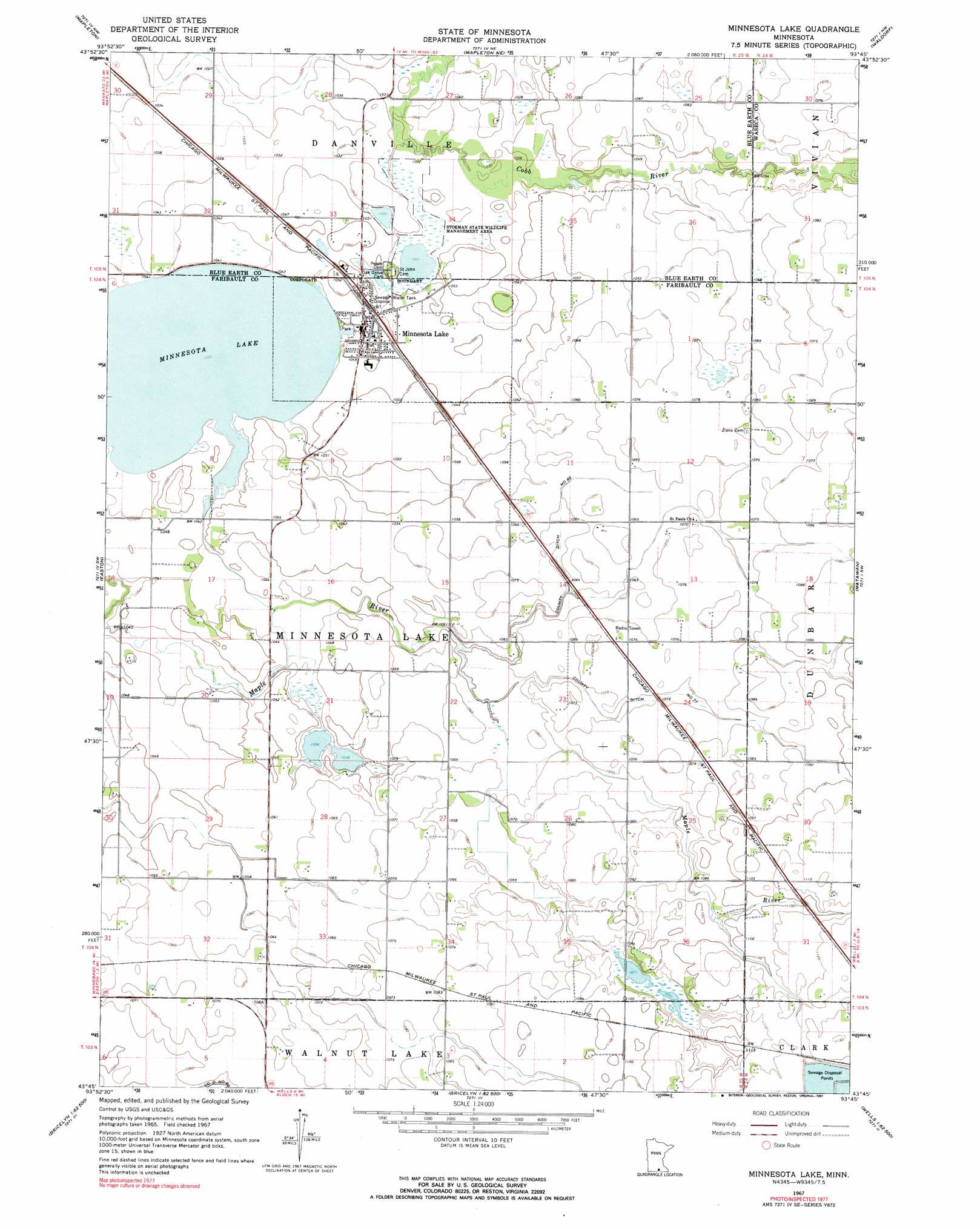
USGS Topo Quad 43093g7 - 1:24,000 scale
| Topo Map Name: | Minnesota Lake |
| USGS Topo Quad ID: | 43093g7 |
| Print Size: | ca. 21 1/4" wide x 27" high |
| Southeast Coordinates: | 43.75° N latitude / 93.75° W longitude |
| Map Center Coordinates: | 43.8125° N latitude / 93.8125° W longitude |
| U.S. State: | MN |
| Filename: | o43093g7.jpg |
| Download Map JPG Image: | Minnesota Lake topo map 1:24,000 scale |
| Map Type: | Topographic |
| Topo Series: | 7.5´ |
| Map Scale: | 1:24,000 |
| Source of Map Images: | United States Geological Survey (USGS) |
| Alternate Map Versions: |
Minnesota Lake MN 1967, updated 1968 Download PDF Buy paper map Minnesota Lake MN 1967, updated 1991 Download PDF Buy paper map Minnesota Lake MN 2010 Download PDF Buy paper map Minnesota Lake MN 2013 Download PDF Buy paper map Minnesota Lake MN 2016 Download PDF Buy paper map |
1:24,000 Topo Quads surrounding Minnesota Lake
Good Thunder |
Beauford |
Saint Clair |
Janesville |
Waseca |
Sterling Center |
Mapleton |
Mapleton Ne |
Waldorf |
Otisco |
Delavan |
Easton |
Minnesota Lake |
Matawan |
Freeborn |
Blue Earth |
Oza Tanka Lakebed |
Brush Creek |
Wells |
Alden |
Elmore |
Frost |
Bricelyn |
Kiester |
Conger |
> Back to 43093e1 at 1:100,000 scale
> Back to 43092a1 at 1:250,000 scale
> Back to U.S. Topo Maps home
Minnesota Lake topo map: Gazetteer
Minnesota Lake: Airports
B and D Flyers International Airport elevation 320m 1049′Minnesota Lake: Canals
County Ditch Number Eightyfive elevation 323m 1059′County Ditch Number Seventyseven elevation 324m 1062′
Minnesota Lake: Lakes
Minnesota Lake elevation 316m 1036′Minnesota Lake: Parks
Stokman State Wildlife Management Area elevation 316m 1036′Stokman State Wildlife Management Area elevation 316m 1036′
Minnesota Lake: Populated Places
Minnesota Lake elevation 318m 1043′Minnesota Lake: Post Offices
Minnesota Lake Post Office elevation 318m 1043′Minnesota Lake digital topo map on disk
Buy this Minnesota Lake topo map showing relief, roads, GPS coordinates and other geographical features, as a high-resolution digital map file on DVD: