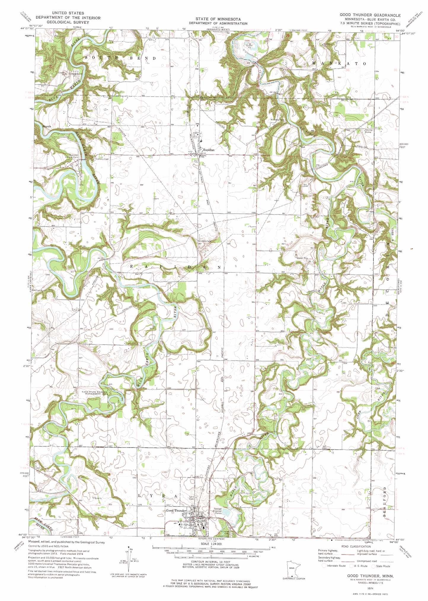
Good Thunder Topo Map Minnesota
To zoom in, hover over the map of Good Thunder
USGS Topo Quad 44094a1 - 1:24,000 scale
| Topo Map Name: | Good Thunder |
| USGS Topo Quad ID: | 44094a1 |
| Print Size: | ca. 21 1/4" wide x 27" high |
| Southeast Coordinates: | 44° N latitude / 94° W longitude |
| Map Center Coordinates: | 44.0625° N latitude / 94.0625° W longitude |
| U.S. State: | MN |
| Filename: | o44094a1.jpg |
| Download Map JPG Image: | Good Thunder topo map 1:24,000 scale |
| Map Type: | Topographic |
| Topo Series: | 7.5´ |
| Map Scale: | 1:24,000 |
| Source of Map Images: | United States Geological Survey (USGS) |
| Alternate Map Versions: |
Good Thunder MN 1974, updated 1976 Download PDF Buy paper map Good Thunder MN 2010 Download PDF Buy paper map Good Thunder MN 2013 Download PDF Buy paper map Good Thunder MN 2016 Download PDF Buy paper map |
1:24,000 Topo Quads surrounding Good Thunder
Courtland |
Nicollet |
North Star |
Saint Peter |
Cleveland |
Cambria |
Judson |
Mankato West |
Mankato East |
Madison Lake |
Perth |
Lake Crystal |
Good Thunder |
Beauford |
Saint Clair |
Willow Creek |
Amboy |
Sterling Center |
Mapleton |
Mapleton Ne |
Truman Se |
Winnebago |
Delavan |
Easton |
Minnesota Lake |
> Back to 44094a1 at 1:100,000 scale
> Back to 44094a1 at 1:250,000 scale
> Back to U.S. Topo Maps home
Good Thunder topo map: Gazetteer
Good Thunder: Dams
Rapidan Dam elevation 265m 869′Good Thunder: Parks
Gage State Wildlife Management Area elevation 274m 898′Rapidan County Park elevation 270m 885′
Good Thunder: Populated Places
Good Thunder elevation 302m 990′Rapidan elevation 301m 987′
Good Thunder: Post Offices
Good Thunder Post Office elevation 288m 944′Rapidan Post Office (historical) elevation 301m 987′
Good Thunder: Reservoirs
Rapidan Lake elevation 265m 869′Good Thunder: Streams
Cobb River elevation 250m 820′Maple River elevation 245m 803′
Good Thunder digital topo map on disk
Buy this Good Thunder topo map showing relief, roads, GPS coordinates and other geographical features, as a high-resolution digital map file on DVD: