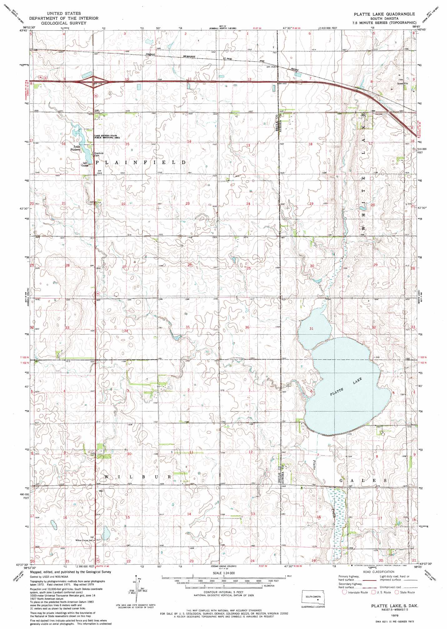
Platte Lake Topo Map South Dakota
To zoom in, hover over the map of Platte Lake
USGS Topo Quad 43098f7 - 1:24,000 scale
| Topo Map Name: | Platte Lake |
| USGS Topo Quad ID: | 43098f7 |
| Print Size: | ca. 21 1/4" wide x 27" high |
| Southeast Coordinates: | 43.625° N latitude / 98.75° W longitude |
| Map Center Coordinates: | 43.6875° N latitude / 98.8125° W longitude |
| U.S. State: | SD |
| Filename: | o43098f7.jpg |
| Download Map JPG Image: | Platte Lake topo map 1:24,000 scale |
| Map Type: | Topographic |
| Topo Series: | 7.5´ |
| Map Scale: | 1:24,000 |
| Source of Map Images: | United States Geological Survey (USGS) |
| Alternate Map Versions: |
Platte Lake SD 1979, updated 1980 Download PDF Buy paper map Platte Lake SD 2012 Download PDF Buy paper map Platte Lake SD 2015 Download PDF Buy paper map |
1:24,000 Topo Quads surrounding Platte Lake
Pukwana Ne |
Isham Lake |
Hoagland Lake |
||
Pukwana Se |
Wilson Dam |
Wilmarth Lake |
||
Bijou Hills Ne |
Kimball South |
Platte Lake |
White Lake |
Crystal Lake |
Eagle |
Snow Lake |
Cedar Grove Colony |
Laffey Lake |
Aurora Center |
Academy |
Lake George |
Platte |
Joubert |
New Holland |
> Back to 43098e1 at 1:100,000 scale
> Back to 43098a1 at 1:250,000 scale
> Back to U.S. Topo Maps home
Platte Lake topo map: Gazetteer
Platte Lake: Dams
Lake 16 Dam elevation 503m 1650′Platte Lake: Lakes
Lake Sixteen elevation 502m 1646′Platte Lake: Parks
Lake Sixteen State Public Shooting Area elevation 503m 1650′Platte Lake: Reservoirs
Lake Sixteen elevation 503m 1650′Platte Lake elevation 471m 1545′
Platte Lake digital topo map on disk
Buy this Platte Lake topo map showing relief, roads, GPS coordinates and other geographical features, as a high-resolution digital map file on DVD:
Eastern North Dakota & Eastern South Dakota
Buy digital topo maps: Eastern North Dakota & Eastern South Dakota