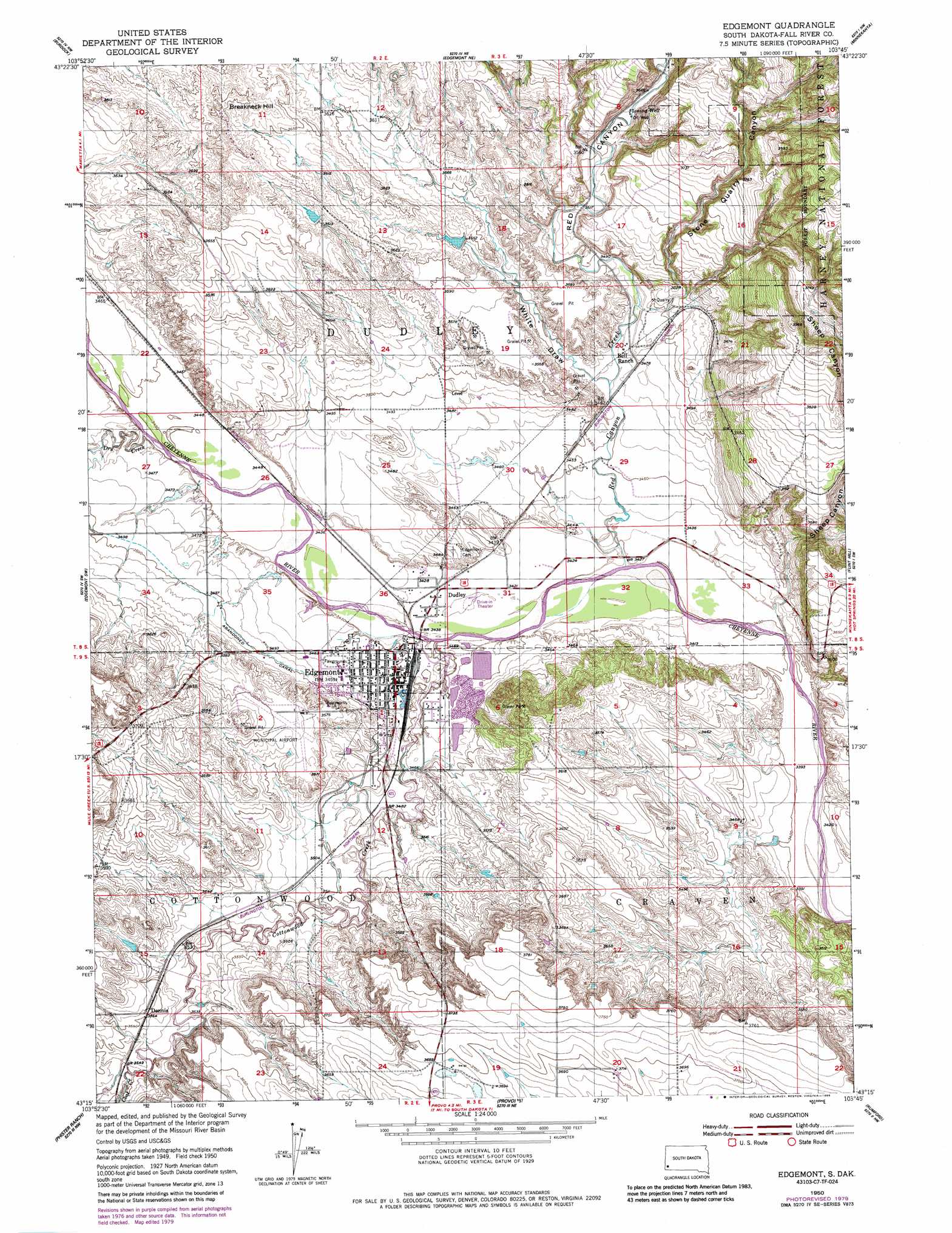
Edgemont Topo Map South Dakota
To zoom in, hover over the map of Edgemont
USGS Topo Quad 43103c7 - 1:24,000 scale
| Topo Map Name: | Edgemont |
| USGS Topo Quad ID: | 43103c7 |
| Print Size: | ca. 21 1/4" wide x 27" high |
| Southeast Coordinates: | 43.25° N latitude / 103.75° W longitude |
| Map Center Coordinates: | 43.3125° N latitude / 103.8125° W longitude |
| U.S. State: | SD |
| Filename: | o43103c7.jpg |
| Download Map JPG Image: | Edgemont topo map 1:24,000 scale |
| Map Type: | Topographic |
| Topo Series: | 7.5´ |
| Map Scale: | 1:24,000 |
| Source of Map Images: | United States Geological Survey (USGS) |
| Alternate Map Versions: |
Edgemont SD 1950, updated 1952 Download PDF Buy paper map Edgemont SD 1950, updated 1957 Download PDF Buy paper map Edgemont SD 1950, updated 1979 Download PDF Buy paper map Edgemont SD 1950, updated 1986 Download PDF Buy paper map Edgemont SD 2012 Download PDF Buy paper map Edgemont SD 2015 Download PDF Buy paper map |
| FStopo: | US Forest Service topo Edgemont is available: Download FStopo PDF Download FStopo TIF |
1:24,000 Topo Quads surrounding Edgemont
Dewey |
Jewel Cave Sw |
Jewel Cave Se |
Argyle |
Pringle |
Twentyone Divide |
Burdock |
Edgemont Ne |
Minnekahta |
Minnekahta Ne |
Mule Creek Se |
Edgemont Sw |
Edgemont |
Flint Hill |
Cascade Springs |
Coffee Flats |
Phister Ranch |
Provo |
Rumford |
Heppner |
Oat Creek |
Wallace Ranch |
Crowe Dam |
Ardmore |
Ardmore Se |
> Back to 43103a1 at 1:100,000 scale
> Back to 43102a1 at 1:250,000 scale
> Back to U.S. Topo Maps home
Edgemont topo map: Gazetteer
Edgemont: Populated Places
Dennis elevation 1086m 3562′Dudley elevation 1046m 3431′
Edgemont elevation 1054m 3458′
Edgemont: Post Offices
Cascade Post Office (historical) elevation 1054m 3458′Edgemont: Streams
Coal Creek elevation 1076m 3530′Cottonwood Creek elevation 1044m 3425′
Dry Creek elevation 1052m 3451′
Red Canyon Creek elevation 1040m 3412′
Edgemont: Summits
Breakneck Hill elevation 1129m 3704′Edgemont: Valleys
Red Canyon elevation 1059m 3474′Sheep Canyon elevation 1087m 3566′
Stone Quarry Canyon elevation 1059m 3474′
White Draw elevation 1056m 3464′
Edgemont digital topo map on disk
Buy this Edgemont topo map showing relief, roads, GPS coordinates and other geographical features, as a high-resolution digital map file on DVD:
Eastern Wyoming & Western South Dakota
Buy digital topo maps: Eastern Wyoming & Western South Dakota