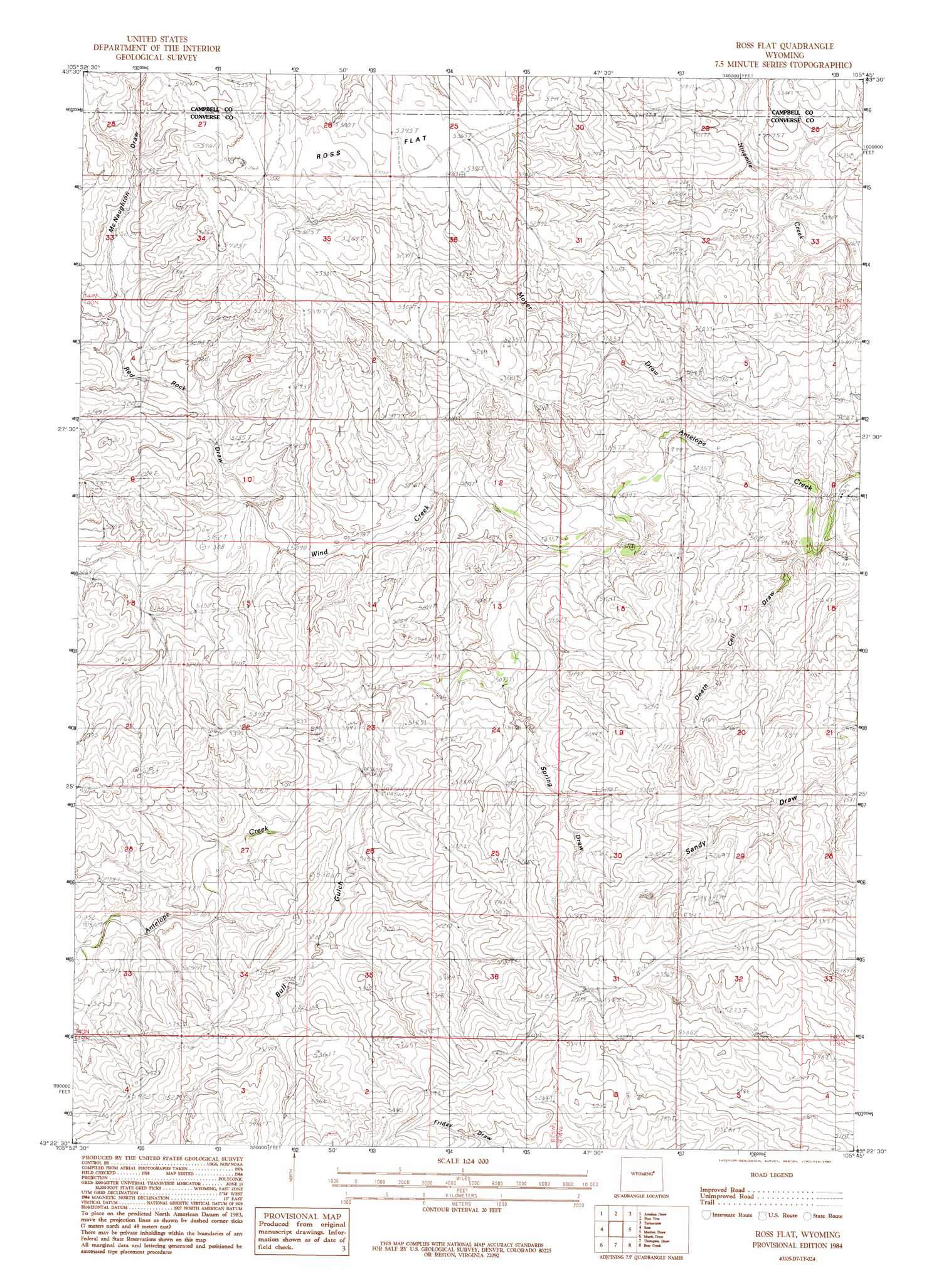
Ross Flat Topo Map Wyoming
To zoom in, hover over the map of Ross Flat
USGS Topo Quad 43105d7 - 1:24,000 scale
| Topo Map Name: | Ross Flat |
| USGS Topo Quad ID: | 43105d7 |
| Print Size: | ca. 21 1/4" wide x 27" high |
| Southeast Coordinates: | 43.375° N latitude / 105.75° W longitude |
| Map Center Coordinates: | 43.4375° N latitude / 105.8125° W longitude |
| U.S. State: | WY |
| Filename: | o43105d7.jpg |
| Download Map JPG Image: | Ross Flat topo map 1:24,000 scale |
| Map Type: | Topographic |
| Topo Series: | 7.5´ |
| Map Scale: | 1:24,000 |
| Source of Map Images: | United States Geological Survey (USGS) |
| Alternate Map Versions: |
Ross Flat WY 1984, updated 1984 Download PDF Buy paper map Ross Flat WY 2012 Download PDF Buy paper map Ross Flat WY 2015 Download PDF Buy paper map |
1:24,000 Topo Quads surrounding Ross Flat
Dry Fork Ranch |
Rolling Pin Ranch |
South Butte |
Baker Spring |
Rattlesnake Draw |
Taylor Ranch |
Artesian Draw |
Pine Tree |
Turnercrest |
Reno Flats |
Sawmill Canyon |
Ross |
Ross Flat |
Macken Draw |
Coal Draw North |
Gillam Draw East |
Marsh Draw |
Thompson Draw |
Bear Creek |
Coal Draw South |
Seven L Creek East |
Fly Draw |
South Fork Reservoir |
Suicide Hill |
Red Hill |
> Back to 43105a1 at 1:100,000 scale
> Back to 43104a1 at 1:250,000 scale
> Back to U.S. Topo Maps home
Ross Flat topo map: Gazetteer
Ross Flat: Flats
Ross Flat elevation 1626m 5334′Ross Flat: Parks
Bozeman Trail Monument elevation 1654m 5426′Ross Flat: Streams
Wind Creek elevation 1531m 5022′Ross Flat: Valleys
Bull Gulch elevation 1555m 5101′McNaughton Draw elevation 1587m 5206′
Red Rock Draw elevation 1555m 5101′
Spring Draw elevation 1547m 5075′
Ross Flat digital topo map on disk
Buy this Ross Flat topo map showing relief, roads, GPS coordinates and other geographical features, as a high-resolution digital map file on DVD:
Eastern Wyoming & Western South Dakota
Buy digital topo maps: Eastern Wyoming & Western South Dakota