Stinking Lake Topo Map Oregon
To zoom in, hover over the map of Stinking Lake
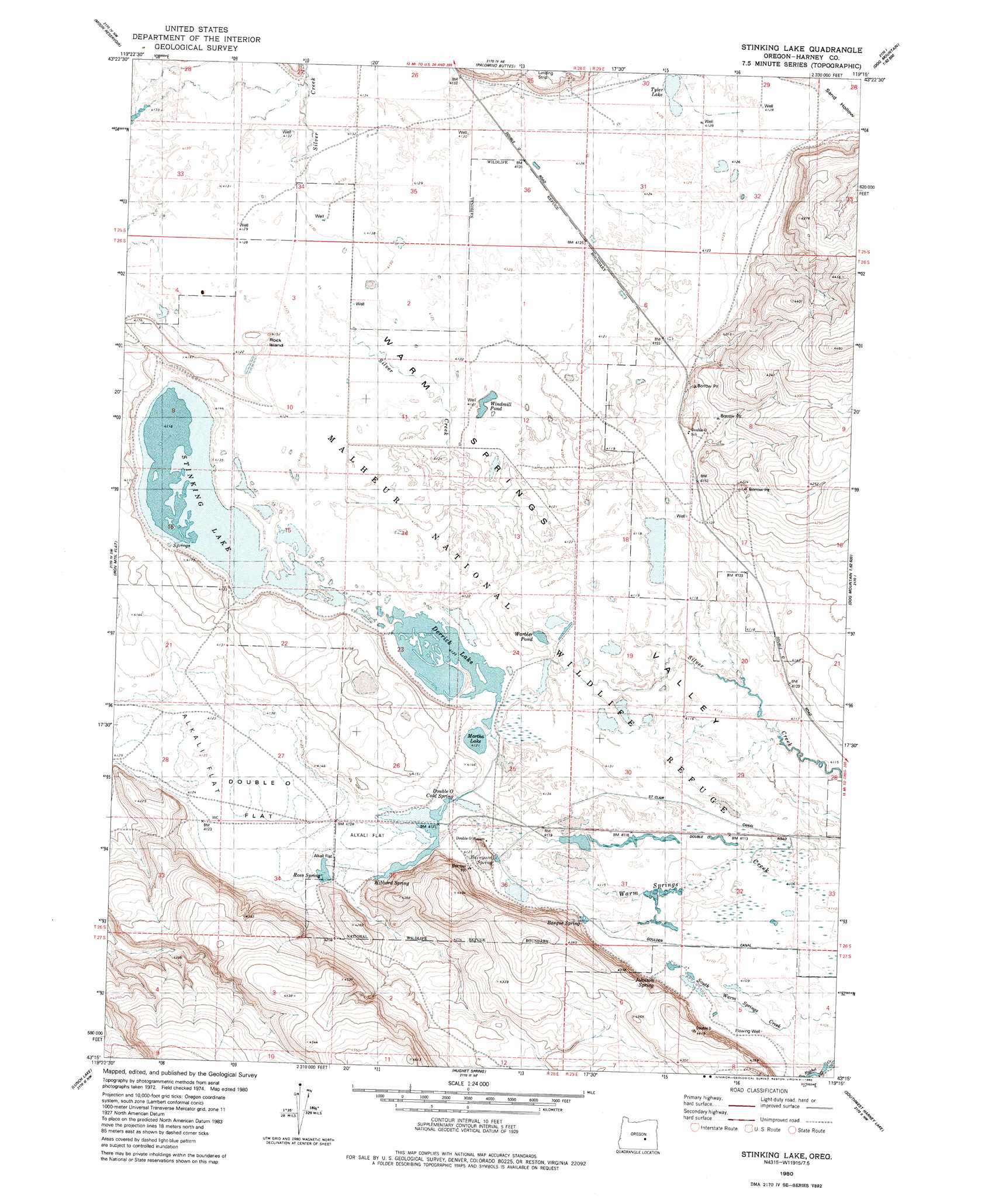
USGS Topo Quad 43119c3 - 1:24,000 scale
| Topo Map Name: | Stinking Lake |
| USGS Topo Quad ID: | 43119c3 |
| Print Size: | ca. 21 1/4" wide x 27" high |
| Southeast Coordinates: | 43.25° N latitude / 119.25° W longitude |
| Map Center Coordinates: | 43.3125° N latitude / 119.3125° W longitude |
| U.S. State: | OR |
| Filename: | o43119c3.jpg |
| Download Map JPG Image: | Stinking Lake topo map 1:24,000 scale |
| Map Type: | Topographic |
| Topo Series: | 7.5´ |
| Map Scale: | 1:24,000 |
| Source of Map Images: | United States Geological Survey (USGS) |
| Alternate Map Versions: |
Stinking Lake OR 1980, updated 1980 Download PDF Buy paper map Stinking Lake OR 2011 Download PDF Buy paper map Stinking Lake OR 2014 Download PDF Buy paper map |
1:24,000 Topo Quads surrounding Stinking Lake
Riley |
Oakerman Lakes |
Sage Hen Hill |
Burns Butte |
Burns |
Capehart Lake |
Moon Reservoir |
Palomino Buttes |
Weaver Lake |
Dog Mountain |
Lake On The Trail |
Iron Mountain Flat |
Stinking Lake |
Northwest Harney Lake |
Northeast Harney Lake |
Wilson Butte |
Lunch Lake |
Hughet Spring |
Southwest Harney Lake |
Southeast Harney Lake |
Rawhide Canyon |
Flybee Lake |
Meadow Lake |
Weed Lake Butte |
Twin Buttes |
> Back to 43119a1 at 1:100,000 scale
> Back to 43118a1 at 1:250,000 scale
> Back to U.S. Topo Maps home
Stinking Lake topo map: Gazetteer
Stinking Lake: Flats
Double O Flat elevation 1258m 4127′Tyler Lake elevation 1258m 4127′
Stinking Lake: Lakes
Derrick Lake elevation 1258m 4127′Stinking Lake elevation 1254m 4114′
Windmill Pond elevation 1256m 4120′
Stinking Lake: Pillars
Rock Island elevation 1264m 4146′Stinking Lake: Post Offices
Kennedy Post Office (historical) elevation 1275m 4183′Stinking Lake: Springs
Barnyard Spring elevation 1269m 4163′Basque Spring elevation 1257m 4124′
Double O Cold Spring elevation 1258m 4127′
Hibbard Spring elevation 1259m 4130′
Johnson Spring elevation 1257m 4124′
Ross Spring elevation 1258m 4127′
Stinking Lake digital topo map on disk
Buy this Stinking Lake topo map showing relief, roads, GPS coordinates and other geographical features, as a high-resolution digital map file on DVD: