Capehart Lake Topo Map Oregon
To zoom in, hover over the map of Capehart Lake
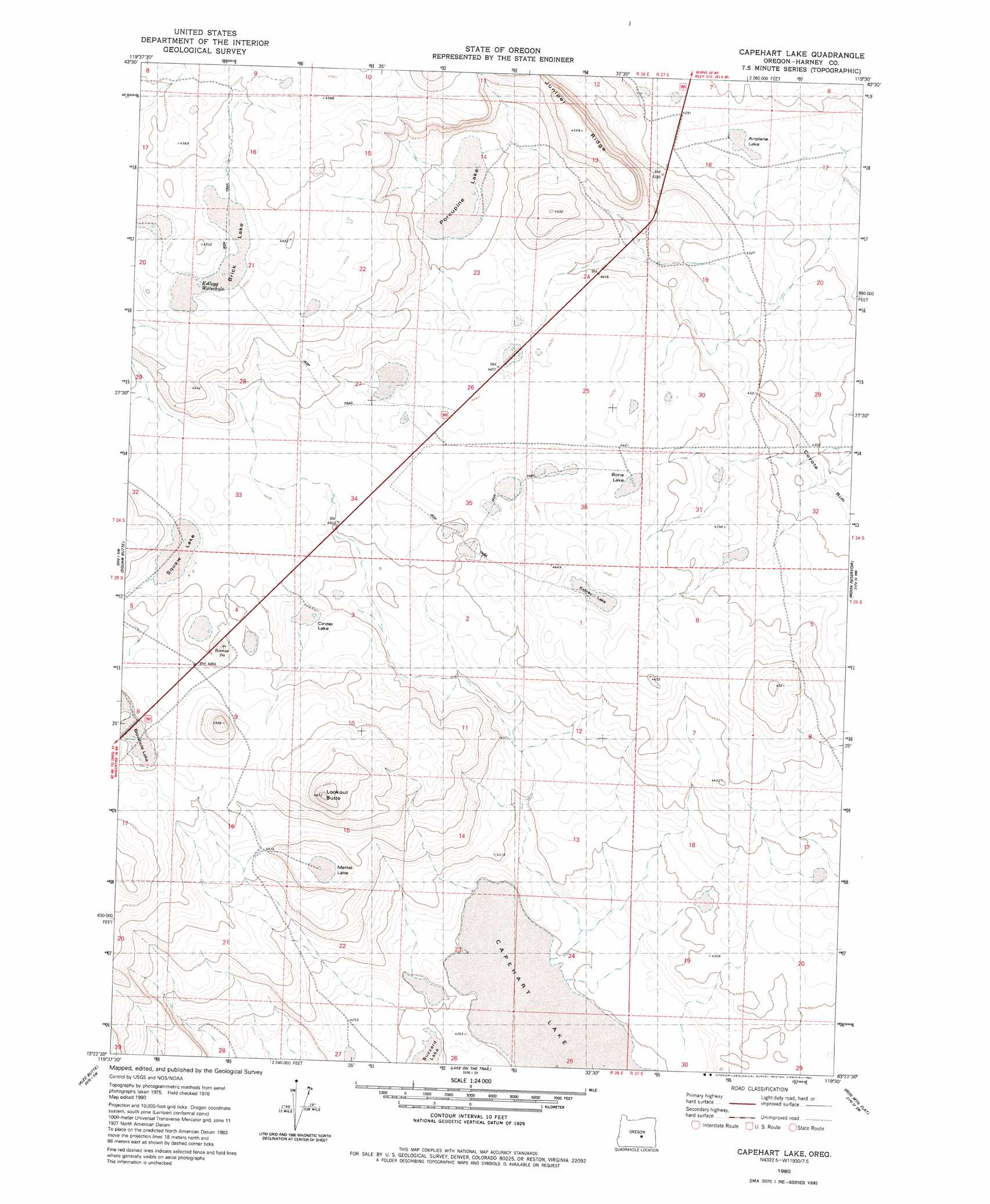
USGS Topo Quad 43119d5 - 1:24,000 scale
| Topo Map Name: | Capehart Lake |
| USGS Topo Quad ID: | 43119d5 |
| Print Size: | ca. 21 1/4" wide x 27" high |
| Southeast Coordinates: | 43.375° N latitude / 119.5° W longitude |
| Map Center Coordinates: | 43.4375° N latitude / 119.5625° W longitude |
| U.S. State: | OR |
| Filename: | o43119d5.jpg |
| Download Map JPG Image: | Capehart Lake topo map 1:24,000 scale |
| Map Type: | Topographic |
| Topo Series: | 7.5´ |
| Map Scale: | 1:24,000 |
| Source of Map Images: | United States Geological Survey (USGS) |
| Alternate Map Versions: |
Capehart Lake OR 1980, updated 1980 Download PDF Buy paper map Capehart Lake OR 2011 Download PDF Buy paper map Capehart Lake OR 2014 Download PDF Buy paper map |
1:24,000 Topo Quads surrounding Capehart Lake
Bulger Ridge |
Camp Currey Spring |
Dry Mountain |
Egypt Canyon |
Holmes Canyon |
Potato Hills |
Suntex |
Riley |
Oakerman Lakes |
Sage Hen Hill |
Hay Lake |
Squaw Butte |
Capehart Lake |
Moon Reservoir |
Palomino Buttes |
Wagontire Mountain East |
Alec Butte |
Lake On The Trail |
Iron Mountain Flat |
Stinking Lake |
Little Juniper Mountain |
Goose Egg Butte |
Wilson Butte |
Lunch Lake |
Hughet Spring |
> Back to 43119a1 at 1:100,000 scale
> Back to 43118a1 at 1:250,000 scale
> Back to U.S. Topo Maps home
Capehart Lake topo map: Gazetteer
Capehart Lake: Flats
Blowhole Lake elevation 1357m 4452′Capehart Lake: Reservoirs
Yellowstone Waterhole elevation 1356m 4448′Capehart Lake digital topo map on disk
Buy this Capehart Lake topo map showing relief, roads, GPS coordinates and other geographical features, as a high-resolution digital map file on DVD: