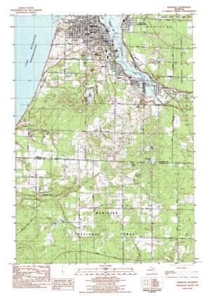
Manistee Ne Topo Map Michigan
To zoom in, hover over the map of Manistee Ne
USGS Topo Quad 44086b3 - 1:25,000 scale
| Topo Map Name: | Manistee Ne |
| USGS Topo Quad ID: | 44086b3 |
| Print Size: | ca. 21 1/4" wide x 27" high |
| Southeast Coordinates: | 44.125° N latitude / 86.25° W longitude |
| Map Center Coordinates: | 44.1875° N latitude / 86.3125° W longitude |
| U.S. State: | MI |
| Filename: | l44086b3.jpg |
| Download Map JPG Image: | Manistee Ne topo map 1:25,000 scale |
| Map Type: | Topographic |
| Topo Series: | 7.5´ |
| Map Scale: | 1:25,000 |
| Source of Map Images: | United States Geological Survey (USGS) |
| Alternate Map Versions: |
Manistee MI 1982, updated 1983 Download PDF Buy paper map |
| FStopo: | US Forest Service topo Manistee is available: Download FStopo PDF Download FStopo TIF |
1:24,000 Topo Quads surrounding Manistee Ne
Bear Lake |
Pleasanton |
|||
Parkdale |
Onekama |
Brethern |
||
Manistee Nw |
Manistee Ne |
Freesoil Nw |
Freesoil Ne |
|
Hamlin Lake |
Kings Corners |
Freesoil Sw |
Freesoil Se |
|
Ludington Nw |
Ludington Ne |
Custer Nw |
Custer Ne |
> Back to 44086a1 at 1:100,000 scale
> Back to 44086a1 at 1:250,000 scale
> Back to U.S. Topo Maps home
Manistee Ne topo map: Gazetteer
Manistee Ne: Lakes
Butcher Lake elevation 184m 603′Canfield Lake elevation 186m 610′
Gambs Lake elevation 182m 597′
King Lake elevation 197m 646′
Lake Winnogene elevation 178m 583′
Manistee Lake elevation 177m 580′
Shingle Mill Lake elevation 200m 656′
Tainer Lake elevation 199m 652′
Manistee Ne: Parks
First Congregational Church Historical Marker elevation 205m 672′First Street Beach elevation 179m 587′
Holy Trinity Episcopal Church Historical Marker elevation 199m 652′
Mangoon Creek Park elevation 193m 633′
Manistee City Library Historical Marker elevation 195m 639′
Manistee Fire Hall Historical Marker elevation 190m 623′
Manistee River State Game Area elevation 199m 652′
North Riverwalk and Memorial Park elevation 186m 610′
Our Saviour's Lutheran Church Historical Marker elevation 192m 629′
Ramsdell Theatre Historical Marker elevation 195m 639′
Rietz Park elevation 203m 666′
Sands Park elevation 200m 656′
Sundling Park elevation 177m 580′
William Douglas House Historical Marker elevation 210m 688′
Manistee Ne: Populated Places
Driftwood Village Mobile Home Park elevation 207m 679′East Lake elevation 199m 652′
Filer City elevation 185m 606′
Manistee elevation 200m 656′
Oak Hill elevation 200m 656′
Stronach elevation 184m 603′
Manistee Ne: Post Offices
Eastlake Post Office elevation 199m 652′Filer City Post Office elevation 183m 600′
Manistee Post Office elevation 191m 626′
Oakhill Post Office (historical) elevation 200m 656′
Stronach Post Office (historical) elevation 184m 603′
Manistee Ne: Streams
Little Manistee River elevation 177m 580′Manistee Ne: Swamps
Hornkohl Swamp elevation 200m 656′Manistee Ne digital topo map on disk
Buy this Manistee Ne topo map showing relief, roads, GPS coordinates and other geographical features, as a high-resolution digital map file on DVD:


