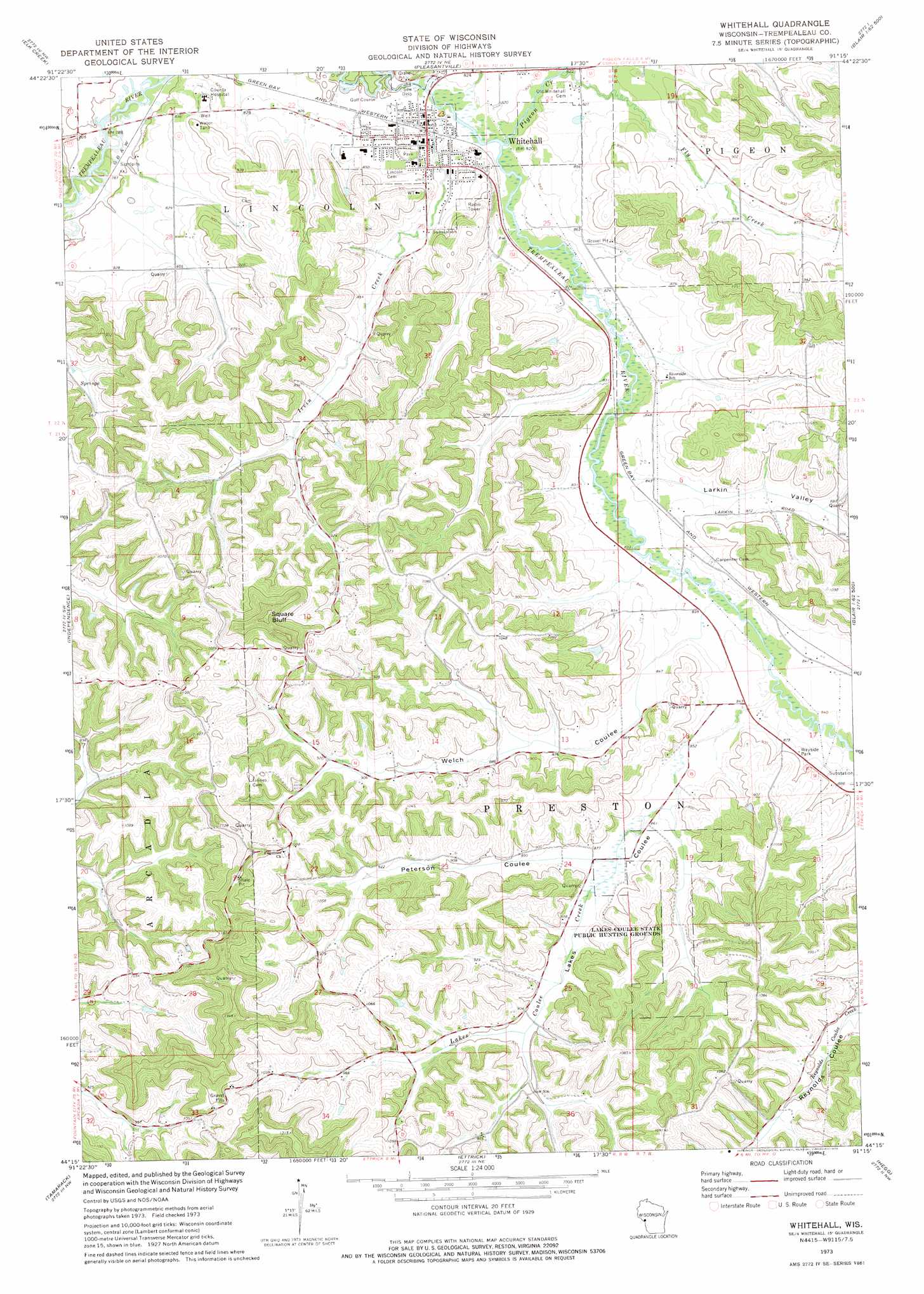
Whitehall Topo Map Wisconsin
To zoom in, hover over the map of Whitehall
USGS Topo Quad 44091c3 - 1:24,000 scale
| Topo Map Name: | Whitehall |
| USGS Topo Quad ID: | 44091c3 |
| Print Size: | ca. 21 1/4" wide x 27" high |
| Southeast Coordinates: | 44.25° N latitude / 91.25° W longitude |
| Map Center Coordinates: | 44.3125° N latitude / 91.3125° W longitude |
| U.S. State: | WI |
| Filename: | o44091c3.jpg |
| Download Map JPG Image: | Whitehall topo map 1:24,000 scale |
| Map Type: | Topographic |
| Topo Series: | 7.5´ |
| Map Scale: | 1:24,000 |
| Source of Map Images: | United States Geological Survey (USGS) |
| Alternate Map Versions: |
Whitehall WI 1973, updated 1975 Download PDF Buy paper map Whitehall WI 2010 Download PDF Buy paper map Whitehall WI 2013 Download PDF Buy paper map Whitehall WI 2015 Download PDF Buy paper map |
1:24,000 Topo Quads surrounding Whitehall
Rossman Creek |
Strum |
Strum Se |
Osseo |
Price |
Lookout |
Elk Creek |
Pleasantville |
Pigeon Falls |
Hixton |
Swinns Valley |
Independence |
Whitehall |
Blair |
Taylor |
Dodge |
Tamarack |
Ettrick |
Hegg |
North Bend Ne |
Winona East |
Trempealeau |
Galesville |
Stevenstown |
North Bend |
> Back to 44091a1 at 1:100,000 scale
> Back to 44090a1 at 1:250,000 scale
> Back to U.S. Topo Maps home
Whitehall topo map: Gazetteer
Whitehall: Dams
Dettloff Paul 3WC77816 Dam elevation 306m 1003′Howley H860 Dam elevation 301m 987′
Jensen Dam elevation 293m 961′
Whitehall: Parks
Lakes Coulee State Public Hunting Grounds elevation 270m 885′Whitehall: Populated Places
Whitehall elevation 249m 816′Whitehall: Reservoirs
0.25 Reservoir elevation 306m 1003′0.3 Reservoir elevation 301m 987′
0.5 Reservoir elevation 293m 961′
Whitehall: Streams
Fly Creek elevation 250m 820′Irvin Creek elevation 246m 807′
Lakes Coulee Creek elevation 256m 839′
Pigeon Creek elevation 248m 813′
Whitehall: Summits
Square Bluff elevation 408m 1338′Whitehall: Valleys
Irvin Coulee elevation 250m 820′Lakes Coulee elevation 258m 846′
Larkin Valley elevation 255m 836′
Peterson Coulee elevation 266m 872′
Welch Coulee elevation 255m 836′
Whitehall digital topo map on disk
Buy this Whitehall topo map showing relief, roads, GPS coordinates and other geographical features, as a high-resolution digital map file on DVD: