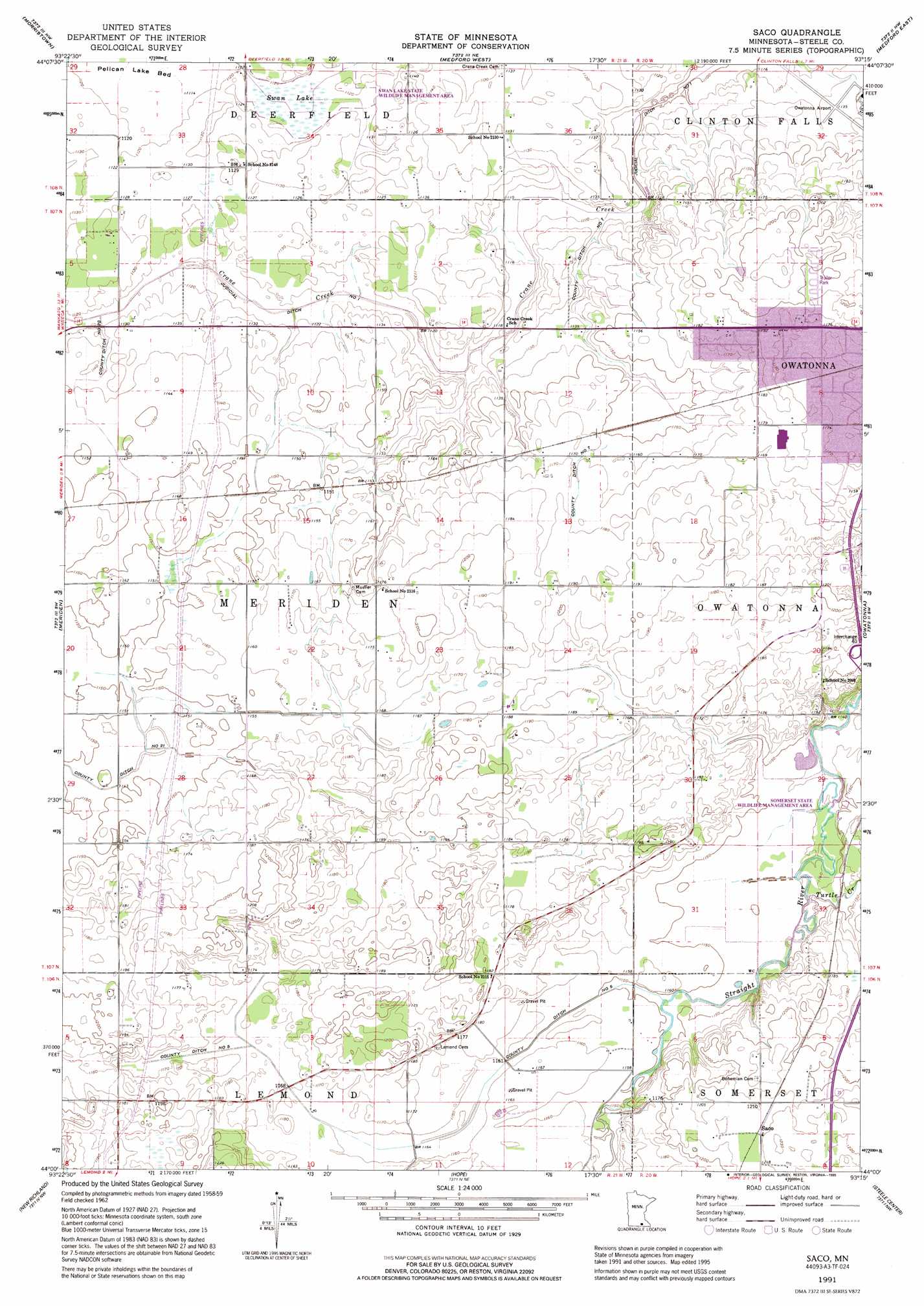
Saco Topo Map Minnesota
To zoom in, hover over the map of Saco
USGS Topo Quad 44093a3 - 1:24,000 scale
| Topo Map Name: | Saco |
| USGS Topo Quad ID: | 44093a3 |
| Print Size: | ca. 21 1/4" wide x 27" high |
| Southeast Coordinates: | 44° N latitude / 93.25° W longitude |
| Map Center Coordinates: | 44.0625° N latitude / 93.3125° W longitude |
| U.S. State: | MN |
| Filename: | o44093a3.jpg |
| Download Map JPG Image: | Saco topo map 1:24,000 scale |
| Map Type: | Topographic |
| Topo Series: | 7.5´ |
| Map Scale: | 1:24,000 |
| Source of Map Images: | United States Geological Survey (USGS) |
| Alternate Map Versions: |
Saco MN 1962, updated 1964 Download PDF Buy paper map Saco MN 1991, updated 1995 Download PDF Buy paper map Saco MN 2010 Download PDF Buy paper map Saco MN 2013 Download PDF Buy paper map Saco MN 2016 Download PDF Buy paper map |
1:24,000 Topo Quads surrounding Saco
Kilkenny |
Shieldsville |
Faribault |
Cannon City |
Nerstrand |
Waterville |
Morristown |
Medford West |
Medford East |
Moland |
Waseca |
Meriden |
Saco |
Owatonna |
Owatonna Se |
Otisco |
New Richland |
Hope |
Steele Center |
Bixby |
Freeborn |
Hartland |
Ellendale |
Hollandale |
Blooming Prairie |
> Back to 44093a1 at 1:100,000 scale
> Back to 44092a1 at 1:250,000 scale
> Back to U.S. Topo Maps home
Saco topo map: Gazetteer
Saco: Airports
Agri Helicopter Incorporated Heliport elevation 361m 1184′Owatonna Municipal Airport elevation 345m 1131′
Saco: Canals
County Ditch Number Five elevation 354m 1161′County Ditch Number Seven elevation 342m 1122′
County Ditch Number Seven elevation 357m 1171′
County Ditch Number Twenty elevation 343m 1125′
County Ditch Number Twentyone elevation 348m 1141′
Judicial Ditch Number One elevation 339m 1112′
Saco: Crossings
Interchange 40 elevation 360m 1181′Saco: Parks
Somerset State Wildlife Management Area elevation 348m 1141′Swan Lake State Wildlife Management Area elevation 341m 1118′
Saco: Populated Places
Colonial Manor Mobile Home Park elevation 365m 1197′Saco elevation 371m 1217′
Saco: Streams
Turtle Creek elevation 348m 1141′Saco: Swamps
Swan Lake elevation 340m 1115′Saco digital topo map on disk
Buy this Saco topo map showing relief, roads, GPS coordinates and other geographical features, as a high-resolution digital map file on DVD: