Russell Topo Map Minnesota
To zoom in, hover over the map of Russell
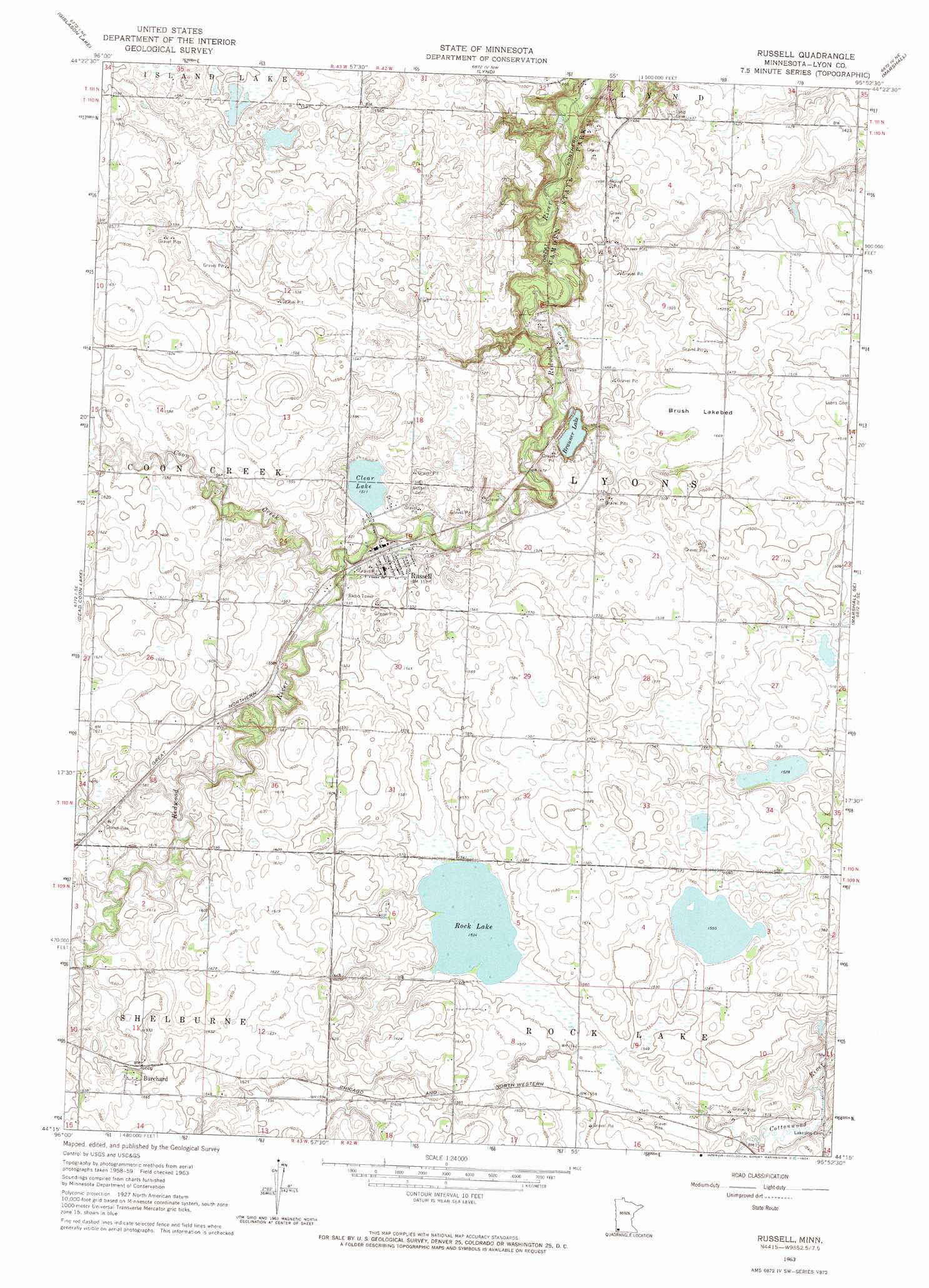
USGS Topo Quad 44095c8 - 1:24,000 scale
| Topo Map Name: | Russell |
| USGS Topo Quad ID: | 44095c8 |
| Print Size: | ca. 21 1/4" wide x 27" high |
| Southeast Coordinates: | 44.25° N latitude / 95.875° W longitude |
| Map Center Coordinates: | 44.3125° N latitude / 95.9375° W longitude |
| U.S. State: | MN |
| Filename: | o44095c8.jpg |
| Download Map JPG Image: | Russell topo map 1:24,000 scale |
| Map Type: | Topographic |
| Topo Series: | 7.5´ |
| Map Scale: | 1:24,000 |
| Source of Map Images: | United States Geological Survey (USGS) |
| Alternate Map Versions: |
Russell MN 1963, updated 1964 Download PDF Buy paper map Russell MN 2010 Download PDF Buy paper map Russell MN 2013 Download PDF Buy paper map Russell MN 2016 Download PDF Buy paper map |
1:24,000 Topo Quads surrounding Russell
Porter Sw |
Taunton |
Minneota |
Green Valley |
Cottonwood |
Arco |
Gislason Lake |
Lynd |
Marshall |
Dudley |
Tyler |
Dead Coon Lake |
Russell |
Marshall Se |
Amiret |
Ruthton Nw |
Ruthton |
Current Lake |
Balaton |
Tracy West |
Holland |
Woodstock |
Balaton Sw |
Hadley |
Currie |
> Back to 44095a1 at 1:100,000 scale
> Back to 44094a1 at 1:250,000 scale
> Back to U.S. Topo Maps home
Russell topo map: Gazetteer
Russell: Dams
Brawner Lake Dam elevation 439m 1440′Russell: Flats
Brush Lakebed elevation 447m 1466′Russell: Lakes
Brauner Lake elevation 439m 1440′Clear Lake elevation 461m 1512′
Rock Lake elevation 468m 1535′
Russell: Parks
Camden State Park elevation 420m 1377′Russell: Populated Places
Burchard elevation 509m 1669′Russell elevation 464m 1522′
Russell: Post Offices
Burchard Post Office (historical) elevation 509m 1669′Russell Post Office elevation 463m 1519′
Russell: Reservoirs
Brawner Lake elevation 439m 1440′Russell: Streams
Coon Creek elevation 459m 1505′Russell digital topo map on disk
Buy this Russell topo map showing relief, roads, GPS coordinates and other geographical features, as a high-resolution digital map file on DVD: