Oahe Sw Topo Map South Dakota
To zoom in, hover over the map of Oahe Sw
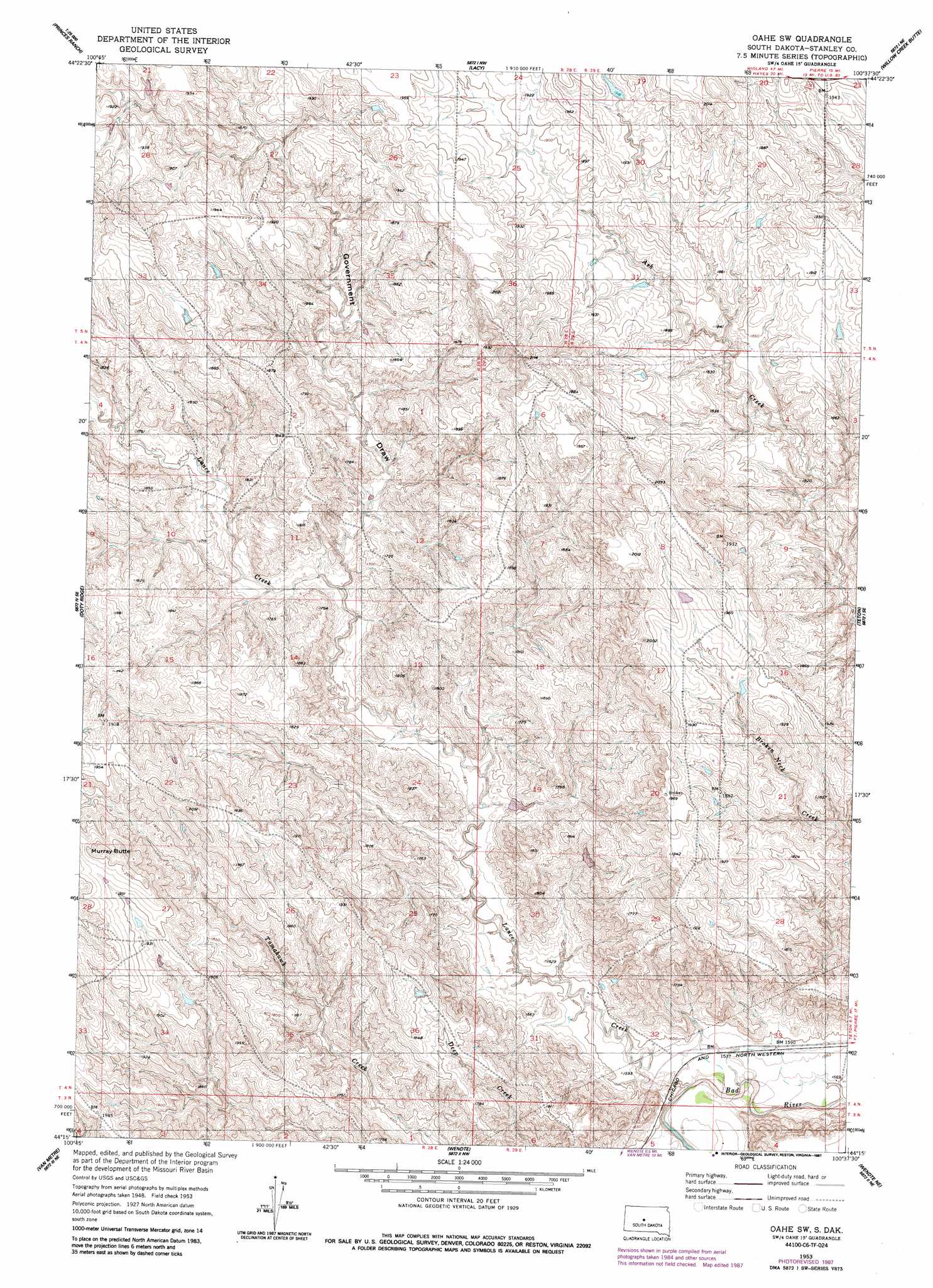
USGS Topo Quad 44100c6 - 1:24,000 scale
| Topo Map Name: | Oahe Sw |
| USGS Topo Quad ID: | 44100c6 |
| Print Size: | ca. 21 1/4" wide x 27" high |
| Southeast Coordinates: | 44.25° N latitude / 100.625° W longitude |
| Map Center Coordinates: | 44.3125° N latitude / 100.6875° W longitude |
| U.S. State: | SD |
| Filename: | o44100c6.jpg |
| Download Map JPG Image: | Oahe Sw topo map 1:24,000 scale |
| Map Type: | Topographic |
| Topo Series: | 7.5´ |
| Map Scale: | 1:24,000 |
| Source of Map Images: | United States Geological Survey (USGS) |
| Alternate Map Versions: |
Oahe SW SD 1953, updated 1955 Download PDF Buy paper map Oahe SW SD 1953, updated 1987 Download PDF Buy paper map Oahe SW SD 2012 Download PDF Buy paper map Oahe SW SD 2015 Download PDF Buy paper map |
1:24,000 Topo Quads surrounding Oahe Sw
Standing Butte Sw |
Standing Butte |
Iron Post Buttes Sw |
Iron Post Buttes Se |
Okobojo Sw |
Princes Ranch |
Lacy |
Willow Creek Butte |
Oahe Dam |
|
Hohrman Ranch |
Doty Ridge |
Oahe Sw |
Teton |
Pierre Sw |
Capa Nw |
Van Metre |
Wendte |
Wendte Ne |
Pierre 3 Nw |
Capa |
Capa Se |
Wendte Sw |
Wendte Se |
Pierre 3 Sw |
> Back to 44100a1 at 1:100,000 scale
> Back to 44100a1 at 1:250,000 scale
> Back to U.S. Topo Maps home
Oahe Sw topo map: Gazetteer
Oahe Sw: Dams
Prince and Sons Number 1 Dam elevation 568m 1863′Prince and Sons Number 2 Dam elevation 577m 1893′
Oahe Sw: Streams
Lance Creek elevation 475m 1558′Oahe Sw: Summits
Murray Butte elevation 622m 2040′Oahe Sw: Valleys
Government Draw elevation 502m 1646′Oahe Sw digital topo map on disk
Buy this Oahe Sw topo map showing relief, roads, GPS coordinates and other geographical features, as a high-resolution digital map file on DVD:
Eastern North Dakota & Eastern South Dakota
Buy digital topo maps: Eastern North Dakota & Eastern South Dakota