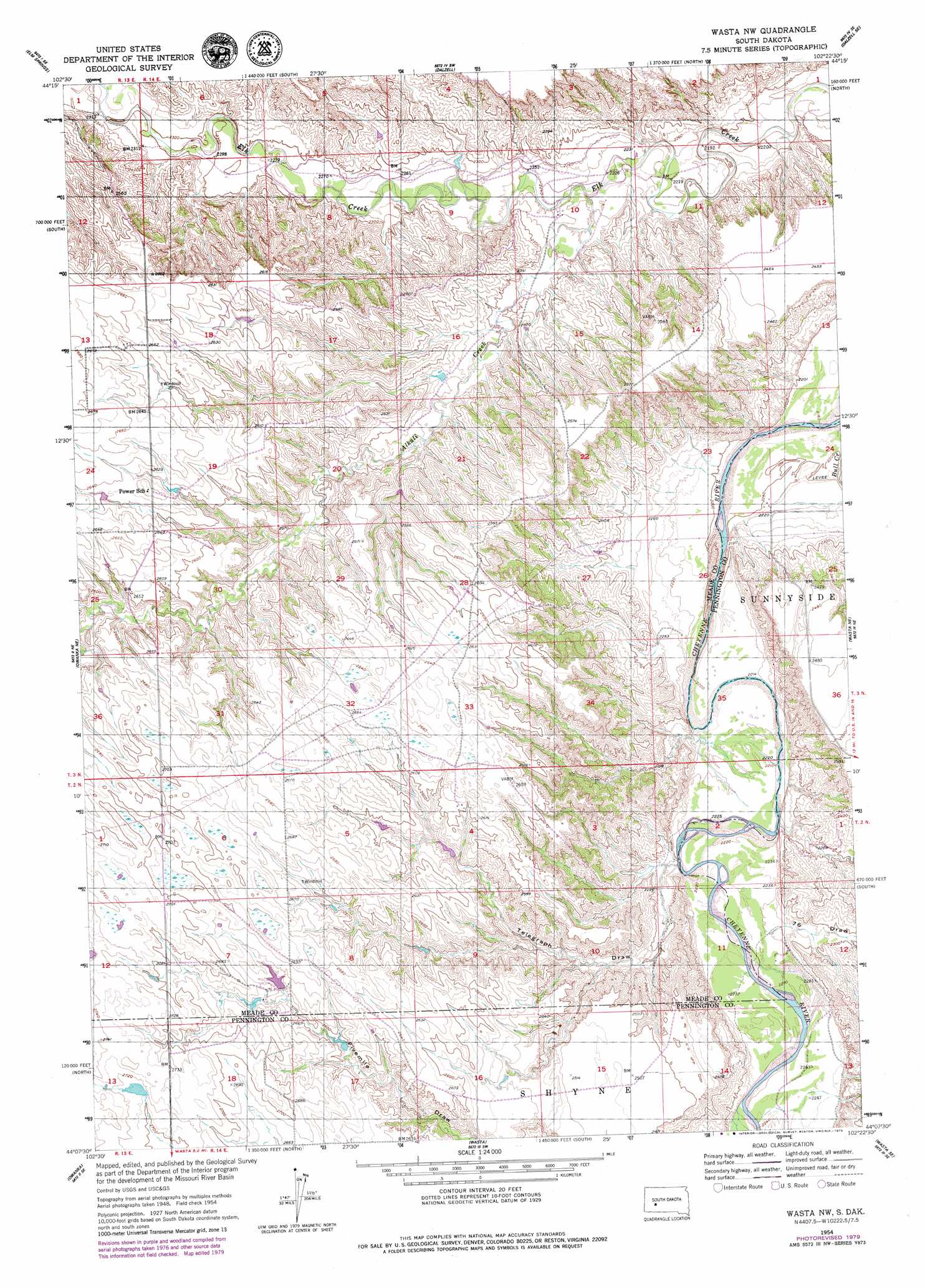
Wasta Nw Topo Map South Dakota
To zoom in, hover over the map of Wasta Nw
USGS Topo Quad 44102b4 - 1:24,000 scale
| Topo Map Name: | Wasta Nw |
| USGS Topo Quad ID: | 44102b4 |
| Print Size: | ca. 21 1/4" wide x 27" high |
| Southeast Coordinates: | 44.125° N latitude / 102.375° W longitude |
| Map Center Coordinates: | 44.1875° N latitude / 102.4375° W longitude |
| U.S. State: | SD |
| Filename: | o44102b4.jpg |
| Download Map JPG Image: | Wasta Nw topo map 1:24,000 scale |
| Map Type: | Topographic |
| Topo Series: | 7.5´ |
| Map Scale: | 1:24,000 |
| Source of Map Images: | United States Geological Survey (USGS) |
| Alternate Map Versions: |
Wasta NW SD 1954, updated 1956 Download PDF Buy paper map Wasta NW SD 1954, updated 1979 Download PDF Buy paper map Wasta NW SD 2012 Download PDF Buy paper map Wasta NW SD 2015 Download PDF Buy paper map |
1:24,000 Topo Quads surrounding Wasta Nw
Haydraw |
Boneita Springs |
Dalzell Nw |
Dalzell Ne |
Pedro Nw |
Elm Springs Sw |
Elm Springs |
Dalzell |
Dalzell Se |
Creighton |
Owanka Nw |
Owanka Ne |
Wasta Nw |
Wasta Ne |
Pedrow 4 Nw |
Owanka Sw |
Owanka |
Wasta |
Wasta Se |
Lake Hill |
Creston |
Brennan Flat |
Quinn Table |
Quinn Table Ne |
Wall |
> Back to 44102a1 at 1:100,000 scale
> Back to 44102a1 at 1:250,000 scale
> Back to U.S. Topo Maps home
Wasta Nw topo map: Gazetteer
Wasta Nw: Streams
Alkali Creek elevation 677m 2221′Wasta Nw: Valleys
Seventysix Draw elevation 685m 2247′Telegraph Draw elevation 703m 2306′
Wasta Nw digital topo map on disk
Buy this Wasta Nw topo map showing relief, roads, GPS coordinates and other geographical features, as a high-resolution digital map file on DVD:
Eastern Wyoming & Western South Dakota
Buy digital topo maps: Eastern Wyoming & Western South Dakota