Opal West Topo Map South Dakota
To zoom in, hover over the map of Opal West
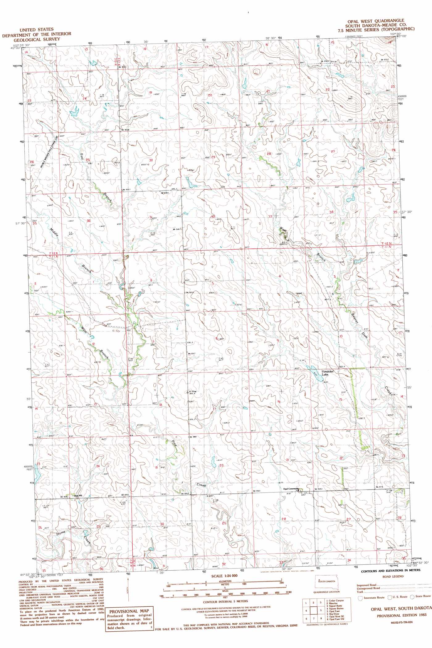
USGS Topo Quad 44102h5 - 1:24,000 scale
| Topo Map Name: | Opal West |
| USGS Topo Quad ID: | 44102h5 |
| Print Size: | ca. 21 1/4" wide x 27" high |
| Southeast Coordinates: | 44.875° N latitude / 102.5° W longitude |
| Map Center Coordinates: | 44.9375° N latitude / 102.5625° W longitude |
| U.S. State: | SD |
| Filename: | o44102h5.jpg |
| Download Map JPG Image: | Opal West topo map 1:24,000 scale |
| Map Type: | Topographic |
| Topo Series: | 7.5´ |
| Map Scale: | 1:24,000 |
| Source of Map Images: | United States Geological Survey (USGS) |
| Alternate Map Versions: |
Opal West SD 2012 Download PDF Buy paper map Opal West SD 2015 Download PDF Buy paper map |
1:24,000 Topo Quads surrounding Opal West
Zeona Ne |
Imogene |
Bixby |
Deep Creek Nw |
Deep Creek Ne |
Beverly Creek |
Cedar Canyon |
Maurine |
Signal Butte |
Deep Creek Se |
Frozen Man Creek |
Squaw Buttes |
Opal West |
Opal East |
Lemmon Butte |
Bull Run Creek |
Big Draw |
Opal West Se |
Opal East Sw |
Opal East Se |
Fairpoint |
Stoneville |
Redowl |
White Owl Nw |
Marcus |
> Back to 44102e1 at 1:100,000 scale
> Back to 44102a1 at 1:250,000 scale
> Back to U.S. Topo Maps home
Opal West topo map: Gazetteer
Opal West: Dams
N Vansickel Dam elevation 813m 2667′Opal West: Populated Places
Fox Ridge elevation 876m 2874′Opal West: Post Offices
Opal Post office elevation 804m 2637′Opal West: Reservoirs
Vansickel Lake elevation 813m 2667′Opal West: Streams
East Branch Pine Creek elevation 821m 2693′Middle Branch Pine Creek elevation 821m 2693′
West Branch Pine Creek elevation 815m 2673′
Opal West digital topo map on disk
Buy this Opal West topo map showing relief, roads, GPS coordinates and other geographical features, as a high-resolution digital map file on DVD:
Eastern Wyoming & Western South Dakota
Buy digital topo maps: Eastern Wyoming & Western South Dakota