Two Ocean Pass Topo Map Wyoming
To zoom in, hover over the map of Two Ocean Pass
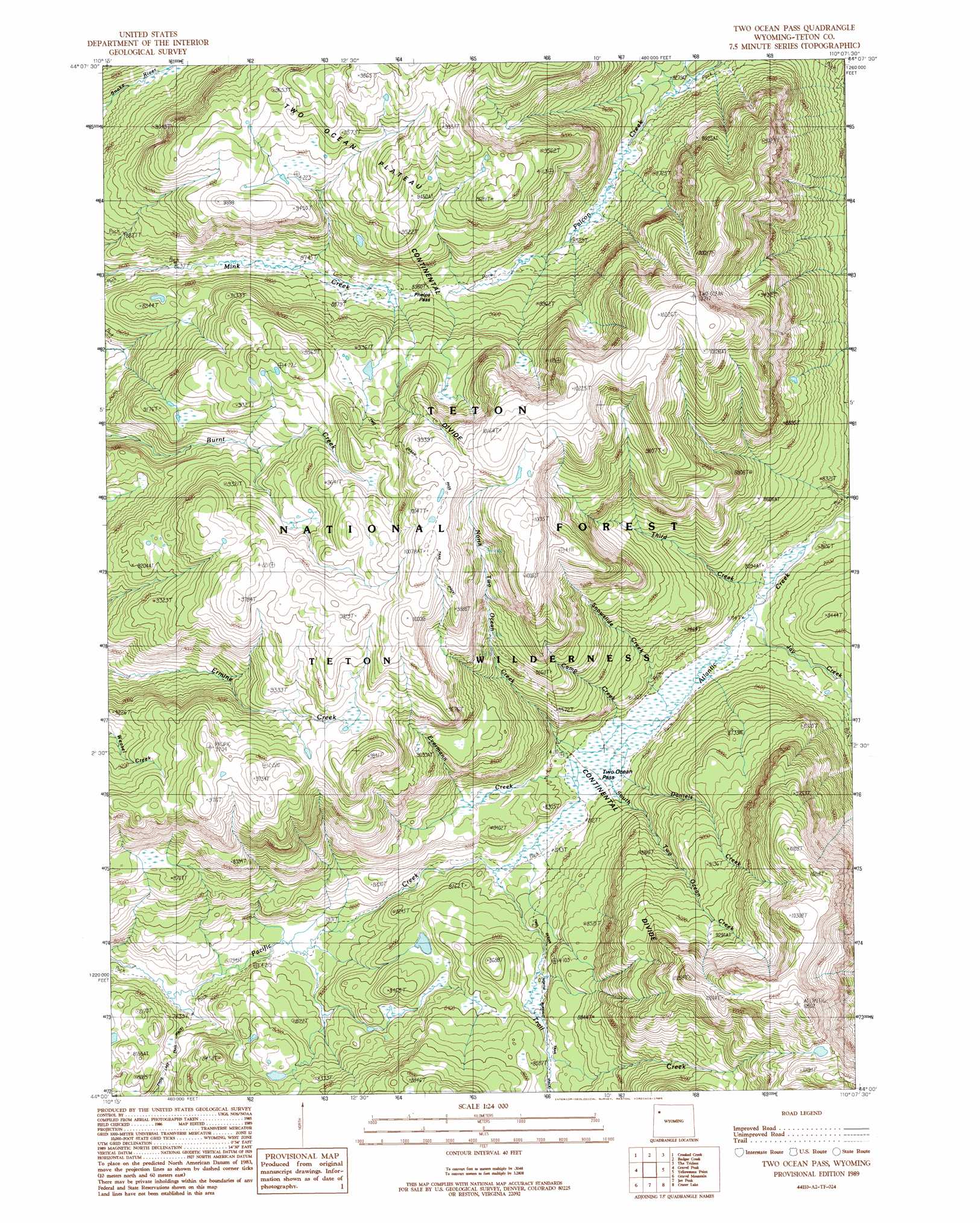
USGS Topo Quad 44110a2 - 1:24,000 scale
| Topo Map Name: | Two Ocean Pass |
| USGS Topo Quad ID: | 44110a2 |
| Print Size: | ca. 21 1/4" wide x 27" high |
| Southeast Coordinates: | 44° N latitude / 110.125° W longitude |
| Map Center Coordinates: | 44.0625° N latitude / 110.1875° W longitude |
| U.S. State: | WY |
| Filename: | o44110a2.jpg |
| Download Map JPG Image: | Two Ocean Pass topo map 1:24,000 scale |
| Map Type: | Topographic |
| Topo Series: | 7.5´ |
| Map Scale: | 1:24,000 |
| Source of Map Images: | United States Geological Survey (USGS) |
| Alternate Map Versions: |
Two Ocean Pass WY 1989, updated 1989 Download PDF Buy paper map Two Ocean Pass WY 1996, updated 1998 Download PDF Buy paper map Two Ocean Pass WY 2012 Download PDF Buy paper map Two Ocean Pass WY 2015 Download PDF Buy paper map |
| FStopo: | US Forest Service topo Two Ocean Pass is available: Download FStopo PDF Download FStopo TIF |
1:24,000 Topo Quads surrounding Two Ocean Pass
Heart Lake |
Alder Lake |
Trail Lake |
Eagle Peak |
Pinnacle Mountain |
Mount Hancock |
Crooked Creek |
Badger Creek |
The Trident |
Open Creek |
Bobcat Ridge |
Gravel Peak |
Two Ocean Pass |
Yellowstone Point |
Thorofare Plateau |
Whetstone Mountain |
Hunter Mountain |
Joy Peak |
Crater Lake |
Ferry Lake |
Davis Hill |
Rosies Ridge |
Angle Mountain |
Togwotee Pass |
Dundee Meadows |
> Back to 44110a1 at 1:100,000 scale
> Back to 44110a1 at 1:250,000 scale
> Back to U.S. Topo Maps home
Two Ocean Pass topo map: Gazetteer
Two Ocean Pass: Gaps
Phelps Pass elevation 2724m 8937′Two Ocean Pass elevation 2478m 8129′
Two Ocean Pass: Streams
Camp Creek elevation 2473m 8113′Daniels Creek elevation 2473m 8113′
Evermann Creek elevation 2485m 8152′
Jay Creek elevation 2474m 8116′
North Two Ocean Creek elevation 2484m 8149′
Snowslide Creek elevation 2473m 8113′
South Two Ocean Creek elevation 2475m 8120′
Third Creek elevation 2459m 8067′
Trail Creek elevation 2472m 8110′
Two Ocean Pass: Trails
Trail Creek Trail elevation 2550m 8366′Two Ocean Pass digital topo map on disk
Buy this Two Ocean Pass topo map showing relief, roads, GPS coordinates and other geographical features, as a high-resolution digital map file on DVD: