Cougar Rock Topo Map Oregon
To zoom in, hover over the map of Cougar Rock
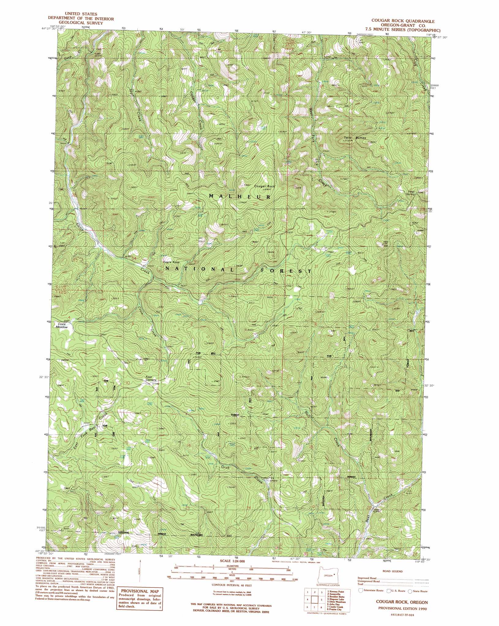
USGS Topo Quad 44118e7 - 1:24,000 scale
| Topo Map Name: | Cougar Rock |
| USGS Topo Quad ID: | 44118e7 |
| Print Size: | ca. 21 1/4" wide x 27" high |
| Southeast Coordinates: | 44.5° N latitude / 118.75° W longitude |
| Map Center Coordinates: | 44.5625° N latitude / 118.8125° W longitude |
| U.S. State: | OR |
| Filename: | o44118e7.jpg |
| Download Map JPG Image: | Cougar Rock topo map 1:24,000 scale |
| Map Type: | Topographic |
| Topo Series: | 7.5´ |
| Map Scale: | 1:24,000 |
| Source of Map Images: | United States Geological Survey (USGS) |
| Alternate Map Versions: |
Cougar Rock OR 1990, updated 1990 Download PDF Buy paper map Cougar Rock OR 1999, updated 2002 Download PDF Buy paper map Cougar Rock OR 2011 Download PDF Buy paper map Cougar Rock OR 2014 Download PDF Buy paper map |
| FStopo: | US Forest Service topo Cougar Rock is available: Download FStopo PDF Download FStopo TIF |
1:24,000 Topo Quads surrounding Cougar Rock
Flowers Gulch |
Wildcat Point |
Sharp Ridge |
Desolation Butte |
Olive Lake |
Long Creek |
Keeney Point |
Susanville |
Boulder Butte |
Vinegar Hill |
Beech Creek Summit |
Magone Lake |
Cougar Rock |
Dixie Meadows |
Bates |
Mount Vernon |
John Day |
Castle Creek |
Prairie City |
Isham Creek |
Fall Mountain |
Canyon Mountain |
Pine Creek Mountain |
Strawberry Mountain |
Roberts Creek |
> Back to 44118e1 at 1:100,000 scale
> Back to 44118a1 at 1:250,000 scale
> Back to U.S. Topo Maps home
Cougar Rock topo map: Gazetteer
Cougar Rock: Flats
Coxie Meadow elevation 1593m 5226′Cougar Rock: Springs
Cold Spring elevation 1365m 4478′Modesty Spring elevation 1360m 4461′
Voight Spring elevation 1744m 5721′
Cougar Rock: Streams
Big Rock Creek elevation 1346m 4416′Charlie Creek elevation 1428m 4685′
Coxie Creek elevation 1447m 4747′
Deep Creek elevation 1270m 4166′
Eagle Creek elevation 1436m 4711′
Hall Creek elevation 1209m 3966′
Little Trail Creek elevation 1366m 4481′
Shoberg Creek elevation 1379m 4524′
Steep Creek elevation 1368m 4488′
Cougar Rock: Summits
Cougar Rock elevation 1874m 6148′Eagle Rock elevation 1557m 5108′
Twin Buttes elevation 1694m 5557′
Cougar Rock: Trails
Davis Trail (historical) elevation 1490m 4888′Cougar Rock digital topo map on disk
Buy this Cougar Rock topo map showing relief, roads, GPS coordinates and other geographical features, as a high-resolution digital map file on DVD: