Albany Island Topo Map Michigan
To zoom in, hover over the map of Albany Island
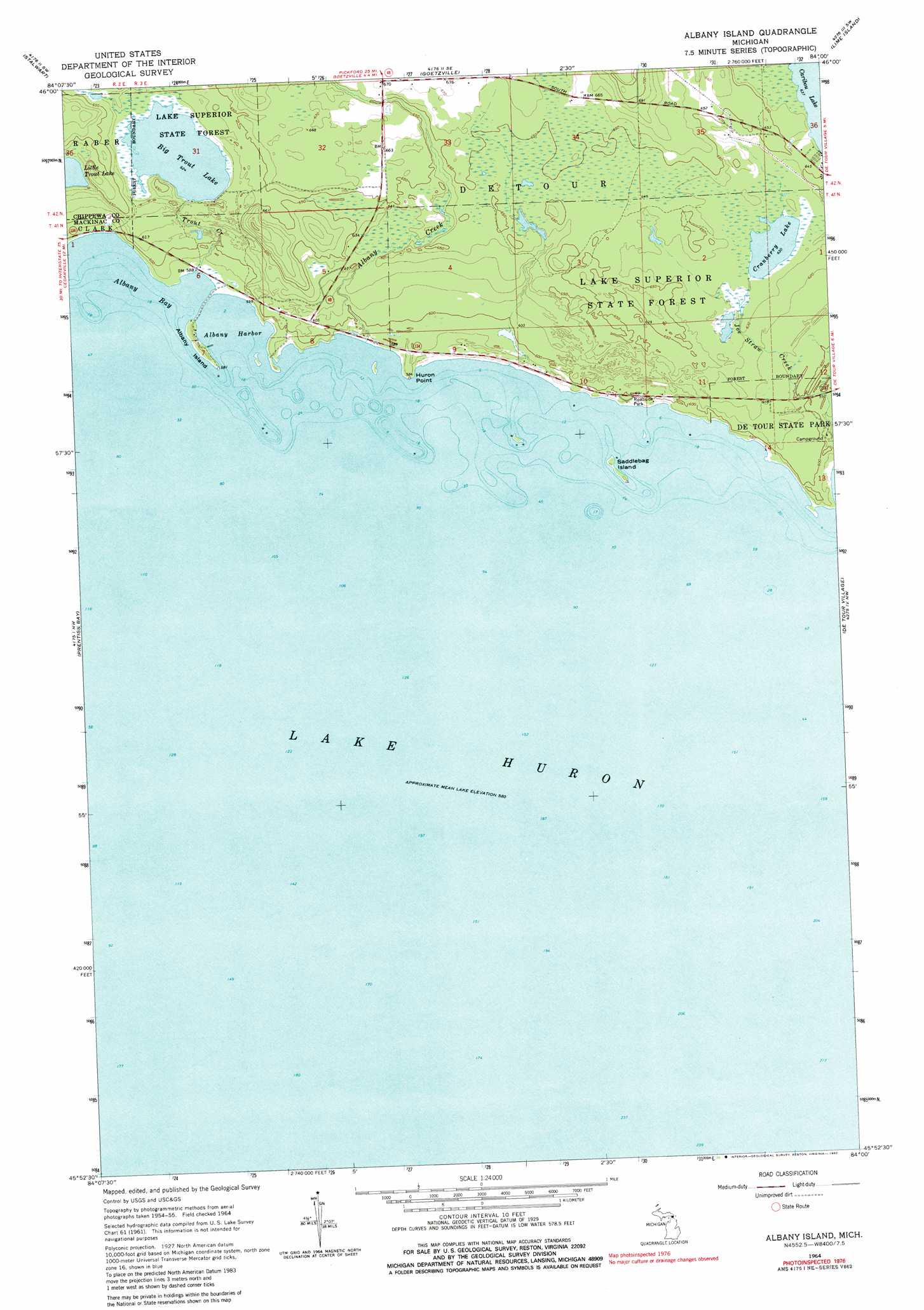
USGS Topo Quad 45084h1 - 1:24,000 scale
| Topo Map Name: | Albany Island |
| USGS Topo Quad ID: | 45084h1 |
| Print Size: | ca. 21 1/4" wide x 27" high |
| Southeast Coordinates: | 45.875° N latitude / 84° W longitude |
| Map Center Coordinates: | 45.9375° N latitude / 84.0625° W longitude |
| U.S. State: | MI |
| Filename: | o45084h1.jpg |
| Download Map JPG Image: | Albany Island topo map 1:24,000 scale |
| Map Type: | Topographic |
| Topo Series: | 7.5´ |
| Map Scale: | 1:24,000 |
| Source of Map Images: | United States Geological Survey (USGS) |
| Alternate Map Versions: |
Albany Island MI 1964, updated 1965 Download PDF Buy paper map Albany Island MI 1964, updated 1980 Download PDF Buy paper map Albany Island MI 1964, updated 1982 Download PDF Buy paper map Albany Island MI 2011 Download PDF Buy paper map Albany Island MI 2014 Download PDF Buy paper map Albany Island MI 2017 Download PDF Buy paper map |
1:24,000 Topo Quads surrounding Albany Island
Pickford |
Munuscong |
Munuscong Ne |
||
Pickford Se |
Stalwart |
Goetzville |
Lime Island |
Burnt Island |
Cedarville |
Prentiss Bay |
Albany Island |
De Tour Village |
Whitney Bay |
Cordwood Point |
Ninemile Point |
> Back to 45084e1 at 1:100,000 scale
> Back to 45084a1 at 1:250,000 scale
> Back to U.S. Topo Maps home
Albany Island topo map: Gazetteer
Albany Island: Bays
Albany Bay elevation 177m 580′Albany Harbor elevation 177m 580′
Albany Island: Capes
Huron Point elevation 180m 590′Albany Island: Islands
Albany Island elevation 180m 590′Saddlebag Island elevation 177m 580′
Albany Island: Lakes
Beaver Pond elevation 189m 620′Big Trout Lake elevation 190m 623′
Cranberry Lake elevation 192m 629′
Little Trout Lake elevation 193m 633′
Albany Island: Parks
De Tour Roadside Park elevation 179m 587′De Tour State Park elevation 186m 610′
Albany Island: Streams
Albany Creek elevation 178m 583′Trout Creek elevation 179m 587′
Albany Island digital topo map on disk
Buy this Albany Island topo map showing relief, roads, GPS coordinates and other geographical features, as a high-resolution digital map file on DVD: