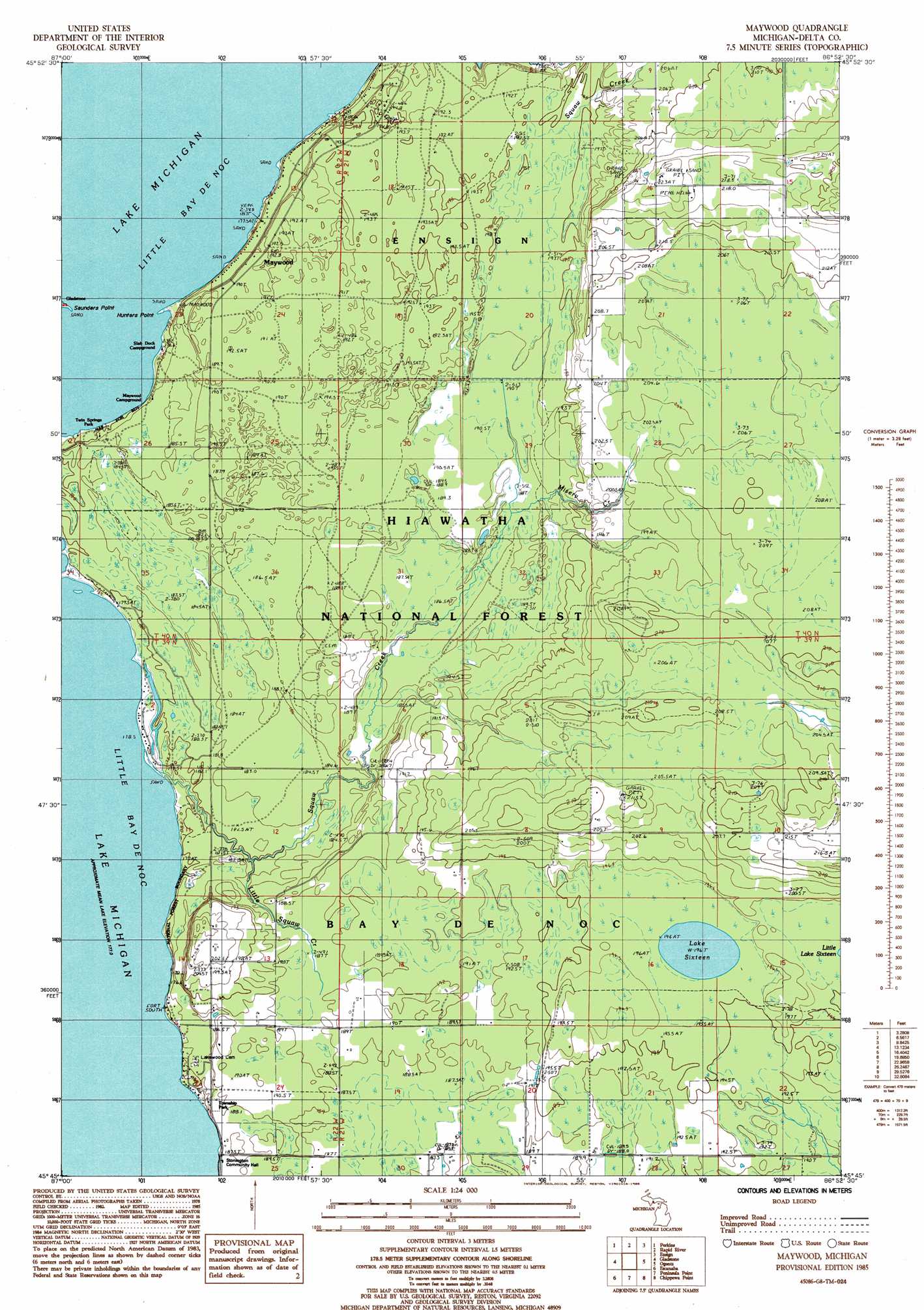
Maywood Topo Map Michigan
To zoom in, hover over the map of Maywood
USGS Topo Quad 45086g8 - 1:24,000 scale
| Topo Map Name: | Maywood |
| USGS Topo Quad ID: | 45086g8 |
| Print Size: | ca. 21 1/4" wide x 27" high |
| Southeast Coordinates: | 45.75° N latitude / 86.875° W longitude |
| Map Center Coordinates: | 45.8125° N latitude / 86.9375° W longitude |
| U.S. State: | MI |
| Filename: | o45086g8.jpg |
| Download Map JPG Image: | Maywood topo map 1:24,000 scale |
| Map Type: | Topographic |
| Topo Series: | 7.5´ |
| Map Scale: | 1:24,000 |
| Source of Map Images: | United States Geological Survey (USGS) |
| Alternate Map Versions: |
Maywood MI 1985, updated 1985 Download PDF Buy paper map Maywood MI 2011 Download PDF Buy paper map Maywood MI 2014 Download PDF Buy paper map Maywood MI 2016 Download PDF Buy paper map |
| FStopo: | US Forest Service topo Maywood is available: Download FStopo PDF Download FStopo TIF |
1:24,000 Topo Quads surrounding Maywood
Rock |
Rock Se |
Baker Creek |
Poplar Lake |
Waco Lake |
Cornell |
Perkins |
Rapid River |
Ensign |
Saint Jacques |
Chandler |
Gladstone |
Maywood |
Ogontz |
Nahma |
Ford River |
Escanaba |
Peninsula Point |
Chippewa Point |
Fayette |
Henderson Lakes |
Fairport |
> Back to 45086e1 at 1:100,000 scale
> Back to 45086a1 at 1:250,000 scale
> Back to U.S. Topo Maps home
Maywood topo map: Gazetteer
Maywood: Capes
Hunters Point elevation 179m 587′Maywood: Lakes
Lake Sixteen elevation 196m 643′Maywood: Parks
Township Park elevation 187m 613′Twin Springs Park elevation 183m 600′
Maywood: Populated Places
Maywood elevation 182m 597′Maywood: Streams
Black George Creek elevation 182m 597′Little Squaw Creek elevation 180m 590′
Misery Creek elevation 188m 616′
Squaw Creek elevation 177m 580′
Maywood digital topo map on disk
Buy this Maywood topo map showing relief, roads, GPS coordinates and other geographical features, as a high-resolution digital map file on DVD: