Lily Topo Map Wisconsin
To zoom in, hover over the map of Lily
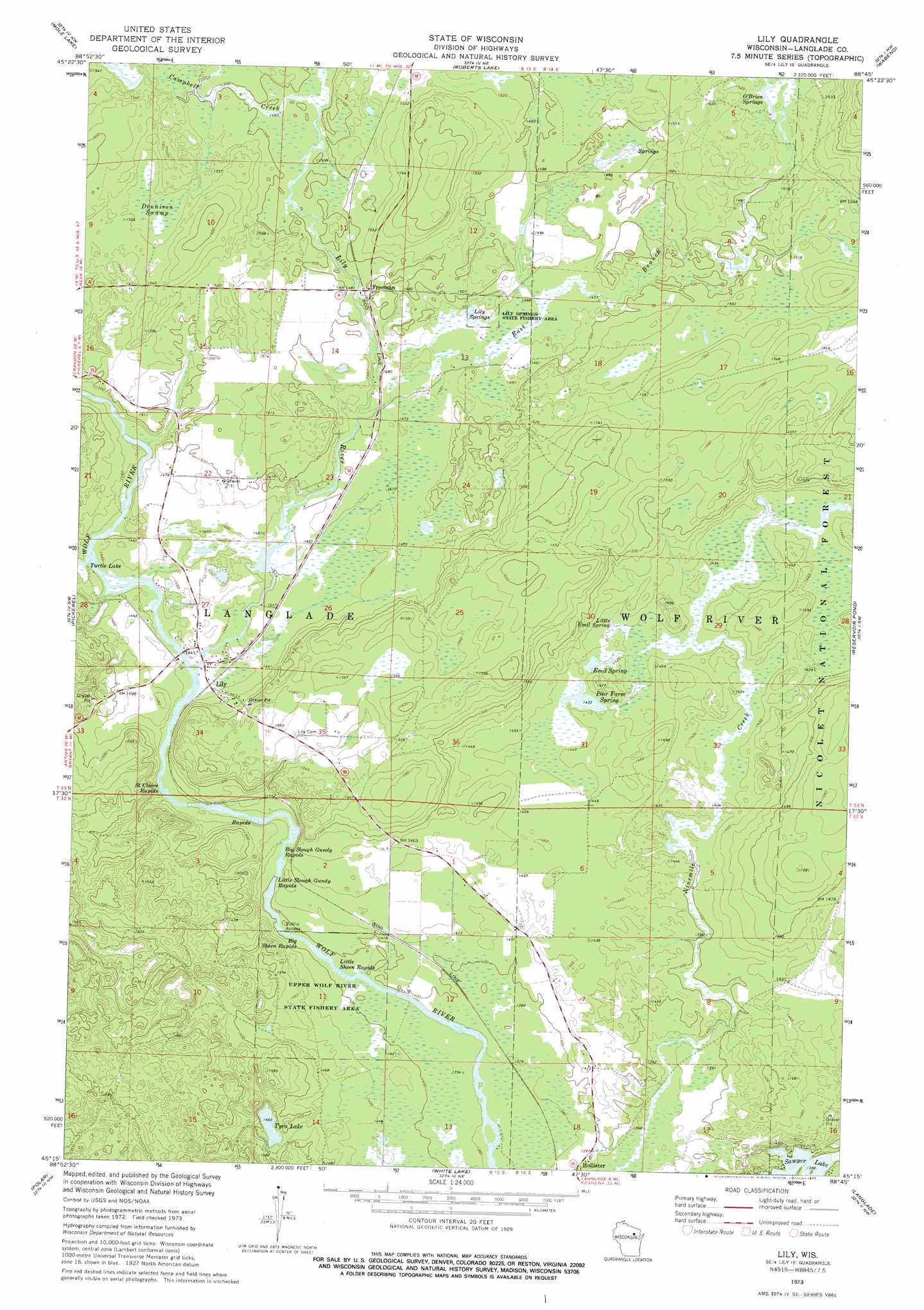
USGS Topo Quad 45088c7 - 1:24,000 scale
| Topo Map Name: | Lily |
| USGS Topo Quad ID: | 45088c7 |
| Print Size: | ca. 21 1/4" wide x 27" high |
| Southeast Coordinates: | 45.25° N latitude / 88.75° W longitude |
| Map Center Coordinates: | 45.3125° N latitude / 88.8125° W longitude |
| U.S. State: | WI |
| Filename: | o45088c7.jpg |
| Download Map JPG Image: | Lily topo map 1:24,000 scale |
| Map Type: | Topographic |
| Topo Series: | 7.5´ |
| Map Scale: | 1:24,000 |
| Source of Map Images: | United States Geological Survey (USGS) |
| Alternate Map Versions: |
Lily WI 1973, updated 1977 Download PDF Buy paper map Lily WI 2011 Download PDF Buy paper map Lily WI 2013 Download PDF Buy paper map Lily WI 2015 Download PDF Buy paper map |
| FStopo: | US Forest Service topo Lily is available: Download FStopo PDF Download FStopo TIF |
1:24,000 Topo Quads surrounding Lily
Nashville |
Crandon |
Lake Lucerne |
Laona |
Blackwell |
Post Lake |
Mole Lake |
Roberts Lake |
Wabeno |
Otter Lake |
Pearson |
Pickerel |
Lily |
Reservoir Pond |
Townsend |
Bryant |
Polar |
White Lake |
Langlade |
Shadow Lake |
Mattoon |
Zoar |
Perote Lake |
Markton |
Fredenberg Lake |
> Back to 45088a1 at 1:100,000 scale
> Back to 45088a1 at 1:250,000 scale
> Back to U.S. Topo Maps home
Lily topo map: Gazetteer
Lily: Lakes
Tyra Lake elevation 447m 1466′Lily: Parks
Lily Springs State Fishery Area elevation 451m 1479′Upper Wolf River State Fishery Area elevation 434m 1423′
Lily: Populated Places
Freeman elevation 456m 1496′Lily elevation 439m 1440′
Lily: Rapids
Big Sheen Rapids elevation 424m 1391′Big Slough Gundy Rapids elevation 428m 1404′
Little Sheen Rapids elevation 423m 1387′
Little Slough Gundy Rapids elevation 427m 1400′
Saint Claire Rapids elevation 433m 1420′
Lily: Springs
Emil Spring elevation 437m 1433′Lambert Springs elevation 449m 1473′
Lily Springs elevation 449m 1473′
O'Brien Springs elevation 463m 1519′
Poor Farm Spring elevation 438m 1437′
Lily: Streams
Campbell Creek elevation 457m 1499′East Branch Lily River elevation 445m 1459′
Lily River elevation 439m 1440′
Lily: Swamps
Dennison Swamp elevation 469m 1538′Little Emil Spring elevation 433m 1420′
Lily digital topo map on disk
Buy this Lily topo map showing relief, roads, GPS coordinates and other geographical features, as a high-resolution digital map file on DVD: