Enemy Swim Lake West Topo Map South Dakota
To zoom in, hover over the map of Enemy Swim Lake West
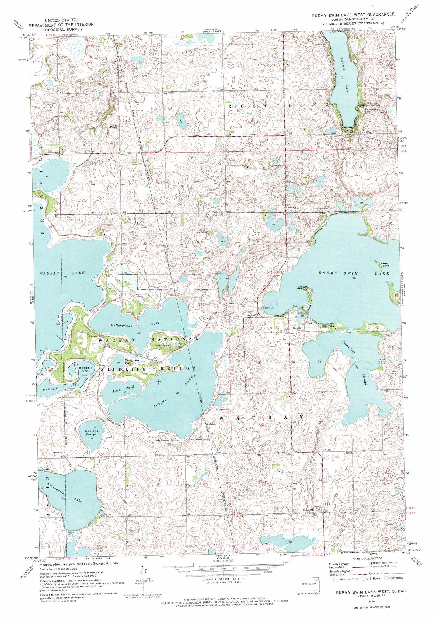
USGS Topo Quad 45097d3 - 1:24,000 scale
| Topo Map Name: | Enemy Swim Lake West |
| USGS Topo Quad ID: | 45097d3 |
| Print Size: | ca. 21 1/4" wide x 27" high |
| Southeast Coordinates: | 45.375° N latitude / 97.25° W longitude |
| Map Center Coordinates: | 45.4375° N latitude / 97.3125° W longitude |
| U.S. State: | SD |
| Filename: | o45097d3.jpg |
| Download Map JPG Image: | Enemy Swim Lake West topo map 1:24,000 scale |
| Map Type: | Topographic |
| Topo Series: | 7.5´ |
| Map Scale: | 1:24,000 |
| Source of Map Images: | United States Geological Survey (USGS) |
| Alternate Map Versions: |
Enemy Swim Lake West SD 1970, updated 1973 Download PDF Buy paper map Enemy Swim Lake West SD 2012 Download PDF Buy paper map Enemy Swim Lake West SD 2015 Download PDF Buy paper map |
1:24,000 Topo Quads surrounding Enemy Swim Lake West
Britton 4 Ne |
Lake City |
South Red Iron Lake |
Whitestone Lake |
Sisseton |
Britton 4 Se |
Eden |
Piyas Lake |
Drywood Lakes |
Goodwill |
Webster Ne |
Roslyn |
Enemy Swim Lake West |
Enemy Swim Lake East |
Summit Ne |
Webster |
Waubay Sw |
Waubay |
Ortley |
Summit |
Swan Lake |
Florence Nw |
Florence Ne |
Lonesome Lake |
Still Lake Ne |
> Back to 45097a1 at 1:100,000 scale
> Back to 45096a1 at 1:250,000 scale
> Back to U.S. Topo Maps home
Enemy Swim Lake West topo map: Gazetteer
Enemy Swim Lake West: Bays
Wingate Arm elevation 543m 1781′Enemy Swim Lake West: Islands
Parker Island elevation 570m 1870′Enemy Swim Lake West: Lakes
Campbell Slough elevation 565m 1853′Dahling Slough elevation 543m 1781′
Enemy Swim Lake elevation 565m 1853′
Hillebrands Lake elevation 543m 1781′
Minnewasta Lake elevation 546m 1791′
Phragmites Pond elevation 543m 1781′
Spring Lake elevation 543m 1781′
Swan Pond elevation 543m 1781′
Enemy Swim Lake West: Parks
Waubay National Wildlife Refuge elevation 545m 1788′Enemy Swim Lake West: Post Offices
Wahbay Post Office (historical) elevation 550m 1804′Enemy Swim Lake West digital topo map on disk
Buy this Enemy Swim Lake West topo map showing relief, roads, GPS coordinates and other geographical features, as a high-resolution digital map file on DVD:
Eastern North Dakota & Eastern South Dakota
Buy digital topo maps: Eastern North Dakota & Eastern South Dakota